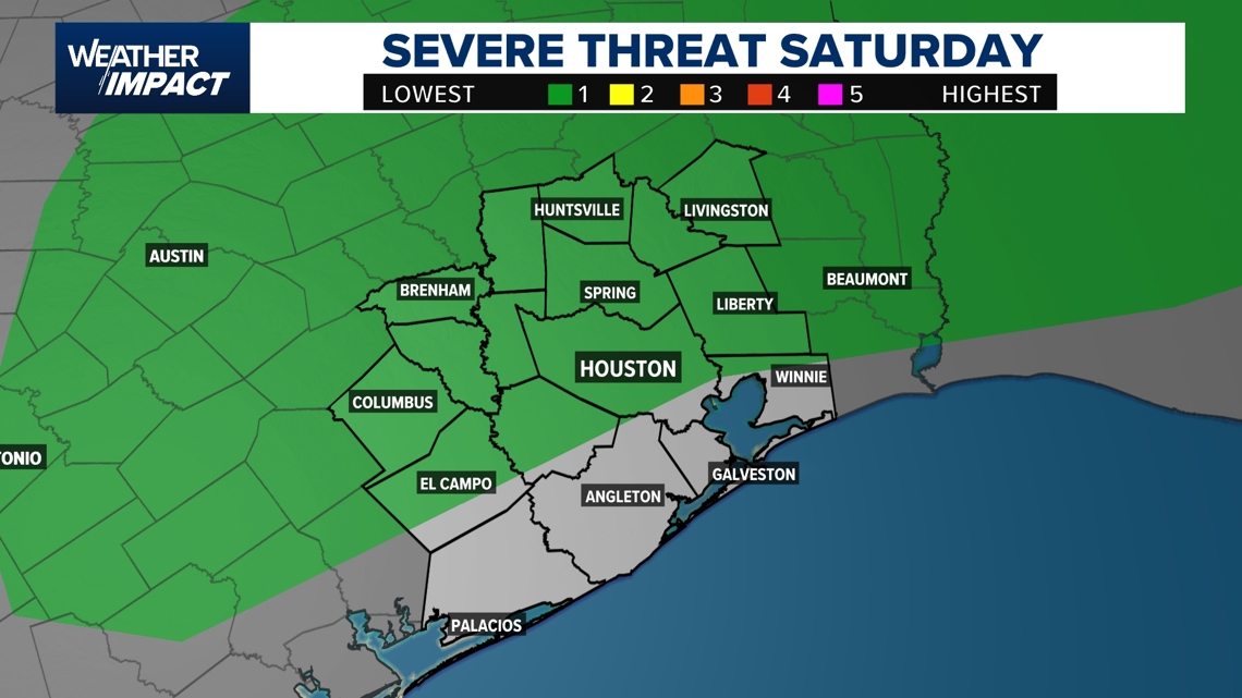
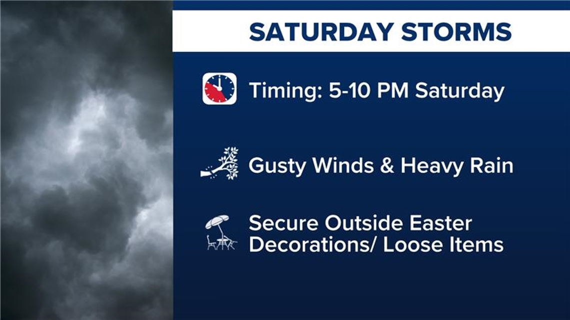
Southeast Texas faces potential storms Saturday, with heavy rain, gusty winds, and hail expected from 5-10 p.m.
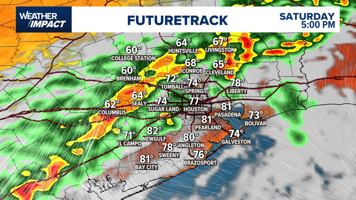
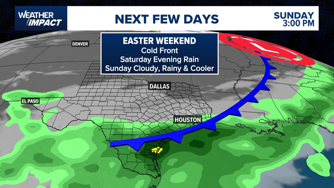
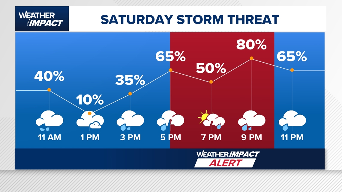
HOUSTON — A soggy and stormy setup is expected to impact Southeast Texas heading into Easter weekend, with the greatest concern arriving Saturday afternoon and evening. KHOU 11 meteorologist Chris Ramirez says strong storms are likely to develop between noon and 8 p.m., especially west of Houston, as a cold front pushes into the region. The KHOU 11 Weather Team has issued a Weather Impact Alert from 5 p.m. to 10 p.m., with the potential for gusty winds up to 40 mph, heavy rain, lightning and even isolated hail.
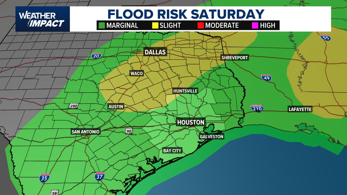
That unsettled pattern could make for messy travel conditions, particularly for those heading west of Houston or toward North Texas, where stronger storms and a higher flood risk are expected around the Dallas-Fort Worth area. Locally, rainfall totals will generally range from a half-inch to an inch, though isolated pockets could see 2 to 3 inches, raising the possibility of ponding on roadways and brief street flooding.
By Easter Sunday, the storms will begin to taper off, but the holiday won’t be completely dry. Morning showers remain possible, followed by a cloudy, breezy and noticeably cooler afternoon. Temperatures will struggle to climb out of the 60s, with gusty winds up to 25 to 30 mph at times. Those heading to sunrise services may want a light jacket, with morning temperatures dipping into the 50s.
Saturday:
Isolated storms begin developing early afternoon (around 12:30–1 p.m.), becoming stronger and more widespread by late afternoon into the evening.
- Main window for severe weather: 5 p.m. to 10 p.m.
- Threats: damaging wind gusts up to 40 mph, heavy rain, lightning, isolated hail
- Highs in the 80s
- Storms move toward the coast by late evening
Saturday night:
Storms gradually push south toward the coast, lingering into early Sunday morning as the front slows.
- Morning: scattered showers possible, temperatures in the 50s to low 60s
- Afternoon: cloudy, breezy and cooler
- Highs near the upper 60s
- Winds gusting 25–30 mph
- Rain chances diminish later in the day
Monday:
Cooler start with morning temperatures in the 50s, especially north of Houston. Clearing skies with a more pleasant, dry pattern developing.
Tuesday:
Mostly sunny and mild. Highs return to the upper 70s to near 80.
Wednesday–Friday (next week):
Quiet start, then rain chances return by mid-to-late week with another active pattern setting up.
Counties we serve:
Harris County (including Houston, Pasadena, Baytown), Fort Bend County (Richmond, Sugar Land, Missouri City), Montgomery County (Conroe, The Woodlands), Brazoria County (Angleton, Pearland, Alvin, Lake Jackson), Galveston County (Galveston, League City, Texas City), Liberty County (Liberty, Cleveland, Dayton), Walker County (Huntsville, New Waverly), Waller County (Hempstead, Prairie View, Waller), Polk County (Livingston, Corrigan), Chambers County (Anahuac, Mont Belvieu, Winnie), Wharton County (Wharton, El Campo), Washington County (Brenham), Matagorda County (Bay City, Palacios), Grimes County (Anderson, Navasota), Austin County (Bellville, Sealy), Colorado County (Columbus, Eagle Lake, Weimar), Trinity County (Groveton, Trinity).


