America’s most dangerous fault line is overdue for a massive earthquake, and scientists now believe the damage could be worse than previously feared.
Researchers from the Lawrence Livermore National Laboratory (LLNL) warned that it is only a matter of time before a major seismic event erupts along the Hayward Fault in California‘s San Francisco Bay Area, home to nearly eight million people.
The Hayward is a 74-mile-long fault line that is part of the massive San Andreas fault system. Like the more famous San Andreas, the Hayward is capable of producing a devastating earthquake stronger than 7.0 in magnitude.
The last time such a quake erupted along the Hayward was in 1868, but scientists have calculated that this fault ruptures every 95 to 183 years.
The team said in a statement: ‘The fault is overdue for an earthquake that could cause extensive damage to such a dense population zone.’
With a major earthquake feared to be imminent in the Bay Area, the new study examined 50 realistic ‘what-if’ scenarios to understand what the coming disaster could look like and how Californians will need to prepare.
The 3D simulations revealed that the shaking during a massive earthquake could be up to 50 percent stronger than older predictions forecasted in several populated areas, including cities such as Livermore, Oakland, Berkeley, Hayward, San Leandro, Emeryville and Alameda.
Researchers also warned that when this fault breaks in one direction, which it almost always does, it focuses the seismic energy forward like a lens. This type of extra-strong shaking can be ‘dangerous for tall or flexible buildings.’
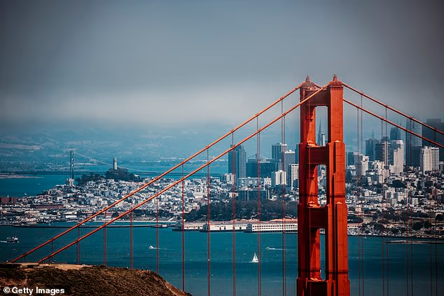
USGS scientists have previously warned that an earthquake stronger than magnitude 6.7 has a 95 percent chance of striking near the Bay Area (Pictured) by 2043

Researchers from Lawrence Livermore National Laboratory warned that shaking from an earthquake along the Hayward Fault may be 50 percent stronger than previously feared
Based on the latest mapping of the Bay Area, the study, published in Seismological Research Letters, warned that deep ‘basin’ areas in California would likely trap and amplify the seismic waves of a major earthquake, making the ground shake harder and longer.
These vulnerable areas include the Livermore Basin, 35 miles east of San Francisco, the East Bay Hills, which sit right along the Hayward Fault, and Bay Mud, the low-lying flat areas right along the shoreline of San Francisco Bay.
Overall, hundreds of thousands of people live and work in these three communities alone, and all are now predicted to experience more damage and violent shaking due to the lensing effect created by a Hayward earthquake.
According to a 2015 report by the US Geological Survey, there is a 95 percent probability that at least one major quake, stronger than magnitude 6.7, will strike somewhere in the Bay Area by 2043.
The new study noted that Hayward is the most likely epicenter of this upcoming earthquake, even more so than the infamous 800-mile-long San Andreas. USGS estimated that there is a one-in-three chance of the Hayward fault rupturing by 2043.
However, no one knows exactly how a future big quake along this fault or others will behave, or how the composition of underground rocks and soil will change the strength and pattern of the shaking.
With that in mind, the researchers from LLNL simulated 50 shockwaves along the Hayward, using the latest 3D maps of the Bay Area’s underground geology.
Their goal was to determine where seismic shaking is likely to be worst once the fault ruptures, so engineers, city planners and emergency officials can update the area’s buildings and bridges to survive the quake.

The Hayward Fault is a 74-mile-long fracture that is part of the great San Andreas fault system in the San Francisco Bay Area

Projections from USGS warn that the Hayward Fault has a one-in-three chance of rupturing and causing a major earthquake by 2043 (Stock Image)
The researchers achieved this by looking at two key factors. First, they looked at breaks along the Hayward in various spots, rupturing at different speeds, including simulating some major ‘slip patches.’
These areas are where the two blocks in this deep crack in the Earth’s crust grind past each other the most, causing built-up stress and force to explode outward.
Then, the team examined how this release of energy, which causes the shaking people feel, traveled outward through the real underground structures beneath California.
LLNL scientist Arben Pitarka said: ‘With this new database, not only can we provide better estimates of the expected ground motion from this type of earthquake, but we can also locate areas that are susceptible to very strong shaking in the San Francisco Bay Area.’
The results showed that previous earthquake models, which have been used to predict the death toll and property damage of major California earthquakes, were mostly correct, but may have underestimated the shaking produced.
The LLNL team noted that they also plan to carry out new simulations for the nearby San Andreas, which has produced some of California’s most devastating earthquakes, including the 1906 San Francisco quake that killed more than 3,000 people.
The most recent predictions from USGS have looked at a magnitude 7.8 earthquake along the San Andreas Fault originating right in Los Angeles, a city of 3.8 million people.
This hypothetical ‘Big One’ would cause roughly 1,800 deaths, 50,000 injuries, and $200 billion in damages, according to the Great California ShakeOut.


