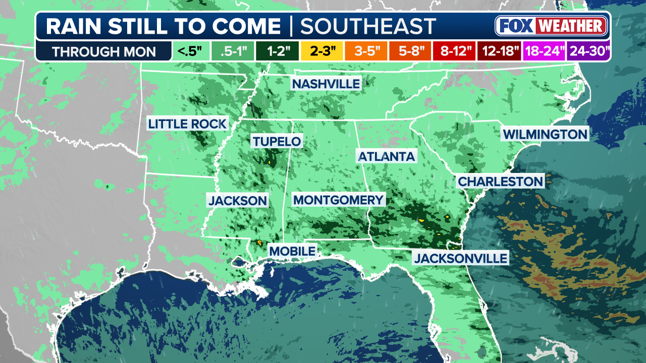
SOUTHEAST SOAKER: Multiple rounds of rain are expected to drench much of the Southeast U.S. at least through the middle of the week, potentially benefiting drought-stricken areas.
As hurricane season begins this week, Americans in the Southeast are bracing for some severe weather.
Coastal areas will be closely monitored for potential development beginning Monday and into mid-week, as a piece of storm energy from the South will combine with a cold front moving through the east. This could allow an area of low pressure to develop along the Mid-Atlantic and Southeast coasts.
While this occurs, a high pressure system will build over the Northwest U.S. and serve as a shield for most of the East Coast against significant tropical impacts, although the Southeast could be the opposite.
(FOX Weather)
As these ingredients of storm development are still in the early stages, the FOX Forecast Center is predicting a coastal low to remain weak before moving quickly to the Northeast, resulting in dry conditions for the region with minimal storm impacts.
HOW HIGH PRESSURE AND LOW PRESSURE DRIVE THE WEATHER
Shifting to the Southeast, impacts could be much different with wet weather making an appearance for much of the region.
Heavy rainfall dampened Memorial Day activities across parts of southern Virginia and the Carolinas, leading to flash flooding. Both regions experienced even more flash flooding on Tuesday.
“If this happens, the low pressure system would slow down, strengthen slightly and potentially stall closer to the coast,” the FOX Forecast Center said. “That would bring a much larger shield of rain directly along the immediate coast, alongside gusty onshore winds.”
Regardless of the exact track of this developing system, it will result in beach erosion, rough surf and minor coastal flooding across the Southeast region.
HEAVY RAIN, BURN SCARS AND SNOWMELT CREATE DANGEROUS FLOOD SETUP IN MONTANA
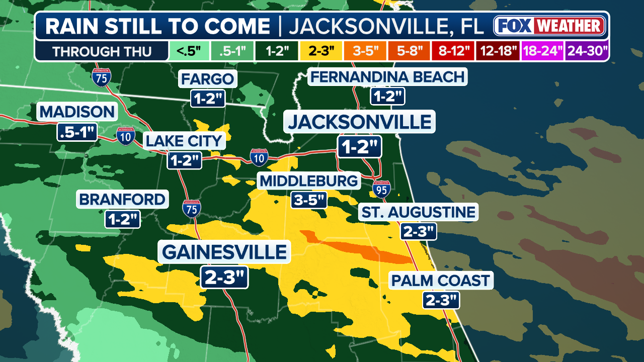
Expect minimal rainfall impacts across the region, with southeast Georgia and parts of Jacksonville, Florida, experiencing the most widespread impacts. The northern portion of the state could see the most weather.
(FOX Weather)
Forecast models are still unsure of the exact strength of these developing systems and the overall impacts they could have on coastal regions.
FLASH FLOOD THREAT CONTINUES ACROSS FLORIDA, SOUTHEAST AS TROPICAL DOWNPOURS BRING DROUGHT RELIEF
Stay tuned to FOX Weather as we continue to track the potential impacts over the next few days.