As Typhoon Jangmi charges toward Japan, severe impacts have begun and will intensify through tomorrow with torrential rain and damaging winds. Evacuations are ordered throughout multiple Okinawa municipalities, with emergency shelters opened and hundreds of flights canceled. Latest:
The FOX Forecast Center is monitoring the development of a possibly powerful typhoon to slam the Marianas Islands over the coming days.
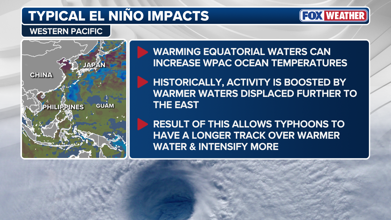
Recently formed Tropical Storm Nine-W continues to intensify in the West Pacific, particularly over the Northwest, where it is interacting with very warm ocean waters due to El Niño.
BRYAN NORCROSS: THE ATLANTIC GOES QUIET TO KICK OFF JULY
This is the typical outcome following an El Niño, which allows typhoons to maintain a longer track and even intensify.
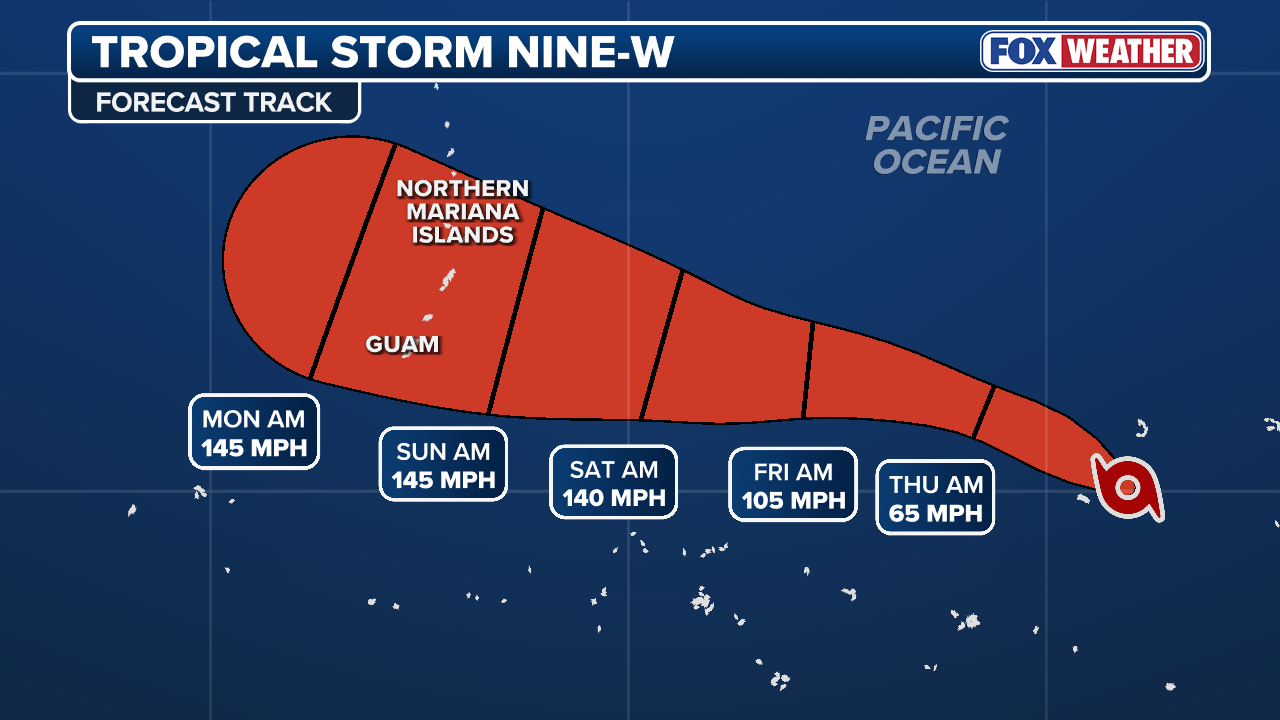
The developing storm is expected to undergo rapid intensification over the next few days, as computer models are increasingly indicating that this system could transition into a powerful typhoon.
(FOX Weather)
According to the FOX Forecast Center, this could even upgrade into a super typhoon as it approaches the Mariana Islands. The next named storm on the list for the West Pacific is Bavi.
“Because atmospheric conditions are highly favorable for strengthening, this system will likely expand its wind field significantly, bringing the potential of hurricane-force winds to all the islands,” the FOX Forecast Center said.
BEYOND SUPER EL NIÑO: THE SECRET OCEAN PATTERN THAT COULD FUEL HURRICANES IMPACTING HAWAII THIS YEAR
The forecast track from the Joint Typhoon Warning Center notes that the core of this dangerous storm system is on a direct collision course with the Mariana Islands this weekend.
(FOX Weather)
Peak intensity winds could reach as high as 145 mph by Monday, which is equivalent to a Category 4 storm.
Forecasters are uncertain whether the neighboring U.S. territories, such as Guam, Rota, Saipan or Tinian, will bear the brunt of the storm’s impacts. Still, they must nonetheless brace for a direct hit.
Powerful wind gusts lashed Guam as super typhoon Sinlaku passed just north of the island.
This comes just as a super typhoon struck the Northern Mariana Islands last year, resulting in 17 deaths and an estimated $1.5 billion in damages.
Potential Super Typhoon Bavi is unfortunately taking a similar track to Sinlaku, but it could dip even farther south, creating an even more dangerous situation, according to the FOX Forecast Center.
DEEP TROPICAL MOISTURE BRINGS FLOOD THREAT TO FLORIDA DESPITE 0% CHANCE OF TROPICAL DEVELOPMENT
Be sure to check back for updates as we continue to track the developments of this potential extreme weather.


