Severe storms target the Central Plains Monday with a Level 2 threat in place before increased risks shift to millions across the Midwest by midweek. By Tuesday and Wednesday, moisture and daytime heating will fuel storms capable of producing very large hail, damaging winds, and tornadoes. Full forecast:
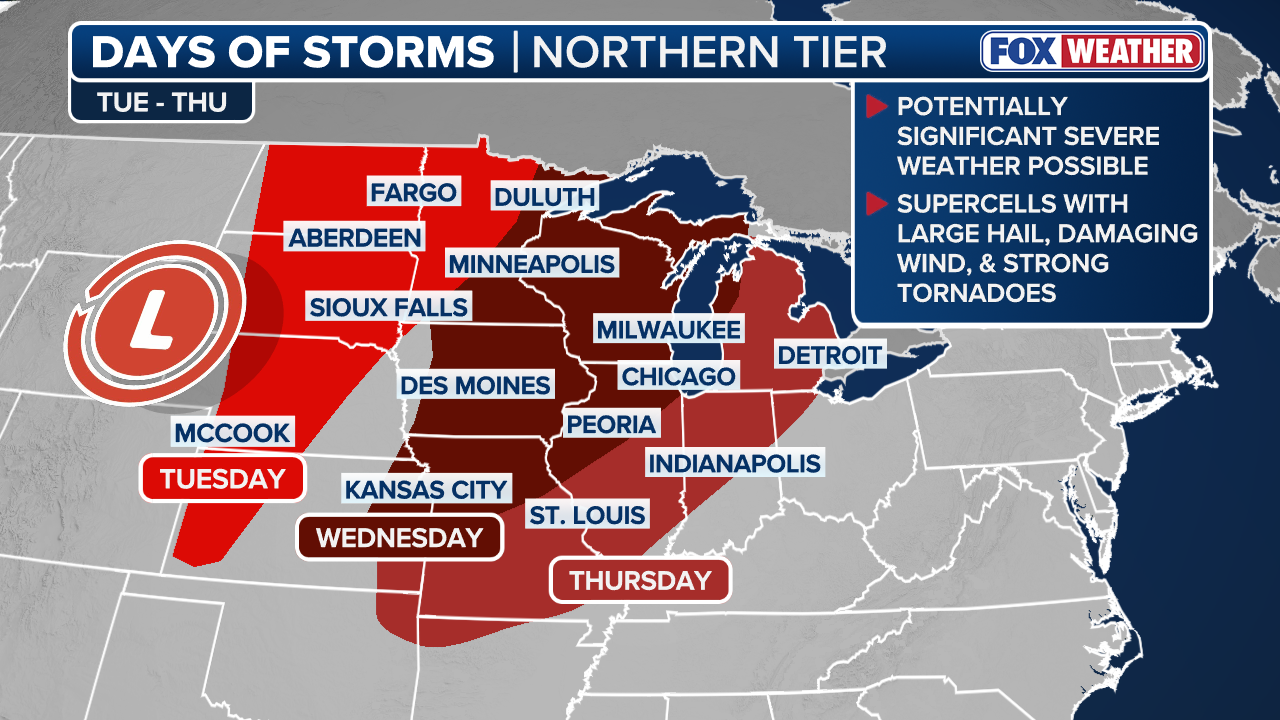
On the heels of last week’s severe weather in the Plains, the focus now turns to the Upper Midwest, where highly populated regions face an increasing multi-day threat.
The FOX Forecast Center warns these storms could be significant. By midweek, the threat zone expands to over 40 million Americans, with large hail, damaging winds, and tornadoes all possible.
(FOX Weather)
DOWNPOURS TO DRENCH MILLIONS IN THE SOUTH AND CENTRAL US AMID GROWING FLOOD THREAT
Additionally, these moisture-rich storms could bring the potential for low-end risk flash flooding, with widespread rainfall totals of 1 to 2 inches possible through midweek.
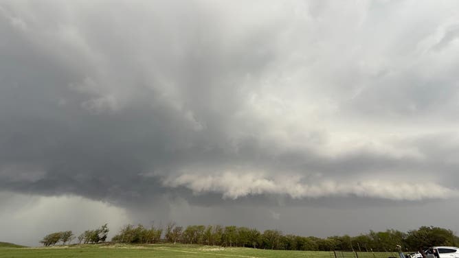
Storm clouds in Junction City, Kansas on April 28, 2025.
( Andrew Pritchard / FOX Weather)
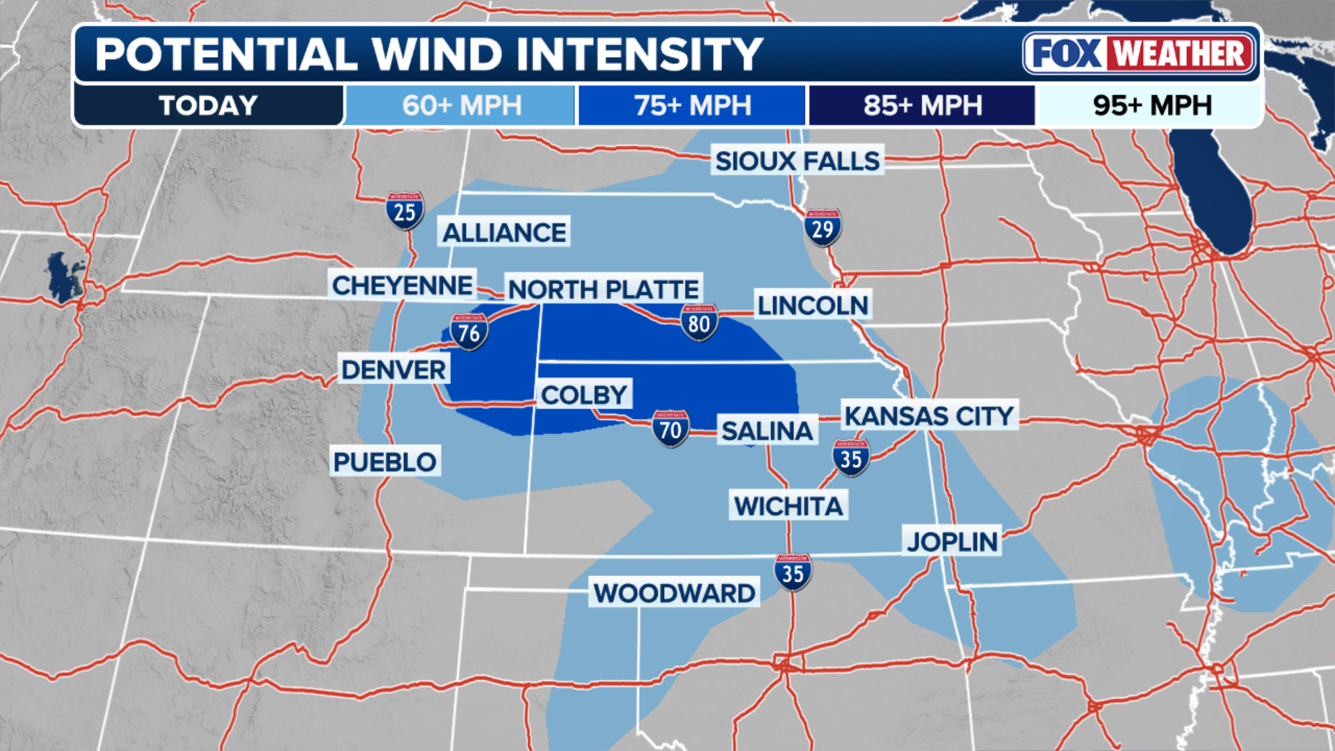
On Monday, a Level 2 out of 5 severe weather threat is in place across the central U.S., stretching from the Front Range in Colorado through central Kansas.
In fact, Newton County, Missouri — which borders Kansas—was issued a Tornado Warning until 5 a.m. CT this morning.
(FOX Weather)
As the day progresses, afternoon storms could produce large hail over 2 inches in diameter, damaging wind gusts over 70 mph, as well as an isolated tornado.
TROPICAL STORM BORIS FORMS IN THE EASTERN PACIFIC JUST OFF SOUTHERN MEXICO, THREATENS FLOODING RAIN
By Tuesday, a large dip in the jet stream is forecast to take shape across the West Coast.
Ahead of a surface low pushing northward overnight and its associated cold front, very high levels of instability will continue to build. Dew points in the 50s and low 60s, paired with strong daytime heating, will help fuel storms capable of producing very large hail, damaging winds, and tornadoes.

(FOX Weather)
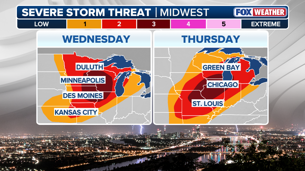
For this reason, a Level 3 out of 5 severe weather risk is in place, mainly across North Dakota, closest to the area of low pressure.
The FOX Forecast Center said the biggest threats with developing storms Tuesday afternoon and into the evening will be large hail and tornadoes. Meanwhile, the overnight threat will transition to primarily damaging winds as storms push into the Red River Valley.
(FOX Weather)
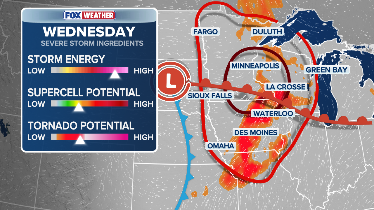
On Wednesday, the focus shifts east as the parent area of low pressure moves into Canada, while its trailing cold front will begin moving through the Upper Midwest.
A Level 3 severe weather risk is also in place and includes portions of Minnesota, Wisconsin, and Iowa.

FILE: FOX Weather Meteorologist Haley Meier tracks tornado that touched down in Truman, Minnesota, on Monday afternoon.
(Jarrod Maloney/FOX Weather / FOX Weather)
POTENTIALLY RECORD-HIGH TEMPS TO ROAST OVER 100 MILLION IN MAJOR CITIES ALONG THE EAST COAST
Specifically, Minneapolis appears to be right in the bullseye for what the Storm Prediction Center is calling a “potentially significant severe weather event” Wednesday afternoon and evening.
Deep-layer shear and instability will set the stage for supercells and bowed lines of storms capable of producing all severe hazards once again.
(FOX Weather)
By Thursday, the threat shifts into the Midwest, with a Level 2 out of 5 severe weather risk that includes more than 26 million Americans and major metro areas such as Chicago, St. Louis, and Milwaukee.
ELDERLY MAN DIES DURING SATURDAY’S SEVERE STORMS AFTER TREE FALLS IN NEW YORK CITY
Storms will continue to develop in the afternoon and evening along the cold front as it marches eastward, with all severe weather hazards possible once again.

Severe thunderstorms put on a light show over the skies of Chicago on Aug. 18, 2025.
(Craig Shimala via Storyful / FOX Weather)
Additionally, widespread rainfall totals of 1 to 2 inches across Minnesota, Wisconsin, Iowa and Illinois could bring the potential for flash flooding.
Localized amounts exceeding 2 to 3 inches are possible where storms move more slowly or repeatedly track over the same areas. Due to this, a Level 1 out of 4 flash flood risk is in place across parts of the region on Wednesday.
Stay tuned to FOX Weather for the latest updates on the multi-day severe weather event.


