Colorado State University (CSU) has again lowered its Atlantic hurricane season forecast Wednesday, citing the high potential for a very strong El Niño during the peak of the season. FOX Weather Hurricane Specialist Bryan Norcross offers exclusive analysis on the revised hurricane season forecast as a Super El Niño brews:
THE TAKEAWAY
- Forecast models give El Niño a 69% chance of becoming the strongest on record since 1950.
- The potential “Super El Niño” could disrupt weather patterns around the globe.
- The event could send global temperatures soaring well above average in 2027.
As El Niño continues to strengthen, models show a 69% chance it will become the strongest event since record-keeping began in 1950. This potential “Super El Niño” could have major ripple effects on weather patterns around the world.
“Nobody alive has ever experienced an El Niño event this strong,” FOX 35 Orlando meteorologist Noah Bergren said. “By this fall, we are tracking a system that easily eclipses the historic events of 2015 and 1997,” adding that impacts could extend into 2027.
🌀 EXCLUSIVE ANALYSIS: FOX Weather Hurricane Specialist Bryan Norcross shares the latest updates from NOAA on the developing El Niño, the quiet start to the season so far, and the number of named storms that could form.
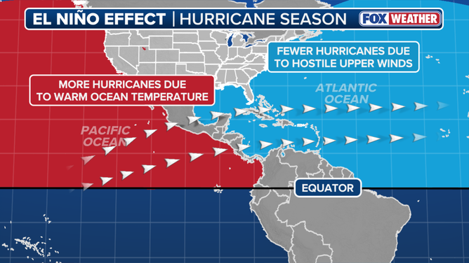
El Niño is typically associated with reduced tropical cyclone activity in the Atlantic Basin and increased storm activity in the Eastern and Central Pacific basins, along with a host of other weather impacts around the world outside of hurricane season.
This is a pattern we’ve already seen so far this year.
THE PACIFIC IS ALREADY SHOWING NEW SIGNS OF TROPICAL ACTIVITY AS LALA MOVES ON AFTER SLAMMING HAWAII
El Niño occurs when ocean temperatures in the equatorial Pacific become warmer than average, but Bergren emphasized that the current warmth isn’t just limited to the ocean surface, the significant heat extends deeper into the Pacific.
Water temperatures in the El Niño zone were 1.4 degrees Celsius above average across July—just shy of the threshold needed to be considered a Super El Niño, which requires temperatures to reach at least 2 degrees Celsius above average for three consecutive months.
El Niño impact on hurricane season.
(FOX Weather / FOX Weather)
The strongest El Niño events on record include 1877–1878, 2015–2016, 1997–1998 and 1982–1983, with sea-surface temperature anomalies during the 2015–2016 event reaching closer to 3 degrees Celsius above average.
EL NIÑO SURGES TOWARD ‘MONSTER’ TERRITORY, SIGNALING AN ACTIVE WINTER FOR EAST AND WEST COASTS
Bergren notes that consensus forecasts indicate current average temperatures abnormally between 3.0 and 3.4 degrees Celsius by November and December, with some extreme model projections indicating 4 degrees Celsius.
“If these averages hold, this system will blow every historical event out of the water,” he said.
BRYAN NORCROSS: THE ATLANTIC STAYS QUIET WHILE THE PACIFIC CAN’T STOP
The potential impacts extend beyond the Pacific Basin. While stronger El Niño patterns typically increase hurricane activity in the Pacific, the consequences reach much further.
-
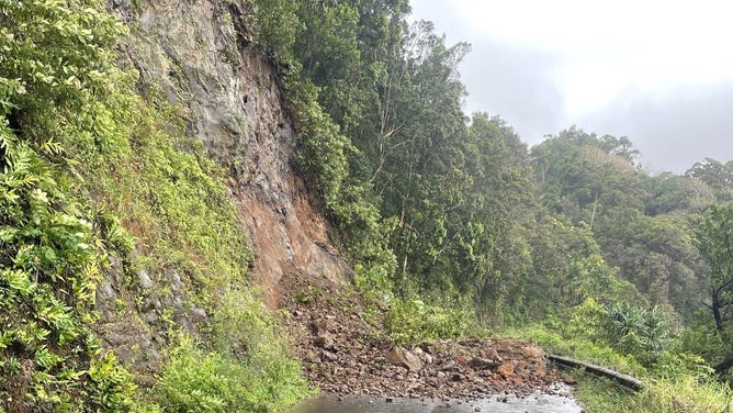
A landslide blocks Hana Highway in Maui on Monday, Feb. 9, 2026.
(Hawaii DOT) -
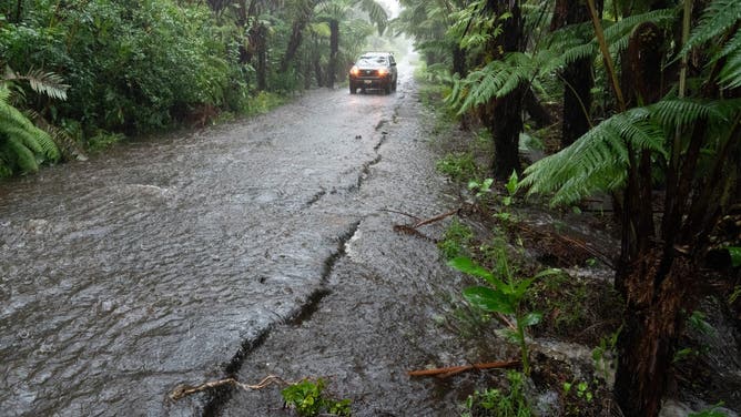
A rural road floods in Volcano Village on Hawaii Island, on August 15, 2026. Hurricane Lala on Saturday lashed Hawaii’s Big Island with heavy rain and strong winds, as forecasters warned of potentially dangerous flooding across the US Pacific island state. Lala strengthened into a Category 1 hurricane at around 9:00 am local time (1900 GMT), generating winds of up to 75 miles per hour (120 kilometers per hour). (Photo by Jill K. Briggs / AFP via Getty Images)
( ) -
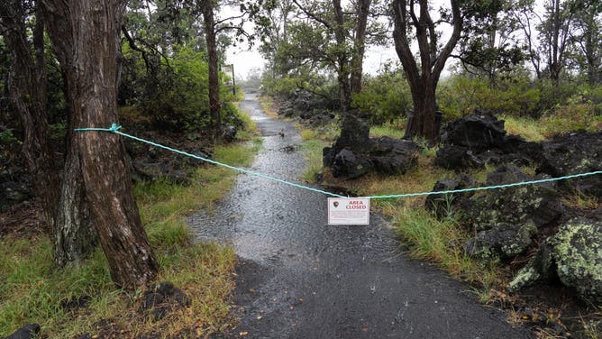
The Ka’u Desert section of Hawaii Volcanoes National Park is seen closed due to high winds and heavy rainfall in Volcano Village, Hawaii, on August 15, 2026. Hurricane Lala on Saturday lashed Hawaii’s Big Island with heavy rain and strong winds, as forecasters warned of potentially dangerous flooding across the US Pacific island state. Lala strengthened into a Category 1 hurricane at around 9:00 am local time (1900 GMT), generating winds of up to 75 miles per hour (120 kilometers per hour). (Photo by Jill K. Briggs / AFP via Getty Images)
( ) -
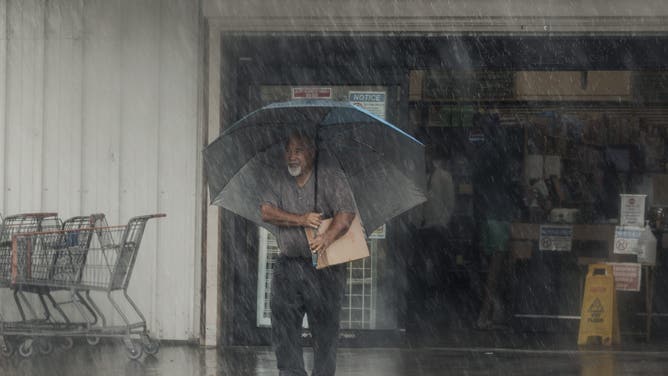
A resident carries supplies during Hurricane Lala in Hawaiian Ocean View, Hawaii, Saturday, Aug. 15, 2026. The storm strengthened into a hurricane as it approached Hawaii, with up to 25 inches of rain possible on the island of Hawaii, commonly known as the Big Island. (Photo by Stephen Lam/San Francisco Chronicle via Getty Images)
( ) -
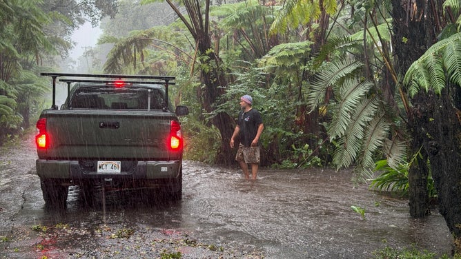
A resident stops on a rural road as it floods in Volcano Village on Hawaii Island, on August 15, 2026. Hurricane Lala on Saturday lashed Hawaii’s Big Island with heavy rain and strong winds, as forecasters warned of potentially dangerous flooding across the US Pacific island state. Lala strengthened into a Category 1 hurricane at around 9:00 am local time (1900 GMT), generating winds of up to 75 miles per hour (120 kilometers per hour). (Photo by Jill K. Briggs / AFP via Getty Images)
( ) -
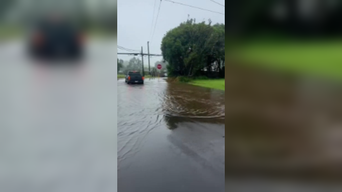
Flooding in Waimea Big Island, Hawaii from Hurricane Lala on Saturday, Aug. 15.
(Christina Butler) -
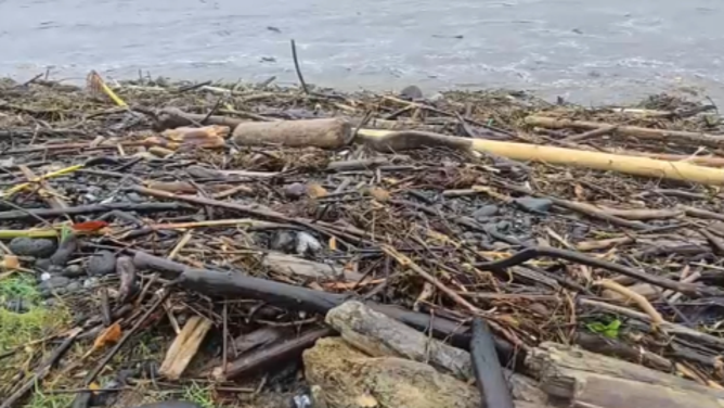
Debris washes ashore in Wainaku, Hawaii, during Hurricane Lala on Saturday, Aug. 15.
(MIKE SEIDEL)
Bergren noted that Florida and the Southern U.S. could face an exceptionally wet winter, with Florida specifically facing a higher potential for severe weather.
“For example, the winters of 1982, 1997, and 2015 all produced EF3 tornadoes (133-165 MPH)—including the deadly “Night of the Tornadoes” that devastated parts of Central Florida in February 1998,” he said.
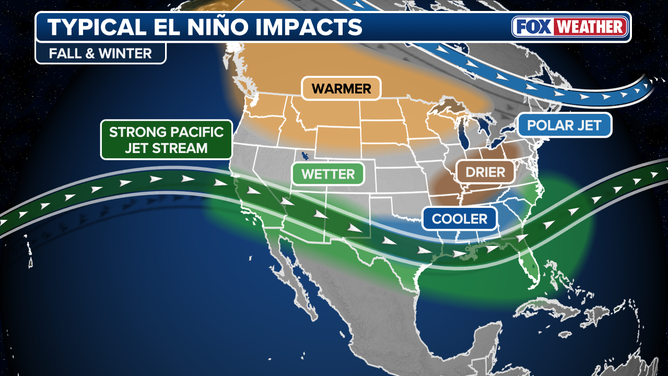
Typical El Niño winter impacts.
(FOX Weather / FOX Weather)
Meanwhile, across Europe, it could mean isolated downpours. Additionally, Bergren points out that El Niño could drive global temperatures way past normal levels in 2027.
“Long story short, different parts of the globe experience major El Niño impacts at different times. This is a globally significant, strengthening weather event that will have clear, undeniable consequences later this year and throughout 2027,” he said.