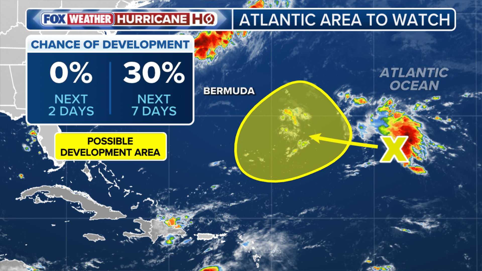
After days of quiet, the National Hurricane Center has highlighted a new area to watch — and this time, it’s outside the main belt, in the subtropical Atlantic. Full outlook:
THE TAKEAWAY:
- A new area to watch has been designated in the subtropical Atlantic.
- The area to watch has low odds of development over the next seven days.
- There is no threat to the U.S. at this time, but Bermuda should continue to monitor the area for potential developments.
After days of quiet in the Atlantic, the National Hurricane Center has highlighted a new area to watch. Unlike the typical tropical disturbances that emerge off the coast of Africa this time of year, this area is located in the subtropical Atlantic.
(FOX Weather)
The subtropical Atlantic lies outside the Main Development Region, or MDR — the primary hurricane belt. That unusual location is part of what makes this area to watch so interesting.
While it currently faces hostile upper-level winds, it is forecast to move into a brief window of more favorable conditions later this week. Even so, development odds remain low over the next seven days.
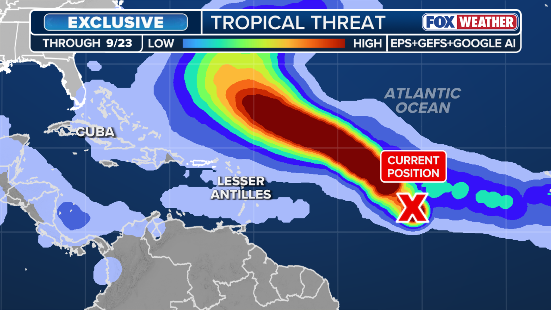
Adding another level of uncertainty, AI and traditional forecast models are completely split on the new area to watch. While AI models are going aggressive—predicting a strong storm—traditional models show virtually no development at all.
According to the FOX Forecast Center, “What is making this so complicated for the forecast models is that the area to watch in its current form really is not even considered a tropical disturbance. It is a large, inverted trough of low pressure with really only some subtropical characteristics.”
So what happens next?
The system is going to have to wait it out for a few days and try and move west into the more favorable zone for true tropical development.
LATEST EXCLUSIVE ANALYSIS FROM HURRICANE SPECIALIST BRYAN NOCROSS
Before that can happen, the trough must first cluster enough thunderstorms to carve out a distinct center of low pressure.
Once that well-defined center forms, computer forecast models will gain a much sharper read on the atmospheric environment, finally revealing if the area to watch can capitalize on the atmospheric setup.
(FOX Weather)
For now, it’s just something to keep an eye on, especially in Bermuda. There’s no indication that it could threaten the U.S. Whatever form it takes, it’s likely to turn north into the open Atlantic or sit for many days, the FOX Forecast Center said.
The Atlantic stalls at peak season
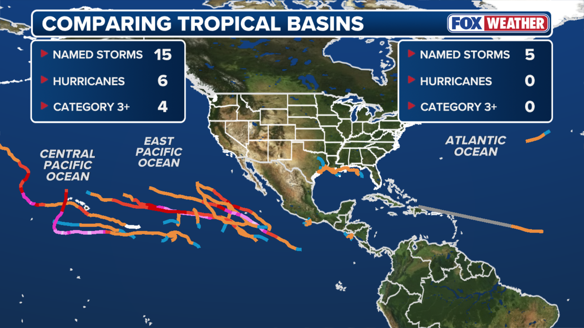
Typically, El Niño suppresses Atlantic activity by increasing wind shear while having the opposite effect in the Pacific, where warmer ocean temperatures fuel increased activity.
That pattern has already played out across both oceans this year.
Adding to that, forecasts indicate this could be a “super El Niño,” potentially making it one of the strongest events on record.
(FOX Weather)
The lack of storm activity has already rewritten history: The Atlantic has now broken the satellite-era record for the latest date without a single hurricane forming in a season.
To put this historic slump into perspective, an average Atlantic hurricane season produces 14 named storms, seven hurricanes and three major hurricanes. So far, there have been just five named storms, zero hurricanes and zero major hurricanes.