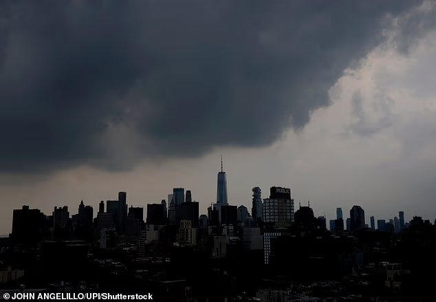
Millions of Americans have been told to brace for tornadoes, destructive winds and flash flooding as a volatile storm system bears down on the eastern US.
The danger stretches from Kentucky and western Pennsylvania to the densely populated Interstate 95 corridor, placing Washington, Baltimore, Philadelphia and New York City inside the forecast highest tornado-risk zone.
The Storm Prediction Center (SPC) has issued a 5 percent tornado risk across the corridor, meaning there is a 5 percent probability of a tornado occurring within 25 miles of any given location.
The threat is expected to develop from late Tuesday morning through the afternoon before dangerous storms continue into the night.
An Enhanced Risk for severe thunderstorms, level 3 of the SPC’s five-tier scale, includes Washington, Baltimore, Philadelphia, Pittsburgh, Lexington, Youngstown and Harrisburg, while New York City remains within the broader ‘slight risk’ area.
Although tornadoes and large hail are possible, damaging winds will be the primary danger, with some locations facing a 45 percent probability of destructive gusts occurring within 25 miles.
Torrential rain could compound the threat by flooding roads, streets and low-lying neighborhoods, particularly where repeated thunderstorms pass over the same communities.
NYC Emergency Management warned on X: ‘Another round of severe weather is expected tomorrow, with heavy rain that could lead to flooding. Conditions may be similar to what we experienced this past Saturday, so now is the time to prepare.’
The danger stretches from Kentucky and western Pennsylvania to the densely populated Interstate 95 corridor, placing Washington, Baltimore, Philadelphia and New York City inside the forecast highest tornado-risk zone
Up to four inches of rain fell across parts of New York City and New Jersey by early Saturday afternoon, flooding roads and neighborhoods.
Officials have warned that similar conditions could return Tuesday and urged residents in vulnerable areas to prepare flood barriers, sandbags or alarms.
‘Never drive or walk through flooded streets,’ NYC Emergency Management said.
‘If you live in a basement apartment, be prepared to move to higher ground immediately if flooding develops. Do not wait.’
The latest threat will be driven by a cold front colliding with warm, humid air across the Ohio Valley, Mid-Atlantic and Northeast.
Forecasters expect clusters of severe thunderstorms and embedded supercells to develop by Tuesday afternoon. These rotating storms can produce tornadoes, large hail and destructive winds.
Western New York and eastern Pennsylvania face the greatest potential for embedded supercells, with possibly a couple of tornadoes.
Washington, Baltimore and Philadelphia are under an Enhanced Risk, Level 3 of five, while New York City remains under a Slight Risk, Level 2.

The Storm Prediction Center (SPC) has issued a 5 percent tornado risk across the corridor, meaning there is a 5 percent probability of a tornado occurring within 25 miles of any given location

Up to four inches of rain fell across parts of New York City and New Jersey by early Saturday afternoon, flooding roads and neighborhoods
Damaging straight-line winds will be the main threat, with organized storm clusters capable of toppling trees, bringing down power lines and damaging buildings.
‘Numerous severe thunderstorms are expected across a broad region from the Ohio Valley into the Mid-Atlantic and Northeast on Tuesday,’ the SPC said, warning that ‘swaths of damaging wind gusts’ could strike from the afternoon into the night.
Heavy rain will add to the danger. The Weather Prediction Center has placed portions of the upper Ohio Valley and Mid-Atlantic under a Slight Risk of excessive rainfall through early Wednesday.
Parts of the Mid-Atlantic and Northeast face a 20 to 40 percent probability of receiving more than one inch of rain, although totals will vary considerably.
Most storms should move quickly, but repeated downpours over the same communities could overwhelm drains and trigger flash flooding from the Appalachians to the Interstate 95 corridor.
Residents should monitor updated forecasts and enable emergency alerts. Anyone placed under a tornado warning should immediately seek shelter in a basement or small interior room on the lowest floor of a sturdy building.