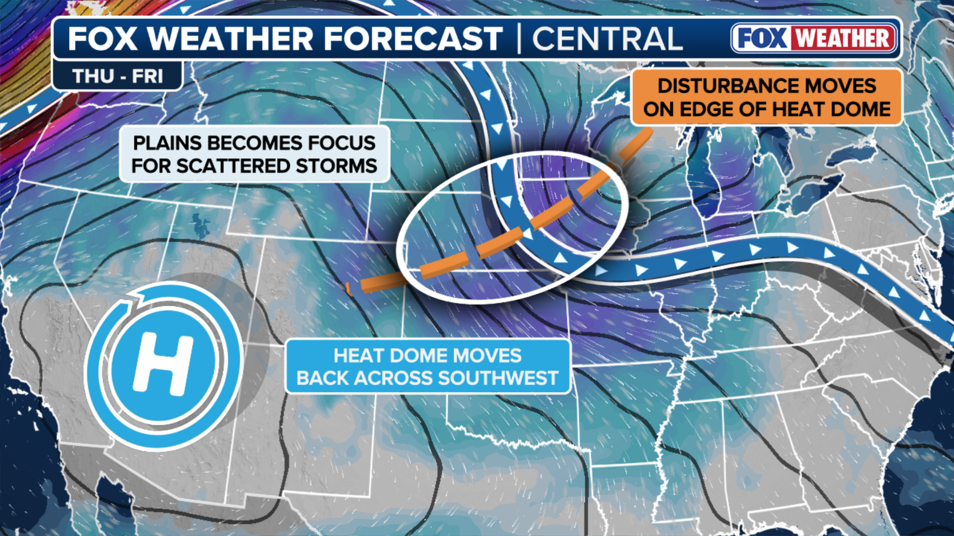
A multiday flood threat looms across the Plains and Midwest as the current heat dome retreats, fueling rounds of heavy rain starting Thursday. While some areas could see rainfall totals topping 3 inches by the end of the work week, the stormy shift could bring a much-needed break from the heat.
A wet storm pattern is expected to develop across parts of the Plains and Midwest late this week as the intense heat shifts back toward the Four Corners, opening the door for storms back in the Heartland.
A robust disturbance will ride along the northern and eastern edge of the heat dome, bringing repeated rounds of thunderstorms from Thursday into Friday and triggering a multiday flash flood threat.
MULTIDAY FLOOD THREAT SHIFTS INTO NEW ENGLAND AS HEAVY STORMS SNARL TRAVEL ACROSS THE NORTHEAST
(FOX Weather)
The storms will tap into a high amount of moisture that is surging north along an old frontal boundary leftover from storms earlier in the week.
The front will be draped along the Gulf Coast and work back toward the Plains, which will help transport the moisture north.
WILDFIRE SMOKE FROM THE NORTHWEST SWEEPS ACROSS THE US TO MID-ATLANTIC AND SOUTHEAST
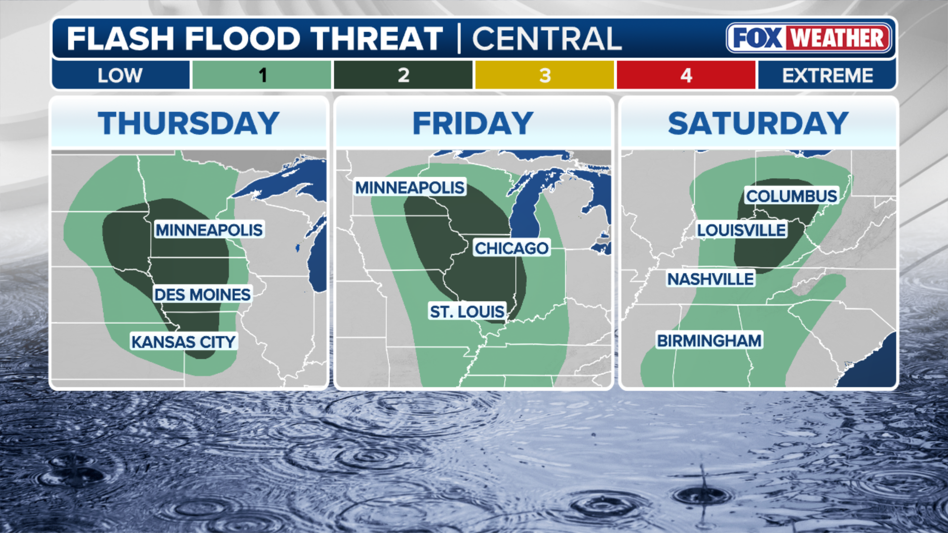
Starting primarily on Thursday, the greatest concern stretches from eastern South Dakota, Nebraska into Iowa, Minnesota, Kansas, and Missouri, according to the FOX Forecast Center.

(FOX Weather)
While it won’t be record hot, there will still be a very warm air mass providing plenty of fuel for thunderstorms, with the potential for some storms to organize into larger complexes capable of producing torrential rain in a short period.
By Friday, the heavy rain threat shifts farther east into the Upper and Middle Mississippi Valley.
Areas that receive heavy rain on Thursday will be more vulnerable to flooding if another round of storms develops.
(FOX Weather)
While there is still some uncertainty about exactly where the heaviest rain sets up, rainfall totals exceeding 3 inches are possible where storms repeatedly move over the same locations.
LIFE-THREATENING FLASH FLOOD EMERGENCY ISSUED NEAR COLORADO BURN SCAR, TRIGGERING DEBRIS FLOWS
The same disturbance will likely keep tracking southeast, teaming up with weekend rain across the region and giving those areas in the Midwest and Plains a much-needed break from the extreme heat.