NEXT STORM UP: FOX Weather Meteorologist Jane Minar provides an analysis of the next storms to hit the U.S. as the Northeast and Mid-Atlantic regions will receive heavy rain, thunderstorms and possible flooding through Monday evening. #Northeast #Severewx #Rain #Thunderstorm #FOXWeather
THE TAKEAWAY
- Rain, thunderstorms and flooding target the East Coast.
- A level 2 out of 4 flash flood risk is in place through Monday for places such as Pittsburgh, Philadelphia, Washington, D.C., and Baltimore.
- Strongest storms could produce winds as strong as 50 to 65 mph.
Nasty weather conditions are headed for portions of the East Coast as the new week begins, with rain and thunderstorms possible.
The FOX Forecast Center is monitoring a warm front moving through the Mid-Atlantic region, bringing elevated moisture and instability starting on Sunday.
A low pressure area is moving eastward across Quebec, Canada, extending from the south and east of the system.
Showers and thunderstorms will likely continue through Sunday night, extending across northern Pennsylvania and keeping the region very humid.
The main threat is heavy rain and thunderstorms, but also persistent southwesterly winds will support stronger storms and an increased flood threat, according to the FOX Forecast Center.
(FOX Weather)
“High amounts of moisture will also slam into the western sides of the Appalachians in West Virginia. Given the recent rain [and] wet soils, an increased, but very localized heightened flood threat sits,” the FOX Forecast Center said.
WHY ARE HURRICANES SO RARE IN HAWAII?
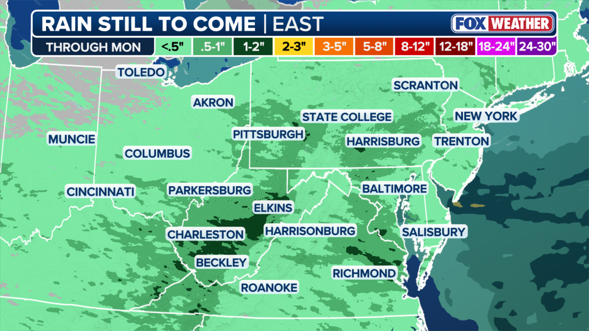
As a result, a Level 3 out of 4 flash flood threat is active in the West Virginia mountains as rain totals steadily pile up on Monday.
New Jersey and the Northeast are facing heavy rain with the potential of flash flooding on Thursday. Video shows cars in Rahway splashing through some pooled water as rain continued.
A Level 2 out of 4 flash flood risk is also in place through Monday for places such as Pittsburgh, Philadelphia, Washington, D.C. and Baltimore, where rain totals could range from about 1 to 2 inches.
Damaging wind gusts are also possible with any storms that do develop, as there is a Level 2 out of 5 severe storm risk across parts of Tennessee, Kentucky, Virginia and as far as northern North Carolina.

(FOX Weather)
According to the FOX Forecast Center, the strongest storms could produce winds as strong as 50 to 65 mph.
The cold front fueling these storms will make its main approach toward the East Coast on Monday, bringing thunderstorms from parts of the Northeast down to the Mid-South.
STORMS TRIGGER CATASTROPHIC FLOODING WITH HUNDREDS OF THOUSANDS STILL WITHOUT POWER ACROSS MIDWEST
By Monday evening, lingering rain and storms will remain, but nothing severe as conditions slowly fade.