FOX Weather Meteorologist Steve Bender breaks down the severe storms headed for the Great Plains and Central U.S., as heavy rain, damaging winds and a flash flood threat plague millions of Americans.
Millions of Americans across the Central and Southern U.S. are bracing for repeated rounds of tropical downpours this week as forecasters monitor a developing threat that spans more than 700 miles.
The threat, which began on Wednesday, has brought the risk of flash flooding, which continues due to heavy rain across parts of southwestern Oklahoma, where over 3 inches fell in just over an hour.
7 FACTS YOU SHOULD KNOW ABOUT FLASH FLOODS
The continued flash flood threat expands from the Central Plains down to the Gulf Coast of Mississippi and Alabama, according to the FOX Forecast Center.
(FOX Weather)
“Northwesterly flow is expected to remain north of the high pressure centered over western Texas, allowing for the active pattern from the Front Range through the mid-South to remain,” the FOX Forecast Center said.
Organized storms will shift southward into the Southeast and the Gulf Coast and Florida panhandle on Wednesday.
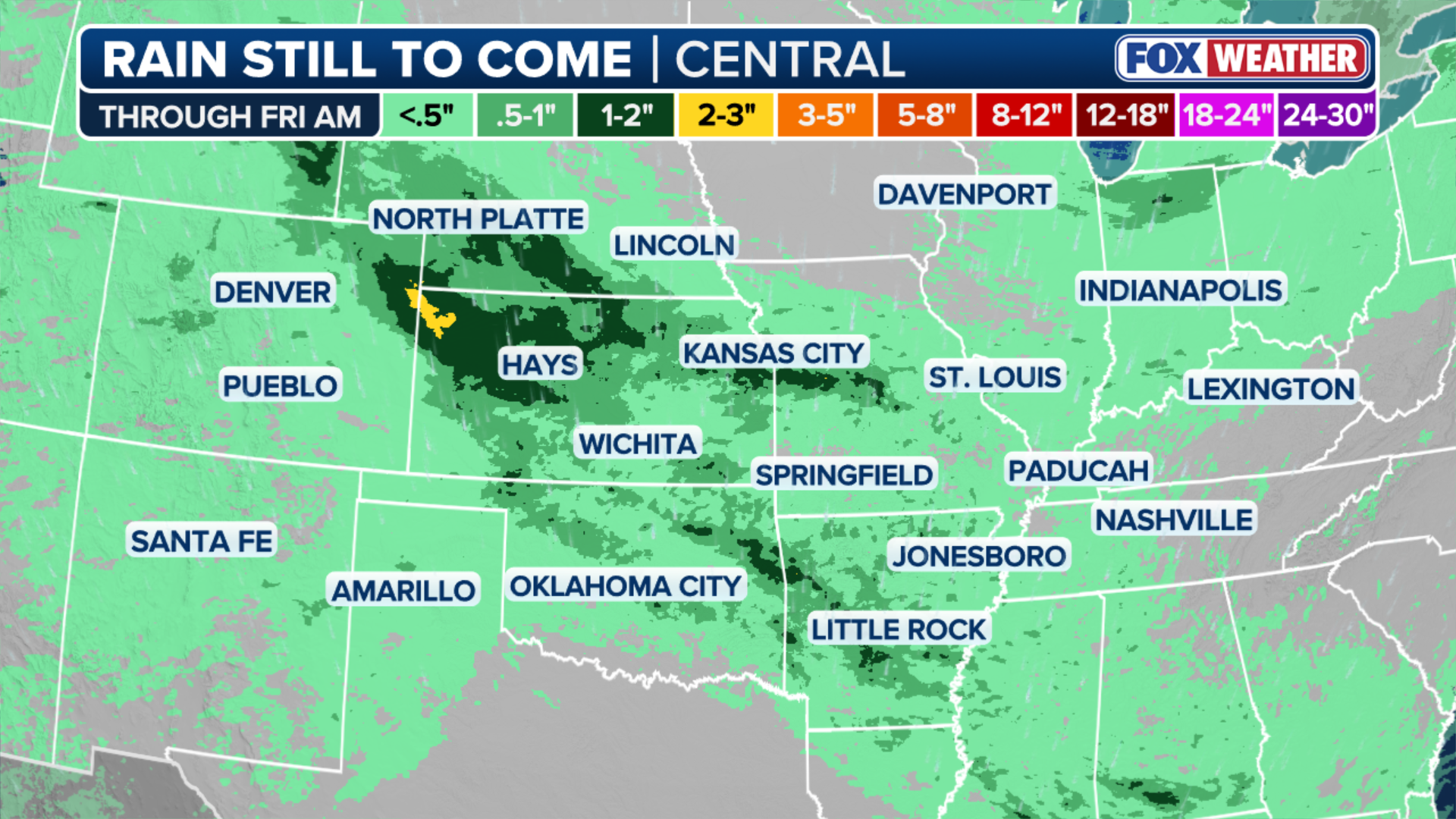
As a result, there is a Level 2 out of 4 flash flood risk extending over 700 miles from Nebraska to western Florida due to the already saturated soils.

(FOX Weather)
Areas such as St. Louis and Oklahoma City are under an ongoing severe threat.
ANOTHER ROUND OF RAIN TO SPREAD ACROSS THE NORTHEAST THROUGH THE WEEKEND
This flash flood threat will persist through Thursday across portions of Kansas and Missouri, and by Friday, rain totals could range from 1 to 2 inches.
Heavy rain drenches Dania Beach, Florida Wednesday.
Despite the persistent wet weather, it is a welcome gift, as many cities across the Central U.S. have experienced extreme drought.
Stay tuned to FOX Weather as we continue to track this developing severe weather.


