The first fall storms of the season are set to drench the Pacific Northwest, just as meteorological fall gets underway, and could provide beneficial rain that would ease wildfires amid a record-setting wildfire season for the region.
THE TAKEAWAY
- First fall storms to bring beneficial rain to the Pacific Northwest.
- Periods of steady rain are expected through Friday, as well as a flash flood threat for the eastern side of the Cascades.
- Storms could help provide relief amid a historically bad wildfire season across the region.
SEATTLE — The first fall storms of the season are set to drench the Pacific Northwest, just as meteorological fall gets underway, and could provide beneficial rain that would ease wildfires amid a record-setting wildfire season for the region.
August fires across Washington and Oregon alone burned more than 2.5 million acres, according to information from the National Interagency Fire Center.
WASHINGTON’S MOST DESTRUCTIVE WILDFIRE IN STATE HISTORY
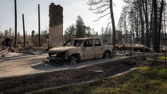
Damage is seen on August 10, 2026, after the Old Trails Fire swept through multiple neighborhoods in Spokane, Washington.
((Photo by Brent Combs/NurPhoto via Getty Images) / Getty Images)
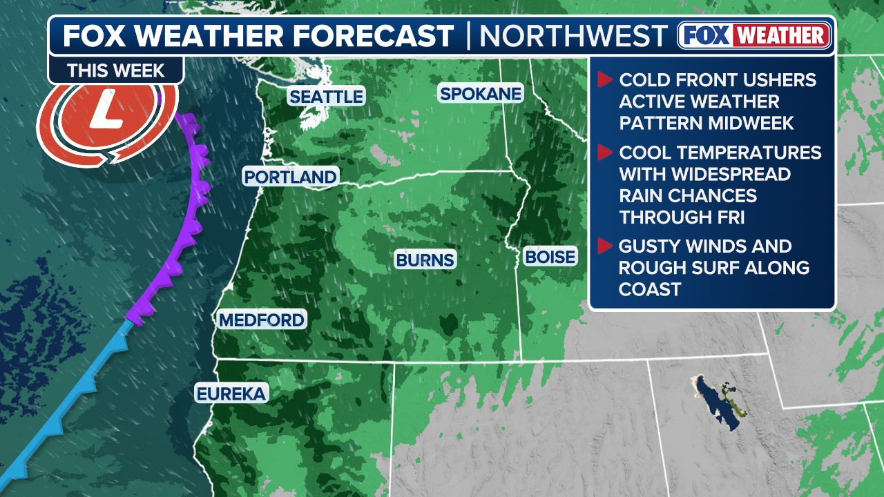
This stormy pattern will bring clouds, cooler temperatures and widespread rain to the region beginning Wednesday. A dip in the Pacific jet stream will start to break the area of high pressure that has baked the Northwest for much of the past month.
HOW HIGH PRESSURE AND LOW PRESSURE DRIVE THE WEATHER
The jet stream acts as an atmospheric conveyor belt of storms and will usher in a stronger storm system Wednesday evening into Thursday morning.
(FOX Weather)
The Interstate 5 corridor including Seattle and Portland, Oregon, could see periods of steady rain and pick up 1-2 inches of rain through Friday, with localized pockets of up to 5 inches.
Storms will also pack strong wind gusts along the coast.
The storm system is expected to move inland through the week and will funnel moisture into the eastern side of the Cascades, which is typically drier because of the mountains’ rain shadow effect.

(FOX Weather)
A Level 1 flash flood risk has been issued for Interior regions across eastern Washington, eastern Oregon and northern Idaho on Thursday and Friday.
Widespread scattered thunderstorms could also develop toward the end of the workweek, bringing brief periods heavy rain, small hail, strong wind gusts and lightning.
WHAT IS A FLASH FLOOD EMERGENCY?
Rain brings relief amid historic wildfire season
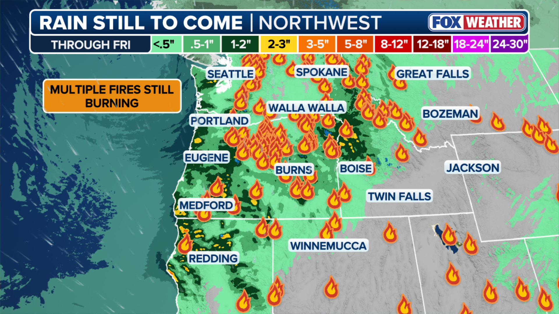
Despite the lightning risk, rain could help put out ongoing wildfires.
There are 13 large active wildfires in Idaho that have burned more than 45,800 acres combined.
(FOX Weather)
The Spokane Area Fires destroyed 833 buildings and burned nearly 10,000 acres last month across Spokane and Stevens counties.
“While it will not completely end fire season, the combination of widespread rain, cooler temperatures, and higher humidity should help slow fire growth and improve conditions for ongoing containment efforts,” the FOX Forecast Center said.