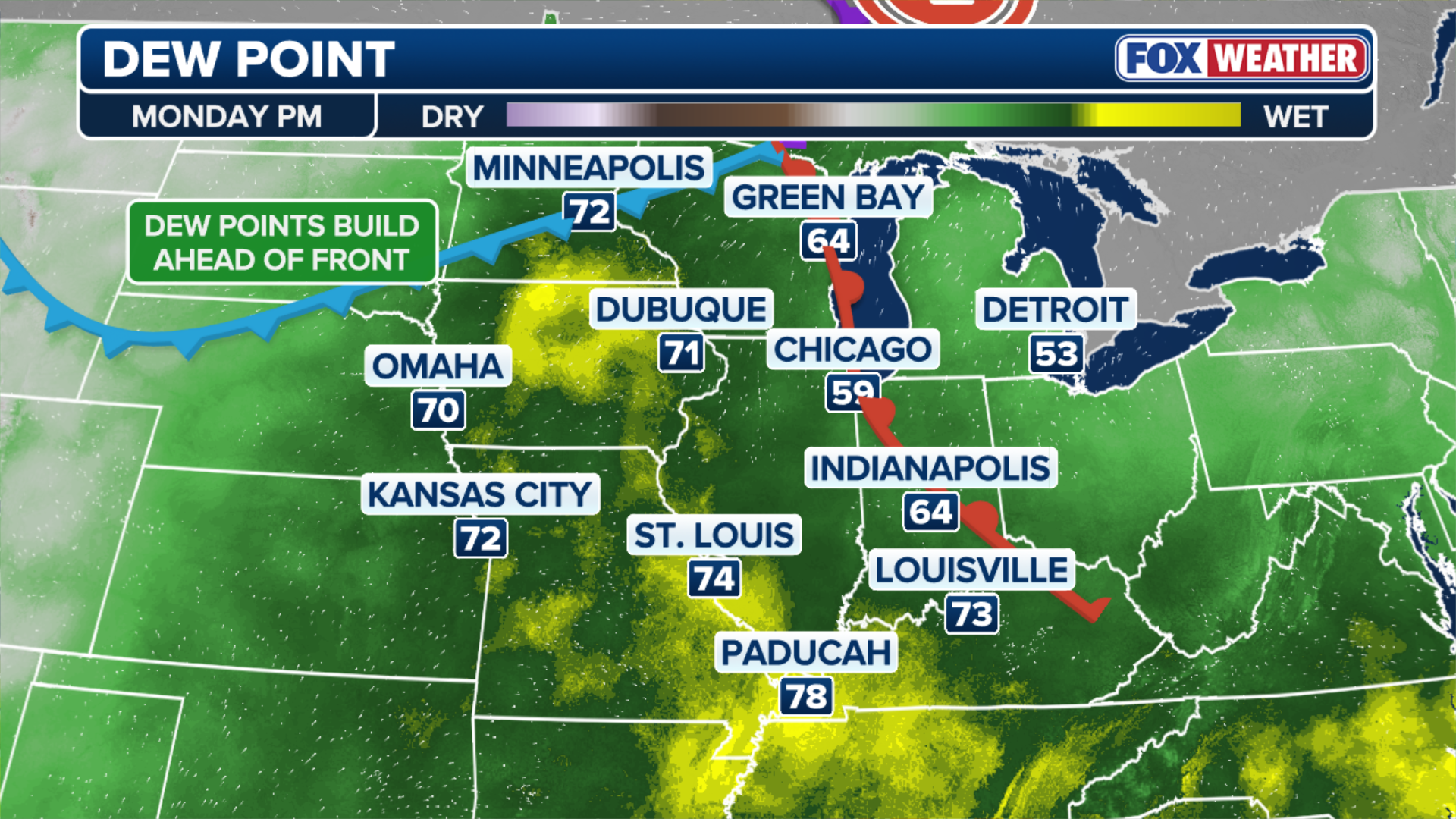
Another round of severe weather looms to start the workweek as a multiday setup will target areas from the Upper Midwest to the Mid-Atlantic and Northeast, ramping up through Wednesday. Damaging winds, large hail and isolated tornadoes are possible, alongside an increasing flash flood risk. Full forecast:
A multiday severe weather event is expected to kick off the workweek, bringing the threat of strong thunderstorms from the Upper Midwest to the Mid-Atlantic and Northeast.
Fueled by surging moisture ahead of a cold front, the storms will shift east each day as the severe risk ramps up through Wednesday, according to the FOX Forecast Center.
7 FACTS YOU SHOULD KNOW ABOUT FLASH FLOODS
(FOX Weather)
As the system and its cold front move in, some storms could become severe, with damaging wind gusts, large hail and even a few tornadoes possible.
The setup begins Monday as a system moves out of southern Canada and into the Great Lakes. Ahead of it, warm and humid air will build across the Upper Midwest, creating favorable conditions for thunderstorms.
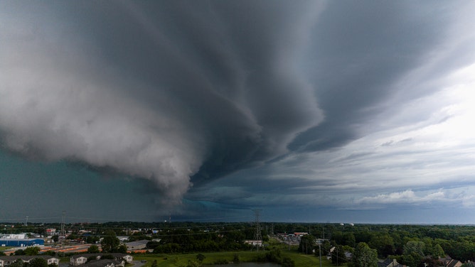
Wall cloud captured over Kenosha, Wisconsin, on June 11, 2026.
(Andrew Meier Photography)
In fact, the Storm Prediction Center upgraded portions of Wisconsin and northern Iowa to Level 3 out of 5 for risk ahead of Monday’s threats.
Destructive winds will be likely in these areas, the FOX Forecast Center said.
HOW MUCH LONGER WILL THE CANADIAN WILDFIRE SMOKE PLAGUE THE NORTHERN US?

(FOX Weather)
Additionally, cities to monitor on Monday include Chicago, Milwaukee, Green Bay and Des Moines, where a Level 2 out of 5 threat exists.
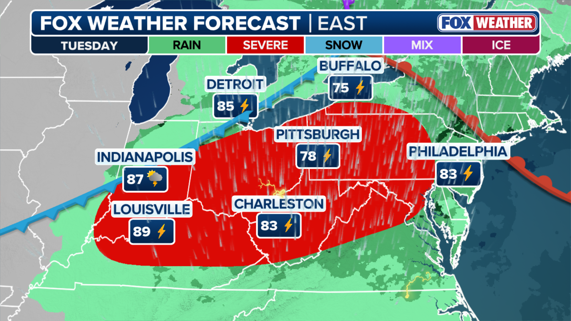
By Tuesday, the threat shifts farther east into the Ohio Valley and central Appalachians as the cold front continues to move across the region.
BRIDGE COLLAPSES DUE TO INTENSE FLOODING IN UVALDE COUNTY AS NONSTOP RAIN SLAMS TEXAS HILL COUNTRY
Additional storms are expected to develop during the afternoon and evening, with the potential for damaging winds remaining the primary concern.
(FOX Weather)
TROPICAL DEPRESSION TWO FORMS IN THE GULF, WITH HEAVY DOWNPOURS EXPECTED IN THE SOUTHEAST
Cities to monitor on Tuesday are Pittsburgh, Cincinnati, Columbus, Louisville and Indianapolis to name a few, where another Level 2 out of 5 severe storm threat is present.
By Wednesday, another disturbance reinforcing the pattern will track through the Great Lakes, pushing the severe weather threat into the Mid-Atlantic and Northeast, including the I-95 corridor.

(FOX Weather)
Within any multiday severe weather event, flash flooding will also be likely each day, the FOX Forecast Center said.
Deep, rich moisture is expected to pool ahead of the front, which will allow for intense rain rates approaching 2 to 3 inches in some locations.
BRIDGE COLLAPSES DUE TO INTENSE FLOODING IN UVALDE COUNTY AS NONSTOP RAIN SLAMS TEXAS HILL COUNTRY
Due to the fact that storms may repeatedly track over the same areas — especially across urbanized corridors susceptible to fast runoff — the flash flooding threat will escalate as the week progresses.
One New Yorker captured video of a Queens street underwater after heavy rain lashed New York City on Saturday.
Video Credit: FLORIDAP8TRIOT/X.COM
While confidence is growing in this overall pattern, there are still some uncertainties about the exact timing and location of the strongest storms.
“Thunderstorms from one day can leave behind clouds and cooler air that influence where storms develop the following day. Even so, the overall setup continues to support multiple days of severe weather as the threat gradually shifts east,” the FOX Forecast Center said.
Stay weather-aware and stick with FOX Weather for the latest updates on these developing storms.