Just when spring seemed to arrive, winter is still holding on! The same system that fueled Saturday’s severe storms is pushing east, bringing rain along the East Coast today and a sharp drop in temperatures—setting the stage for a chance of snow to return to major cities across parts of the Northeast by early this week.
Just when it seemed like spring was settling in, winter is making a comeback.
A fast-moving clipper system could bring another round of snow to major cities across the Northeast this week.
(FOX Weather)
The same system that fueled Saturday’s severe storms is now pushing east, delivering rain along the East Coast and triggering a sharp drop in temperatures—setting the stage for the chance of snow to return to parts of the Northeast.
Cities such as New York, Boston and Burlington, Vermont, could all see a dusting of snow by early this week.
This late-season clipper proves that the harsh 2025-2026 winter isn’t over just yet.
Providence broke its record for all-time biggest snowstorm and snowiest day ever on Monday during Blizzard ’26. Snow totals approached three feet on Monday afternoon.
From record-shattering totals to feet of snow that paralyzed the region, the relentless season has buried parts of the Northeast under repeated rounds of snowfall — some measuring in feet — leaving records shattered and communities digging out for days.
TIMELINE: A DAY-BY-DAY GUIDE TO THE 10-DAY ARTEMIS II MISSION TO BRING HUMANITY BACK TO THE MOON
It has been a historic winter for many; spanning cross-country storms and powerful blizzards, winter’s grip has held the Northeast tight throughout the season.
PROVIDENCE SHATTERS 48-YEAR RECORD FOR ALL-TIME BIGGEST SNOWSTORM WITH OVER 37 INCHES OF HEAVY SNOW
That said, the Great Lakes and Northeast can expect rain on Sunday, followed by snow showers and below-average temperatures from Monday through Wednesday.

Snow falling in Marquette, Michigan, on Sunday, March 15, 2026.
(Robert Ray / FOX Weather)
APRIL WEATHER OUTLOOK: SEVERE STORMS TARGET MILLIONS AS SPRING TEMPERATURE WARMUP FINALLY NEARS
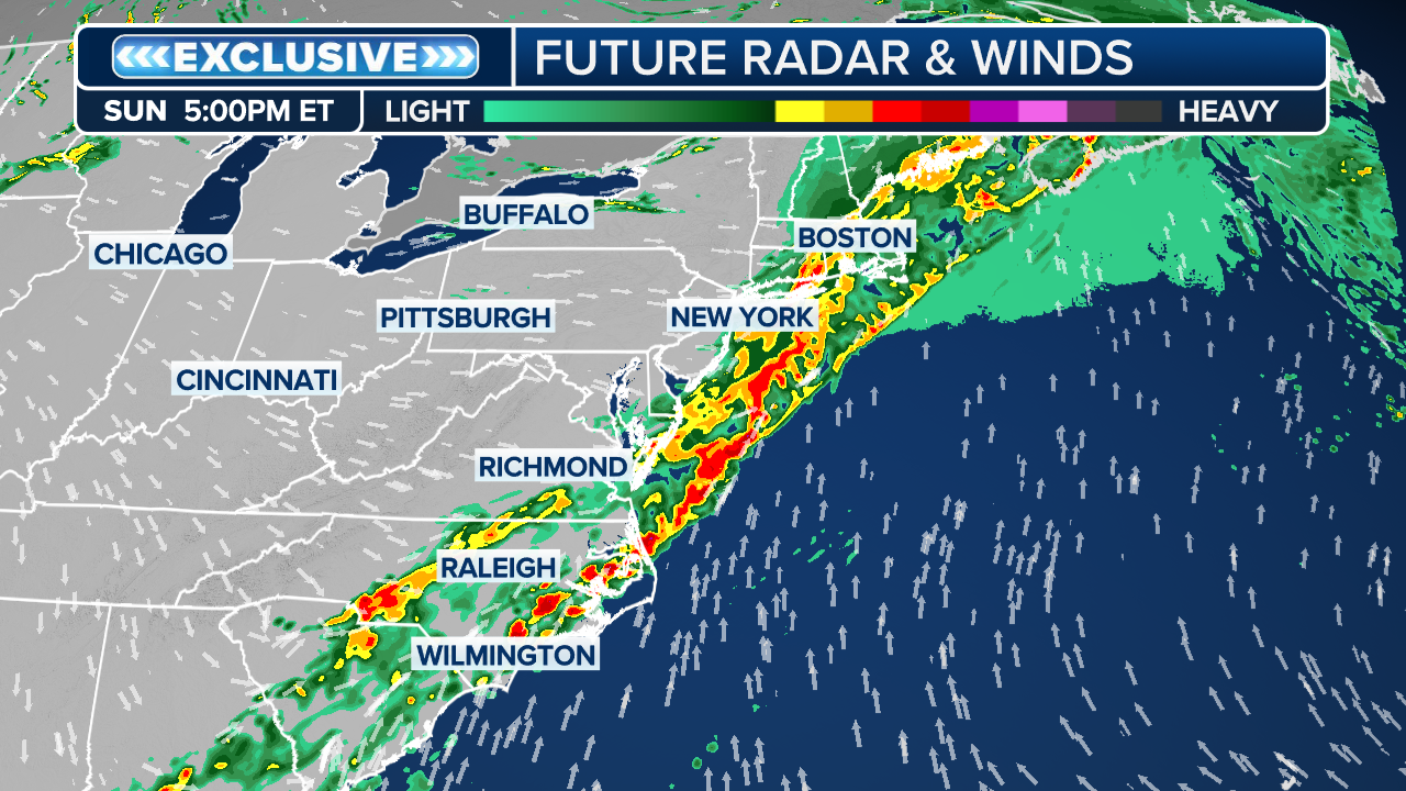
Showers and scattered downpours are expected to begin in the morning, stretching from Georgia to upstate New York, as the cold front from Saturday’s severe storms moves east.
(FOX Weather)
From Raleigh to Boston along the I-95 corridor, rain is expected through the afternoon, likely impacting travel and airport operations for the Easter holiday, especially across the Northeast.
By evening, much of the rain is expected to move offshore.
The FOX Forecast Center said the wake of the cold front will trigger cooler air to return to the region as well as the Mid-Atlantic.
“While not unusually cold for this time of year, Monday’s temperatures will fall closer to seasonal averages with highs in the 40s and 50s,” they noted.
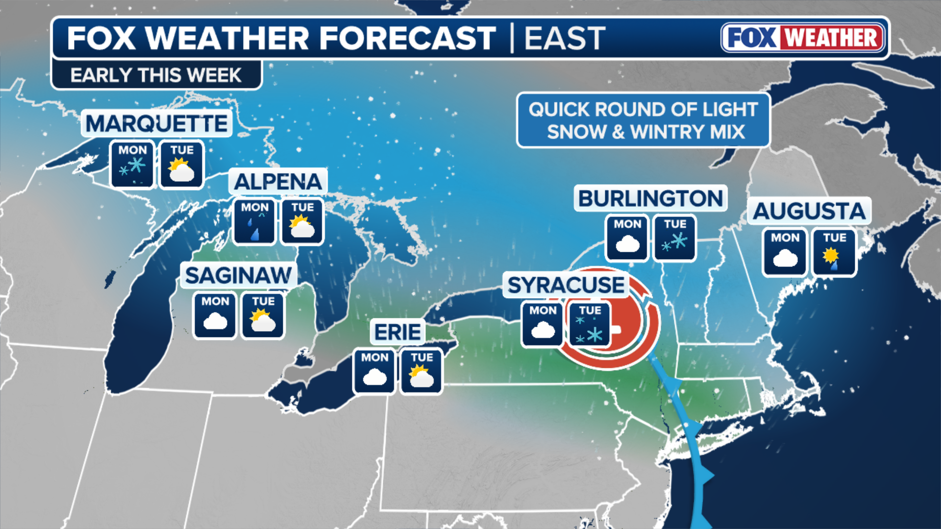
With that, an area of low pressure will push into the Great Lakes, drawing in just enough moisture to trigger light snow.
While overall totals are expected to remain light, 1 to 3 inches of snow is possible, with slightly higher amounts near the Great Lakes and the higher terrain of the Adirondacks.

(FOX Weather)
Cities in the path of the snow include Buffalo; Syracuse, NY, 1 to 3 inches; Burlington, VT, around 1 inch; Albany, NY; and a few flakes possible in Boston and New York City.
The FOX Forecast Center highlights that most of these areas typically see their last measurable snow by early-mid April.
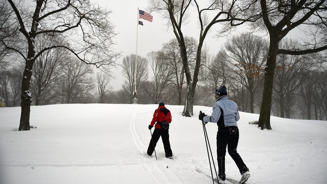
NEW YORK, NY – JANUARY 23: Cross country skiers exercise through Central Park on January 23, 2016 in New York City. A major Nor’easter is hitting much of the East Coast and parts of the South as forecasts warn of up to two feet of snow in some areas.
(Astrid Riecken / Getty Images)
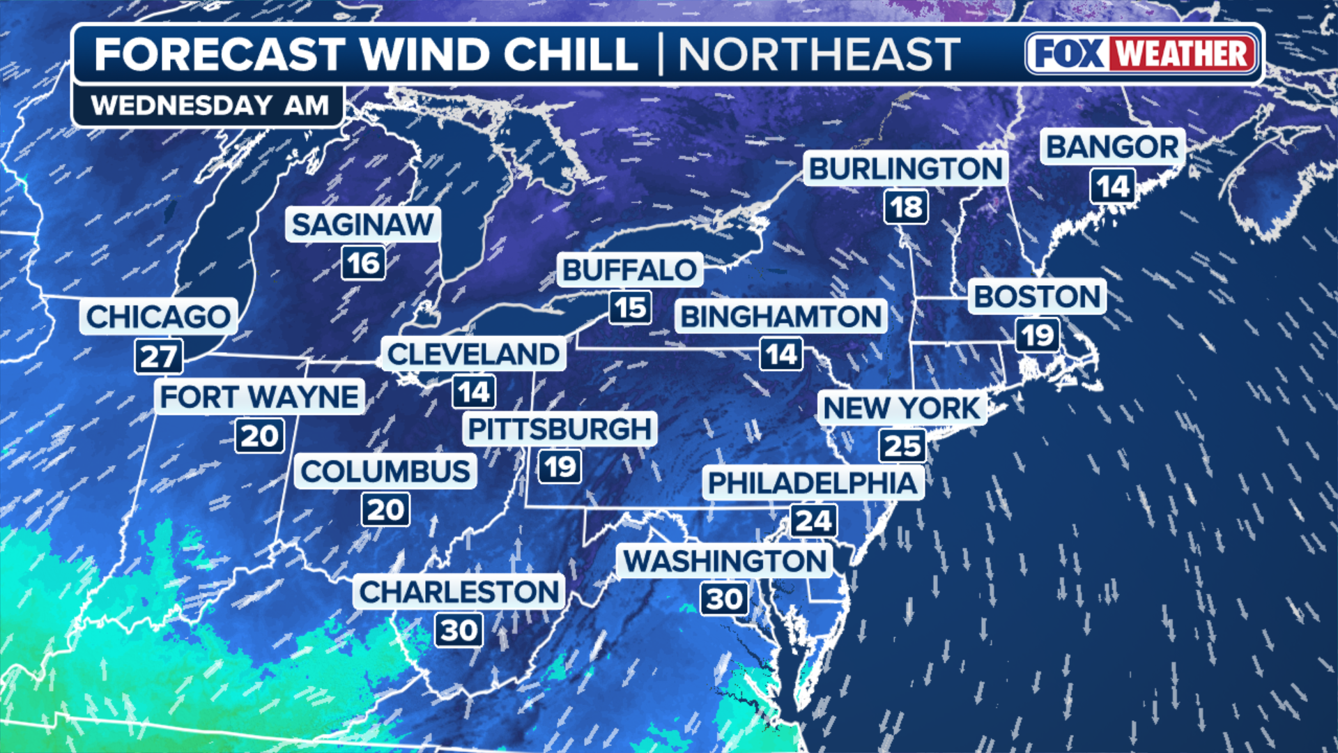
Although the late-season snow is noteworthy, the approaching surge of cold air will affect a wider area.
Just days after near-record warmth, temperatures are expected to drop 10 to 15 degrees below average from Monday through Wednesday.
(FOX Weather)
Wednesday is likely to be the coldest day, with wind chills remaining in the 20s across interior parts of the Northeast.
WHAT DOES THE WIND CHILL MEAN?
By Thursday, temperatures are expected to rebound, returning closer to seasonal averages.


