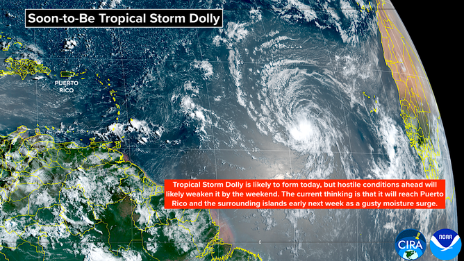
Invest 96L is still organizing in the Atlantic, despite hostile conditions presented by El Niño. The system is likely to develop into a Tropical Depression or Tropical Storm Dolly for a short time before conditions for development deteriorate on Friday.
Last updated at 8:45 a.m. on Thursday, Aug. 27, 2026.
The disturbance we’ve been following is finally developing an organized circulation, so it’s on the cusp of being designated Tropical Storm Dolly. Dolly’s life is going to be short, however.
Soon-to-be Dolly is in a pocket of atmosphere that’s reasonably supportive of development. There is Saharan dust nearby, but the plume is thinner than it has been, so it’s having less effect on the system than it did on other disturbances earlier in the season.
Satellite imagery of Invest 96L, likely to become Tropical Storm Dolly.
(CIRA CSU / NOAA)
Beginning tomorrow, the atmospheric environment is forecast to deteriorate, however. Hostile upper winds are forecast over the eastern Caribbean islands and nearby Atlantic waters. As a result, the storm should weaken into a depression or a gusty moisture surge.
On the current schedule, the squally weather will reach the northeastern Caribbean islands on Sunday and Puerto Rico Monday. Everyone there should stay aware of the latest information on the system, just in case something unexpected happens.
DO SANDBAGS ACTUALLY PREVENT FLOODING? WHAT TO KNOW BEFORE A BIG STORM
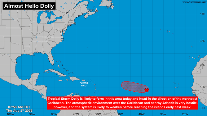
Overview of the Atlantic where Invest 96L is likely to become Tropical Storm Dolly.
(Bryan Norcross / FOX Weather)
Later next week, long-range models continue to show some chance that the remnants of the system could regenerate north of the islands. The odds are low and getting lower, and there is no consensus what might develop or where it might go. The slight possibilities range from the middle of the Atlantic to the Gulf.
Nothing will happen fast, so for now, we’ll just monitor the situation.
Elsewhere in the Atlantic
Nothing else is in the offing. Disturbances will continue to roll off Africa, but there’s no sign that the generally unsupportive atmospheric environment will change.
In the Pacific
Unlike the Atlantic, the environment in the Eastern and Central Pacific continues to be extremely supportive of tropical development.
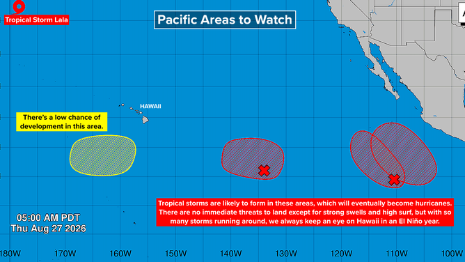
Tropical overview of the Eastern Pacific.
(Bryan Norcross / FOX Weather)
Off and on, some of the very long-range computer forecasts show systems or remnants of systems coming near Hawaii. But long-range forecasts for systems that haven’t even developed are intrinsically error prone. We’ll keep them in mind but not pay too much attention.
Otherwise, the systems are all forecast to stay away from land.