
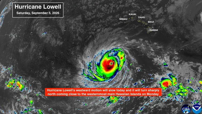
Hurricane Lowell is expect to make its shift to the north in the next 18 or so hours, pushing it up into cooler waters and quite close to the Hawaiian Islands. FOX Weather Hurricane Specialist Bryan Norcross breaks down exactly what we know about Lowell’s track and what could happen as the storm inches closer to Hawaii.
Updated at 9:30 a.m. on Saturday, Sept. 5, 2026.
Hurricane Lowell is a strong Category 4 as it drifts into a hard right bank and a path in the general direction of the western end of the main Hawaiian Island chain. The steering mechanism is changing from high pressure that has been driving Lowell to the west to a sharp dip in the jet stream that is going to yank it north.
During that handoff, steering currents will be very light. Whenever a storm slows down, the uncertainty in its future track increases because there is no strong river of air driving it forward. As a result, there is high confidence that Lowell is going to turn north, but there is also intrinsic uncertainty on its exact path.
TRACK HURRICANE LOWELL: PATH, FORECAST CONE, SPAGHETTI MODELS, WIND AND MORE
A look at Hurricane Lowell on radar satellite
(NOAA / NOAA)
The consensus of the computer forecast models and the official National Hurricane Center forecast cone is that the core of the hurricane with the most damaging winds is most likely to pass by the main Hawaiian Islands, so the westernmost islands only get a glancing blow. That’s not 100% due to the uncertainty introduced by the slow-motion turn. A more direct hit on Kauai or Niihau still can’t be completely ruled out.
Having said that, the spread in the computer forecasts today is significantly less than it has been the last few days, so confidence is increasing that the core of Lowell will miss the islands to the west. That’s likely because the jet stream dip is already developing, so the pattern is not just a forecast, it is indeed materializing.
TIMELINE: WHEN HAWAII WILL START FEELING HURRICANE LOWELL’S IMPACTS
People in Hawaii remember devastating Hurricane Iniki in 1992, which took a similar track. The odds are very high that this storm will not hit Kauai head-on like Iniki did. Ocean effects will be dramatic, however. Giant waves will be crashing on the south shore and currents will be very strong.
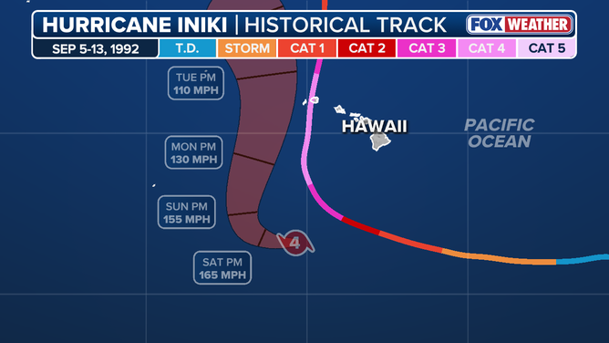
Hurricane Lowell forecast cone vs Hurricane Iniki track.
By late tomorrow, Lowell’s forward speed should be increasing as it is grabbed by the jet stream dip. At that time, leftover uncertainty should decrease because the steering currents will be well-defined.
If Lowell behaves properly, sustained hurricane-force winds would avoid the islands, but on Kauai, the mountain will enhance whatever winds they get. Everyone on Kauai and Niihau should stay up to date on the latest forecasts as they are fine-tuned over the next couple of days.
At FOX Weather, we have a new graphic based on the Google DeepMind AI model to show where potentially damaging winds have a reasonable chance of occurring.
Research has shown that when winds gust over hurricane force, power tends to go out and damage often results. Google allows us to extract that data from their latest model, which was just released this week. The traditional forecast track cone only shows where the center of the storm is likely to track, but it doesn’t adjust for the size of the storm and the distribution of strong winds.
We’re still evaluating this new tool, but it’s promising as a valuable way to understand the extent of damaging winds and the uncertainty in the track. The width of the potential damaging wind area will shrink if the steering is well established, and the track is more certain.
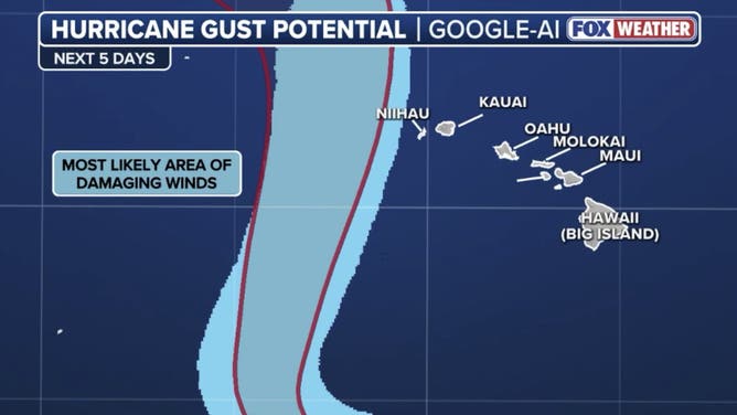
Hurricane Lowell wind gust forecast.
(FOX Weather)
Remember, this graphic is based on Google’s forecast only. Even though that has proven to be quite accurate, it’s not perfect. It is, however, representative of the official National Hurricane Center forecast.
Even if Lowell doesn’t make a direct hit on one of the main Hawaiian Islands, heavy and dangerous rainfall is likely in some locations. The current forecast is for up to 10 inches of rain on Kauai and the Big Island of Hawaii, with significant rainfall on the windward side of the islands across the state.
Giant waves and strong swells will pound the southern coasts of all of the islands. Pay close attention to all of the alerts coming from the National Weather Service office in Honolulu.
Elsewhere in the Pacific
Hurricanes Marie and Karina are tracking into the open ocean and will not be a direct threat to land. They are putting a tremendous amount of energy into the Eastern Pacific, however, and that’s going to show up along the California coast this Labor Day weekend.
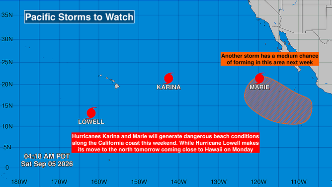
The busy Eastern Pacific.
Large, powerful waves and dangerous currents along the coast are likely. Sneaker waves, which suddenly crash over a jetty or wash far up on the beach, are possible. Use care if you’re heading to the California coast.
In the Atlantic
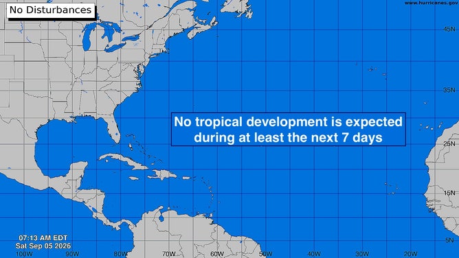
A look at the Atlantic
(Bryan Norcross / FOX Weather)
The El Niño-driven weather pattern that’s hostile to tropical development is forecast to continue for the foreseeable future. Enjoy your Labor Day without worrying about tropical development.


