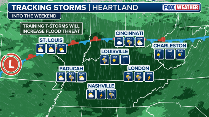
30 million Americans face a renewed flash flood threat as a slow-moving cold front gradually shifts southeast out of the Upper Midwest, bringing rain to the Heartland and Northeast by the end of the week.
Following early-week storms and flash flood threats across the Upper Midwest, heavy rainfall will gradually shift out of the region as a cold front pushes southeast.
SEVERE THUNDERSTORMS BRING DAMAGING WINDS TO MID-ATLANTIC WHILE SOUTH FACES EXPANDING FLOOD THREAT
By the end of the week, this front will become the focus for increasing showers and thunderstorms from the Heartland, as well as the Northeast.
Ohio Valley rain overview
(FOX Weather)
This slow-moving front brings a resurgence of rain and flood risks to 30 million Americans.
Recently, some of these areas across the Ohio and Tennessee valleys have been slammed—and this system is set to target communities where soils are already completely saturated from recent torrential downpours at the end of June.
4 DEAD AS FLASH FLOODING SLAMS KENTUCKY, TRIGGERING EMERGENCIES AND EVACUATIONS
The front will continue to move southeast as stronger southerly flow develops ahead of it, with storm coverage expected to increase across the Mississippi Valley on Thursday before expanding into the Ohio and Tennessee Valleys on Friday.
Abundant moisture and high instability ahead of the front will support multiple rounds of heavy rain-producing thunderstorms through Sunday.
Winds running parallel to the front will allow storms to repeatedly develop and move over the same locations, increasing the potential for training thunderstorms and excessive rainfall.
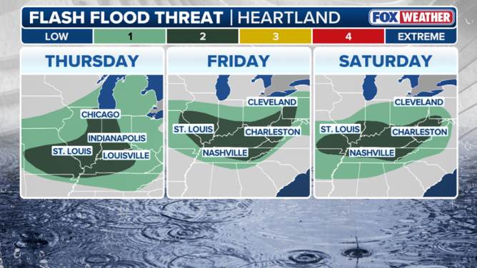
As a result, a level 2 out of 4 flash flood threat is in place Thursday across portions of the Mississippi River Valley, including Western Kentucky, southern Illinois and parts of eastern Missouri.
By Friday, the threat shifts just ever so slightly to the east, where a Level 2 flash flood risk is once again in place from Friday through early Sunday across portions of southwestern Pennsylvania, Ohio, Kentucky, Missouri, Tennessee, and West Virginia.
Multiday flash flood threat outlook
(FOX Weather)
According to the FOX Forecast Center, the threat into Friday could be upgraded to a Level 3 out of 4 if the forecast holds for slow-moving storms tracking over the same areas.
Flash flood threats will extend into next week as the front continues to sag slowly south and east.
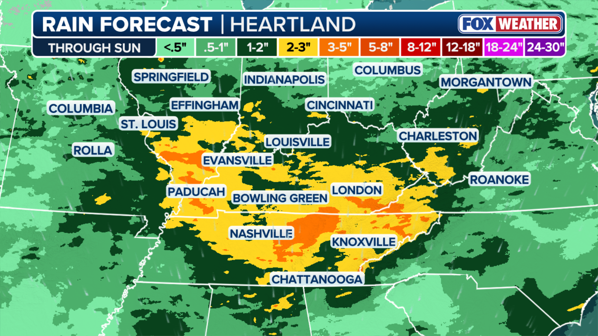
Widespread rainfall totals of 1 to 2 inches are expected from southern and central Missouri eastward into West Virginia and northern Tennessee, with up to 3 inches possible across southern Indiana, Kentucky, and Tennessee.
Beyond widespread totals, localized amounts exceeding 3 to 5 inches are possible where storms repeatedly track over the same areas.
(FOX Weather)
Additionally, with soils already saturated, especially across Kentucky, where Flash Flood Emergencies were issued to end June, the risk of flash flooding will be elevated.
While the heaviest and most impactful rainfall is expected across the Ohio and Tennessee Valleys, scattered showers and thunderstorms will also accompany the front across the Northeast through the end of the week—mainly on Friday.
Behind the front, an area of high pressure will build in, bringing a return to sunny, drier conditions by Saturday evening and Sunday for the Northeast.