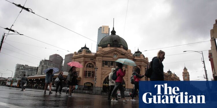
Severe thunderstorms with “giant hail” the size of golfballs, wild winds and heavy rainfall are lashing Australia’s southeast as a cold front tracks across the nation, bringing the risk of tornadoes to parts of Victoria.
A senior meteorologist at the Bureau of Meteorology, Angus Hines, said the focus of the thunderstorm outbreak on Friday afternoon was turning to the southeastern states of New South Wales, and parts of Tasmania and Victoria.
He said severe thunderstorms were bringing “heavy rain, damaging wind and large hail to many areas”, including Melbourne, where flash flooding was possible.
In Victoria on Friday, 26mm of rain was recorded in the inner Melbourne suburb of Elsternwick in the 30 minutes to 12pm, while Frankston received 35mm of rain in two hours.
“The rain is all being driven by a low pressure area and a cold front, which are currently crossing southern regions and will continue to do so during Friday afternoon,” Hines said.
“We’ve seen some giant hail in the past couple of days for parts of Australia – we may see that replicated again this afternoon. Down in Victoria, severe storms could bring any of the three: the wind, the rain and the hail.”
A spokesperson for Victoria’s State Control Centre said emergency services had received 254 requests for assistance since 6pm on Thursday, including 99 for building damage and 86 for flooding. Frankston was the busiest unit, with 45 requests in the same time period.
There were more than 700 power outages across the state.
“The risk of destructive winds, giant hail and intense rainfall continues, with the possibility of tornadoes potentially forming in this area for the upper northeast of the state,” the spokesperson said.
Three severe thunderstorm warnings were in place for large parts of NSW and Victoria on Friday afternoon, including Geelong and outer east and western Melbourne. Winds in excess of 125 km/h and giant hail measuring five centimetres or more in diameter were possible, Hines said, particularly in alpine regions.
Overnight, large parts of the country were hit with severe thunderstorms, including South Australia, southern parts of the Northern Territory, inland NSW and north-west Victoria. Weatherzone recorded more than 200,000 lightning strikes.
South Australia bore the brunt of the storms.
Port Pirie in SA was hit with winds up to 137 km/h, while Roxby Downs and Tarcoola observed winds of 113 km/h. Mount Horrocks was lashed with 36mm of rainfall in just one hour.
Severe Thunderstorm Warning
DAMAGING, LOCALLY DESTRUCTIVE WINDS and LARGE HAILSTONES
For people in Eastern Eyre Peninsula, Flinders and parts of Yorke Peninsula, Mid North, Northwest Pastoral, Northeast Pastoral and West Coast districts.
Issued at 6:07 pm Thursday, 17 October #SA pic.twitter.com/bNESYKQvKR— Bureau of Meteorology, South Australia (@BOM_SA) October 17, 2024
The bureau’s Miriam Bradbury said on Friday the cold front and low pressure system would move across the southeast, with “warm, humid, windy weather” increasing through the day.
Storms were most likely across central and south-west slopes in NSW and Victoria’s north east, with destructive wind gusts in excess of 125 km/h possible.
A marine wind warning was in place for every state and territory bar the ACT and the NT on Friday. A severe weather warning for widespread damaging wind gusts up to 100 km/h was in place for the central and eastern ranges of Victoria, including outer northern suburbs of Melbourne, and for the alpine areas of NSW, where winds of 120 km/h were likely.
Heavy rain on Philip Island delayed the start of the MotoGP, with Friday’s session cancelled after a repeated deluge of rain on the track.
Severe Weather Warning for DAMAGING WINDS, For people in parts of Central, East Gippsland, North Central, North East, West and South Gippsland, South West and Wimmera Forecast Districts.
Issued at 4:45 pm Thursday, 17 October 2024. #Vic #Victoria pic.twitter.com/3s6a4IpOks
— Bureau of Meteorology, Victoria (@BOM_Vic) October 17, 2024
Minor river rises through parts of Tasmania and Victoria were expected because of forecast rainfall. Flood warnings are possible over the coming days, the BoM said.
Bradbury said overnight the front would move off the east coast and take the bulk of severe weather offshore.
“Southern Victoria, Tasmania and eastern NSW will see easing showers during Saturday with gusty southerly winds at times, it will be a little cool through southern Victoria, but it will remain mild elsewhere,” Bradbury said.
“There is a slight chance of a thunderstorm through northeast NSW and southeast Queensland, but these are not expected to bring a lot of rain or become severe.”
Conditions would continue easing through the weekend. Sunday should be mostly dry and partly cloudy to sunny day across the east and southeast.


