Southern California is set to receive its first notable rainfall in quite some time, and while the rain is needed, with it comes the risk for debris flows in burn areas affected by recent wildfires.
The highest rain totals are forecast in Los Angeles County and the eastern San Gabriel Mountains, according to the National Weather Service. There is a 15 to 25% chance of thunderstorms “anywhere and anytime” which may pose the risk of small hail.
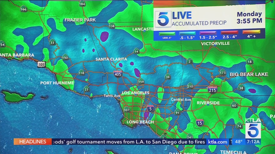
Three quarters of an inch of rain may fall per hour in some spots, NWS said in a weather bulletin.
As for timing, forecasters predict the cold front will bring temperatures down and rain chances up starting Saturday afternoon and lasting into Monday. Rain rates are expected to be highest on Sunday and Monday.

One major concern on the minds of weather officials and SoCal residents alike is possible mudslides in burn areas, and the National Weather Service has issued a Flood Watch for affected parts of the region which starts Sunday.
“Flash flooding and debris flows caused by excessive rainfall are possible in and hear the Eaton, Palisades, Franklin, Bridge and Hughes fire burn scars,” NWS said. “Heavy rain over the burn scars could trigger debris flows. Rain rates [may potentially] exceed USGS thresholds for debris flows.”
In preparation for the storm, workers have been clearing sediment and obstacles from storm drains and setting up barriers to divert any water and debris flows that could affect buildings that survived the fires.
“We don’t want to scare you, but we just have to tell you the reality of what’s to come,” KTLA 5 meteorologist Kacey Montoya said. “If we get a thunderstorm in one of those [burn scar] areas, all bets are off.”

At higher elevations, the cold front will bring snow levels to 3,500 to 4,500 feet, with three to eight inches of snow predicted in most areas. Even further up, a foot will “definitely” fall, Kacey said.
A Winter Weather Advisory is in effect for Ventura County mountain communities starting Saturday afternoon.
In the eastern San Gabriel Mountains, six inches to two feet of snow could fall between Saturday and Monday afternoons, and a Winter Storm Warning has been issued for the area with high winds forecasted. Travel during that period could be “very difficult to impossible,” the National Weather Service said.
“There could be impacts to the Interstate 5 corridor as snow levels lower,” NWS stated. “Slick roadways are expected above 3,000 feet with winter driving conditions at higher elevations, especially in the San Gabriels.”
Click here for the most up-to-date forecast for your community.


