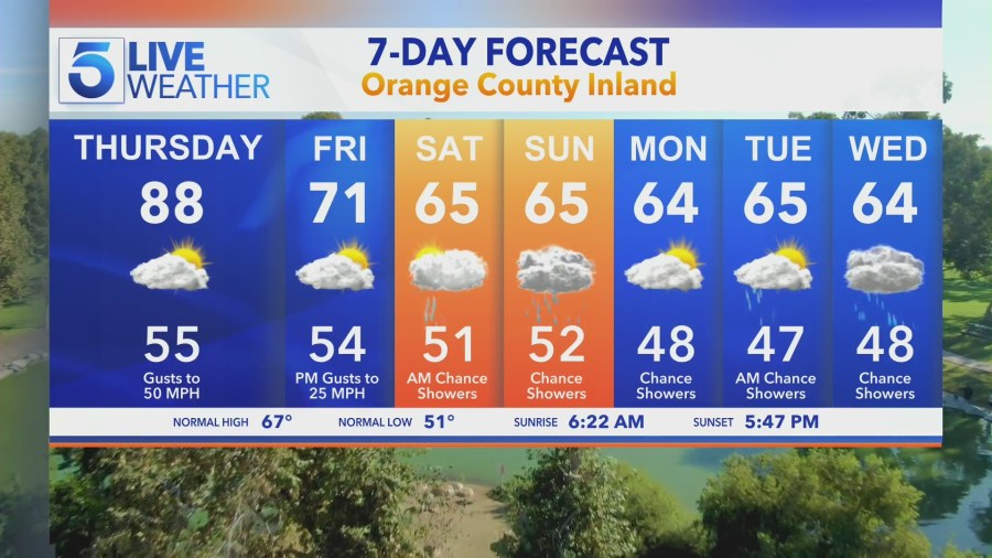
A ridge of high pressure will bring another round of well-above-average temperatures and gusty Santa Ana winds to Southern California on Thursday before a storm system arrives with a chance of rain this weekend.
Afternoon highs in the valleys are expected to climb into the 80s and possibly near 90 with lower to mid-80s forecast for areas along the coasts of Los Angeles and Ventura counties.
Santa Ana winds are also expected to pick up Thursday with peak gusts between 30 and 50 mph over our local mountain and foothill areas, according to the National Weather Service.
Despite the warm weather and gusty winds, the Weather Service announced only “minimal fire weather risk” thanks to our recent rains.
“Ultimately this is our last day of warm weather before we start to see some big changes coming in the forecast. Big changes in terms of a cool down,” KTLA’s Kirk Hawkins said.
A big drop in temperatures and increased cloud cover is expected beginning on Friday.
“A series of storms will move through the area starting Friday night with a chance of rain off and on through the weekend and into next week,” the Weather Service stated in its forecast.

Rain accumulations from the multiple storms are expected to remain rather low but “we could see a rainy start to March,” Kirk said.
The best chance of rain will come on Sunday. “While rain is likely, it will not be too much of a rainmaker,” the Weather Service stated, predicting a third of an inch or less.


