According to the latest outlook from NOAA’s Climate Prediction Center and the International Research Institute (IRI), the La Niña pattern is now breaking down, with neutral conditions likely to take over within the next month. NOAA has issued an El Niño Watch as conditions are expected to develop within the next six months. A number of projections point to around an 80-90 percent chance of a strong El Niño taking hold. Historically, a strong El Niño is associated with fewer tropical systems overall, but it only takes one to create major impacts.
MIAMI, Flo. — The most recent climate forecast from the National Oceanic and Atmospheric Administration (NOAA) shows that the La Niña climate pattern is now breaking down, with neutral conditions likely to take over within the next month and with forecast models agreeing on the growing chance for a strong, and maybe even Super El Niño conditions during hurricane season.
WHAT ARE THE EL NINO AND LA NINA CLIMATE PATTERNS?
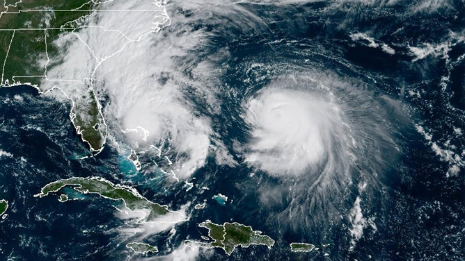
FILE – Tropical Storm Imelda on the left near Florida, and Hurricane Humberto on the right in the Atlantic, both seen by NOAA GOES Satellite on Sept. 29, 2025.
(NOAA)
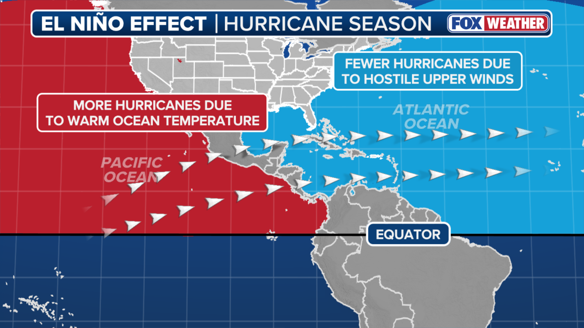
El Niño is one of three climatological phases of the El Niño-Southern Oscillation (ENSO) that describe natural changes in Pacific Ocean temperatures and atmospheric circulation that can greatly influence global weather.
ATLANTIC 2026 HURRICANE SEASON COULD SEE MAJOR IMPACTS FROM POTENTIALLY STRONG EL NIÑO
El Niño describes warmer conditions, while La Niña describes colder conditions, and ENSO neutral refers to a state where temperatures are close to average.
(FOX Weather)
As it pertains to hurricane season, El Niño generally limits hurricane activity by increasing hostile winds that act to prevent the development of tropical systems over the Atlantic. And taken in a vacuum, the stronger the El Niño event, the more storm development is inhibited.
In recent weeks, some long-range forecast models have signaled an increased chance of a strong El Niño pattern forming during hurricane season.
(FOX WEATHER)
Columbia’s International Research Institute for Climate and Society (IRI), which aggregates nearly 20 different dynamical and statistical climate forecast models from around the world into a single visual summary, is much more aggressive than the past forecast for El Niño. The February outlook called for equatorial Pacific water temperatures to peak around 0.7 degrees above average, which is a weak El Niño.
HURRICANE MELISSA TIES RECORD FOR STRONGEST HURRICANE IN ATLANTIC HISTORY
The new forecast is calling for temperatures to peak in October in strong El Niño territory (about 1.5 degrees above average). This, along with NOAA’s forecast, continues to highlight the growing chance for a strong, and maybe even Super El Niño conditions during hurricane season.
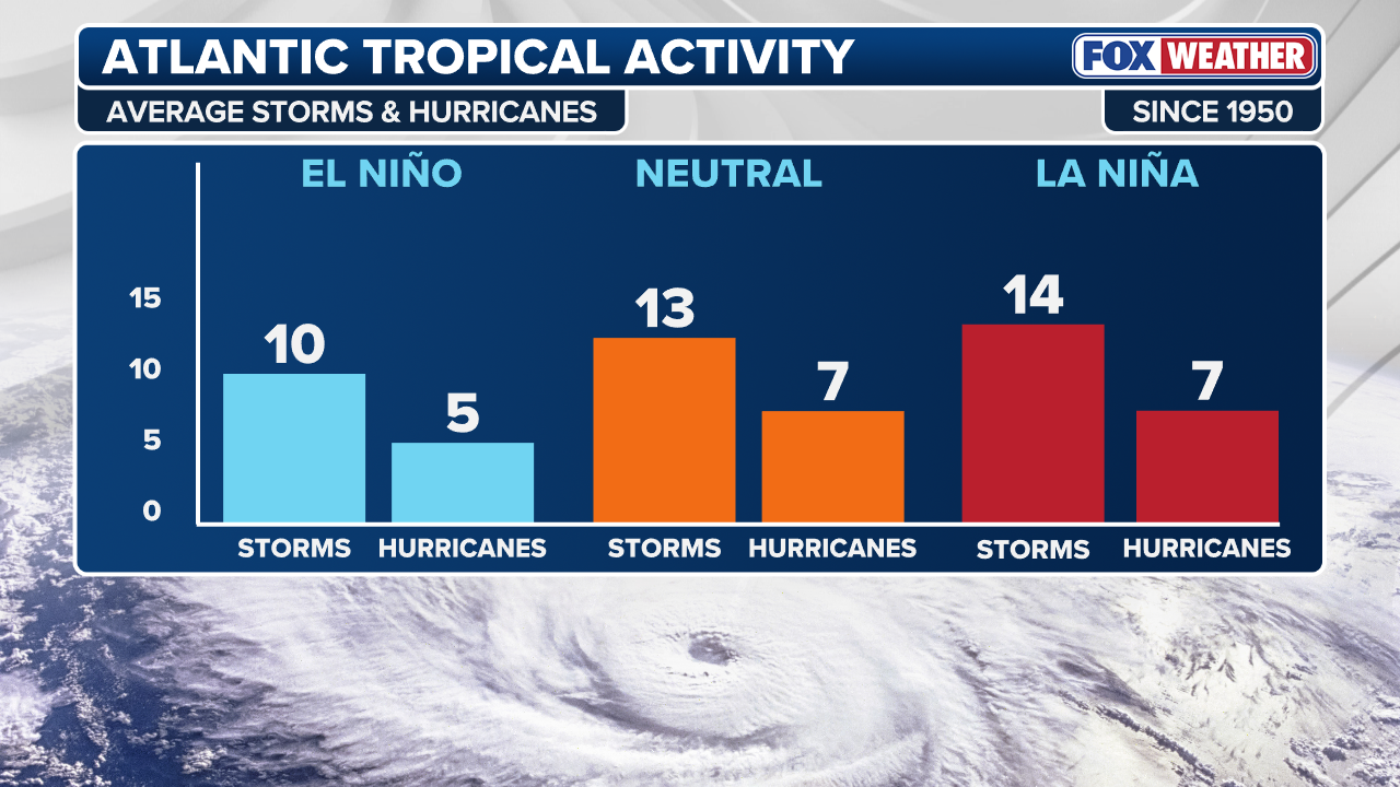
During El Niño years, the Atlantic generates, on average, roughly 10 storms and five hurricanes.
Conversely, during La Niña years, the Atlantic tends to be hyperactive, generating an average of 14 storms and seven hurricanes.
(FOX WEATHER)
However, many other factors influence storm activity during hurricane season, including sea surface temperatures in the Atlantic, which remain near or slightly above average. These warmer waters will provide fuel for storm development.
According to the FOX Forecast Center, this sets up a bit of a battle between unfavorable wind conditions caused by El Niño and the warmer ocean waters that help storms grow.
HERE’S WHY PEOPLE IN THE SUNSHINE STATE NEED TO BE ON ALERT DURING ALLIGATOR MATING SEASON
“Even in years with a strong El Niño, the risk is never zero,” the FOX Forecast Center cautioned.
As FOX Weather Hurricane Specialist Bryan Norcross often notes, even in seasons with fewer storms, it only takes one to create major impacts.
HURRICANE HQ: Hurricane Specialist Bryan Norcross joined FOX Weather 101 days out from the official start of Hurricane Season to provide an exclusive outlook into what to expect this year as we inch closer to the warmer weather, summer and FOX Weather hurricane coverage.
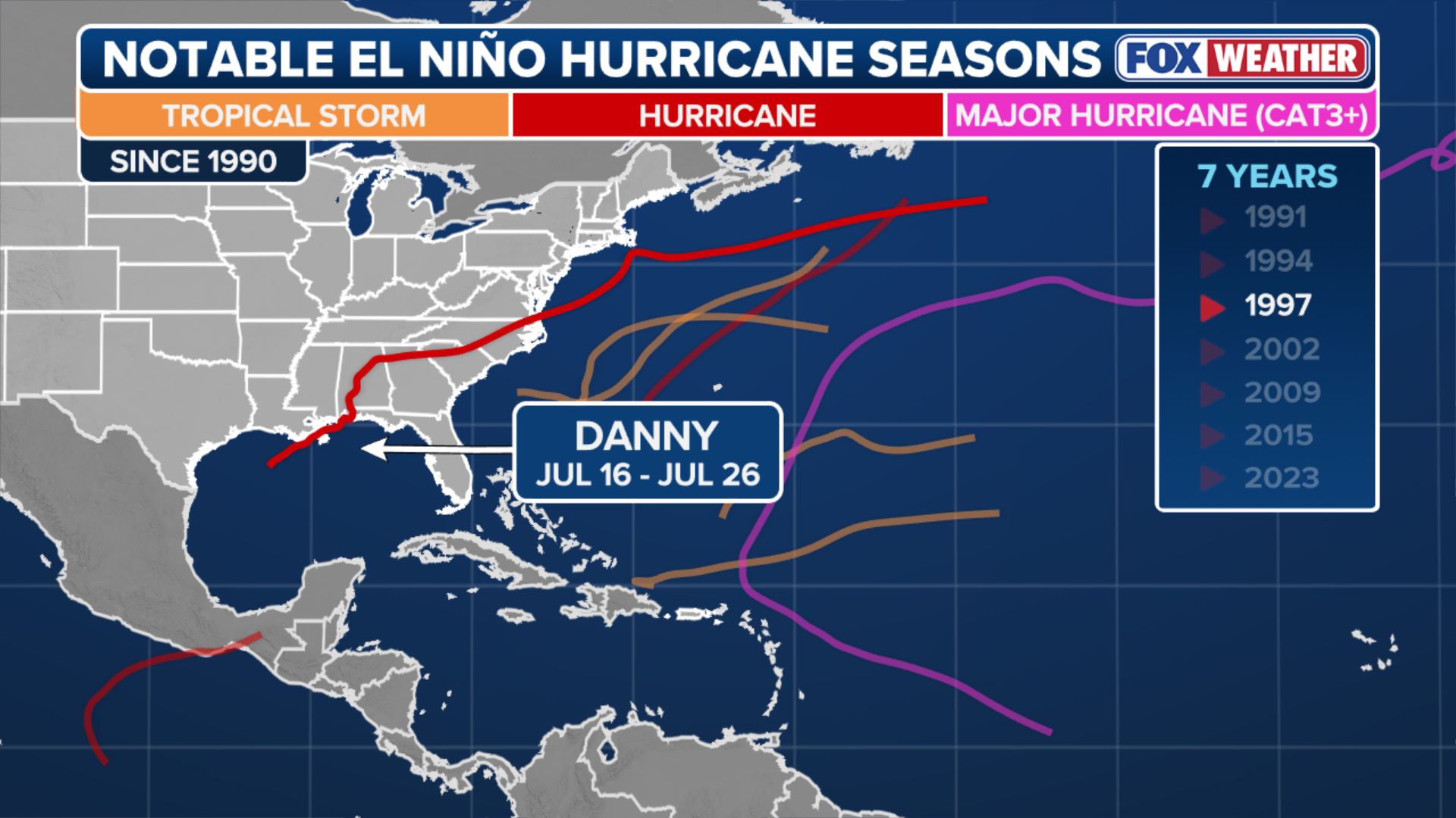
Notably, Hurricane Andrew in 1992, which killed 65 people and resulted in more than $25 billion in damages, formed during an El Niño year.
More recently, during the 2023 season, record warm sea surface temperatures offset the negative impacts of El Niño and is currently the fourth most-active season in Atlantic history.

What is left of one neighborhood after Hurricane Andrew ripped through the area in August 1992 in South Dade City, Florida.
(Photo by mark peterson/Corbis via Getty Images / Getty Images)
One of those storms was Hurricane Idalia, which resulted in $3 billion in damages after it slammed into the Big Bend of Florida.
While comparing hurricane seasons is rarely an apples-to-apples match, these examples illustrate the devastating impact a single powerful storm can have.

FILE – Palm trees blow in the wind ahead of Hurricane Idalia in Cedar Key, Florida, US, on Tuesday, Aug. 29, 2023.
(Christian Monterrosa/Bloomberg / Getty Images)
Also key to the impact of El Niño on the upcoming hurricane season is exactly when those conditions take hold.
According to the FOX Forecast Center, if El Niño develops quickly by mid-summer, it could limit activity during the peak of hurricane season. However, if the transition is slower, there may still be a window for early-season storms in June and July.


