MEMPHIS, Tenn. – Over 50 million people are bracing for severe weather Saturday as a powerful storm system slides out of eastern Texas and slams parts of the Mississippi Valley.
The stage was being set Saturday morning as warm, humid air surged from the Gulf into the Ark-La-Tex region, as well as the Mississippi Valley and the Ozarks.

Warning boxes are color coded as: Severe Thunderstorm Warnings in yellow, Tornado Warnings in red, Tornado Warnings with confirmed tornado in purple, Flash Flood Warnings in green, and Flash Flood Emergencies in pink.
(FOX Weather)
The approaching storm will tap into this fuel, with increasing atmospheric instability and wind shear that will support supercells capable of large hail, damaging winds, and possibly tornadoes well into Saturday evening, according to the FOX Forecast Center.
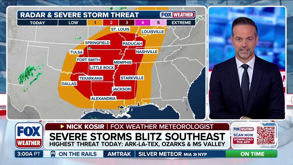
“We’ve got a big cold front moving through the nation’s midsection and conditions are expected to become more unstable as we go throughout the day with all severe weather threats on the board,” said FOX Weather Meteorologist Nick Kosir. “Some of these areas… Little Rock, Fort Smith (Arkansas) and some of the spots just to the south are a bit in the bullseye when it comes to the potential for severe weather.”
Eventually, the storms may congeal from individual supercells into lines of storms later Saturday, shifting to more of a damaging wind threat with brief tornado spinups.
The threat could linger overnight into the north and central Gulf Coast.

(FOX Weather)
Overall, NOAA’s Storm Prediction Center has placed over 13 million people across parts of 10 states around the Lower Mississippi Valley and Ozarks into a Level 2 out of 5 severe weather threat, including Memphis, Tennessee; Jackson, Mississippi; Shreveport, Louisiana and the entire state of Arkansas.

(FOX Weather)
A level 1 threat expands over another 40 million in the Gulf Coast, eastern Southern Plains and north into the Ohio Valley, including Dallas, Oklahoma City and Indianapolis.
“October, we see tornadoes popping up, but not as common, so you know it’s just a good reminder to always be aware and keep your wits about you, even as we move into those cooler weather days,” said FOX Weather Meteorologist Bayne Froney. “This is kind of our second severe season that we see coming into the fall as those temperatures start to collide, but also to watch out for that flash flood warning, or flash flood threat that’s going to be imminent too, because that rain is going to be packing a punch.”
The same system will quickly move east Sunday and into Monday, bringing more widespread storms.


