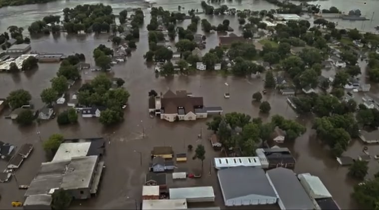
Portions of Iowa were struck by historic flooding that damaged nearly 2,000 properties and prompted evacuations and disaster declarations over the weekend.
“I can tell you that the devastation is severe and it’s widespread,” Iowa Gov. Kim Reynolds said at an afternoon news conference in Des Moines.
Flooding on Saturday and overnight into Sunday was the result not just of direct rain — some areas measured 15 inches in two days, Reynolds said — but of overflowing rivers flooding dry communities downstream, National Weather Service meteorologist Roger Vachalek said.
Precipitation drawn north from the Gulf of Mexico parked over northwest Iowa and neighboring states was then unleashed in a clash with a cool, low pressure wave moving from west to east, he said.

An official tally for weather-related deaths over the weekend was not yet available.
In Tucson, Arizona, fire officials said a motorist stranded in monsoonal floodwaters was declared dead when first responders arrived to rescue her and discovered her lifeless body.
In South Dakota, an 87-year-old driving a utility task vehicle — a golf cart-sized conveyance with off-road capability — died when it rolled down an embankment created by a washed-out roadway near Harrisburg, the South Dakota Highway Patrol said in a statement.
Areas impacted by direct rainfall or overflowing rivers also included southern Minnesota and southeastern Dakota, according to the National Weather Service.
The weekend rain fell on already saturated ground, making flooding fast and widespread in the northwest corner of Iowa. Reynolds indicated that farmland was hit hard.
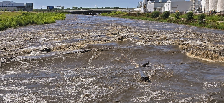
There was enough rain and river swelling in the Des Moines, Rock, and Little Sioux rivers, among others, to break flood level records at 16 locations in Iowa, the governor said.
More than 1,000 Iowans needed shelter overnight, 1,900 properties across the state were damaged, and hundreds of residential properties were destroyed, Reynolds said.
Some cities do not have working clean water systems on Sunday, and some have sewage system failures, she said. Disaster declarations covered 25 Iowa counties by nightfall Sunday.
Spencer, a city of more than 11,000, was cut off from the rest of the state by floodwater overnight as hundreds were evacuated to two city shelters, Mayor Steve Bomgaars said.
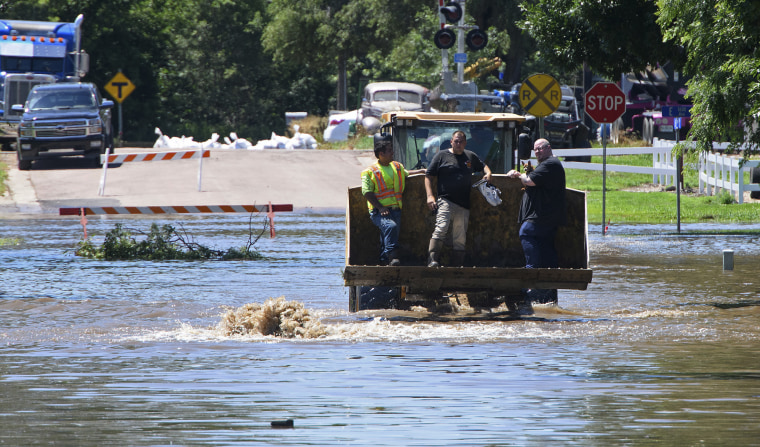
Spencer Fire Department Chief Jesse Coulson said city first responders, with the mutual-aid help of neighboring departments, made 383 rescues since the first one related to floodwater was reported at 5:15 a.m. Saturday.

One person was missing, the fire chief said at a news conference on Sunday where the mayor also spoke. Coulson indicated the missing could be recovered from a flooded vehicle after waters recede.
A nighttime curfew for the city was to return Sunday, Bomgaars said, as authorities were expected to fan out and check on residents cut off by floodwaters after they recede a few feet.
On Friday, city and county officials expected the Little Sioux River to crest at 17.5 feet but said it did so multiple feet higher. The crest level was an estimate, however.
“The electronic gauge that the Iowa Flood Center put in was under water,” Clay County Emergency Management Agency coordinator Eric Tigges said at the Spencer news conference. “That makes it difficult for us to get an accurate reading.”
He and city officials believe the river crested at 22.1 feet, beating a record set in 1953 by about 2 feet. With that number falling, some roads were passable and residents could get out with careful planning, officials said.
“We’re going to recover from this,” Bomgaars said.
In South Dakota, Gov. Kristi Noem declared a statewide emergency and said the worst of the flooding would come Monday and Tuesday by river.
The Big Sioux River in South Dakota was expected to crest Sunday night, and state officials closed Interstate 29 in the southeastern portion of the state in order to build a temporary levee across it, according to a statement.
The threat of severe thunderstorms remained, with the director of Iowa Homeland Security and Emergency Management, John Benson, urging residents to stay vigilant.

The Des Moines River at Humboldt, a small city about 105 miles north of Des Moines, was forecast to crest on Wednesday at 17 feet, more than a foot higher than it’s 1969 record, according to the National Weather Service. On Sunday it flowed more than a foot above flood stage, the agency said.
The rain and swelling waterways contrasted with persistent heat felt in much of the rest of the nation on the first weekend of summer. An estimated 95 million people in the United States were covered by heat alerts on Sunday, with near-record high temperatures — 5 to 15 degrees above normal — expected to remain at least through the early part of the week.
As high pressure baked the Mid-Atlantic, where record temperatures were expected Sunday and Monday, the Southwest broiled in sometimes triple-digit temperatures, and parts of the Northeast were expected to experience brief rain and thunderstorms alongside high temperatures.
Another cool wave moving in from the West was expected to clash with warm, wet air stationed over the Great Plains and Midwest, triggering the possibility of more sever thunderstorms, federal forecasters said.
Rain, wind, hail and flooding was possible again beginning Monday night for northern Iowa as well as for northern Missouri, northern Illinois, southern Wisconsin, southwest Lower Michigan, northern Indiana and northwestern Ohio, they said.
“It’s not going to cease,” Iowa emergency management director Benson said of the flooding, thunder and rain. “It’s going to blossom.”


