MIAMI – Even though Hurricane Erin remained safely off Florida’s east coast, the hurricane’s path produced significant consequences on land in the form of dry, windy weather, leading to increased dangers of wildfires.
With the cyclone tracking between 400 and 600 miles offshore, the intrusion of drier air on its western flank helped fuel worsening drought conditions across much of the state, setting the stage for rapidly spreading blazes.
The largest blazes are burning west and northwest of Miami, where officials report that a brush fire has already scorched roughly 20,000 acres.
Dozens of other fires are flaring throughout the state, and forecasters warn that with low humidity and windy conditions, wildfires could quickly flare up and burn out of control.
Persistent northwesterly winds are carrying the thick smoke into major cities, deteriorating air quality for millions of residents across much of South Florida.
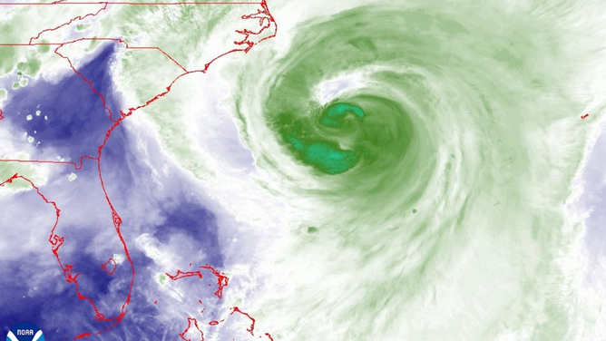
Dry air pictured in blue streaming into the Southeast.
(NOAA)
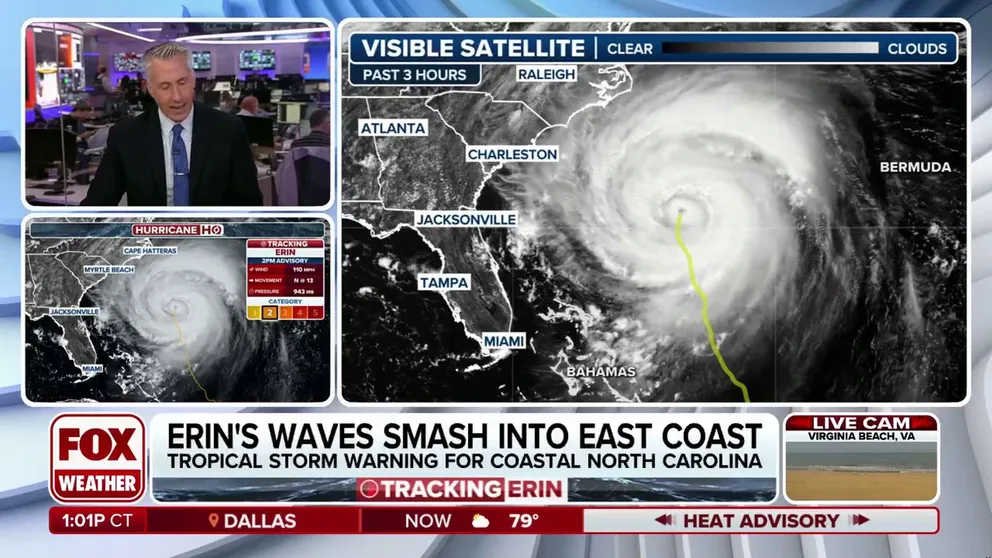
HURRICANE ERIN MAKING CLOSEST APPROACH TO US WITH MASSIVE WAVES, DANGEROUS RIP CURRENTS
The combination of drought, intense heat, and smoke-filled skies has triggered multiple alerts to be issued, including Heat Advisories and Air Quality Warnings, with a thick smell of smoke in the air.
“Fine particulates concentrations within the region may approach or exceed unhealthy standards,” an advisory from health officials stated.
Ironically, the smoke was visible from the National Hurricane Center, the agency tasked with issuing advisories for Erin, but the smoke and flames remained far enough away from the center as to not cause any impacts.
According to the U.S. Drought Monitor, about 30% of Florida is considered to be abnormally dry, while some communities in the southeastern part of the state are experiencing severe drought conditions.
Forecasters are even watching for the onslaught of what is called a “flash drought,” which is marked by a rapid intensification of dry fuels, warm temperatures, and below-normal precipitation.
Without the moisture in place to help produce the state’s daily thunderstorms, the terrain will likely turn into a tinderbox, aided by the fact other tropical disturbances are also expected to bypass the state to its east.

(FOX Weather)
All hope for rainfall is not lost as a frontal boundary is expected to stall over the Southeast and Interstate 10 corridor, producing beneficial rains during the end of the week and over the weekend.
The FOX Forecast Center says it is a bit unusual to see such a potent boundary across the South during late August, but without the precipitation chances, enhanced wildfire risks would easily have spread northward into Georgia and the Carolinas.
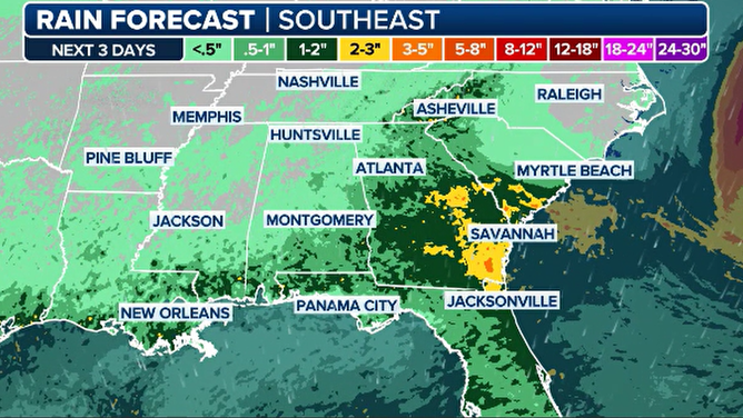
Southeast expected rainfall
(FOX Weather)
Still, the front is unlikely to push far enough into Florida to provide relief for the entire state, which means residents across the southern peninsula may remain locked in a dry regime until the daily thunderstorm pattern can reestablish itself.
Without daily thunderstorm activity, the state’s only hope of heading off significant rainfall deficits is actually to be directly impacted by a tropical cyclone – something that is not in the extended forecast.


