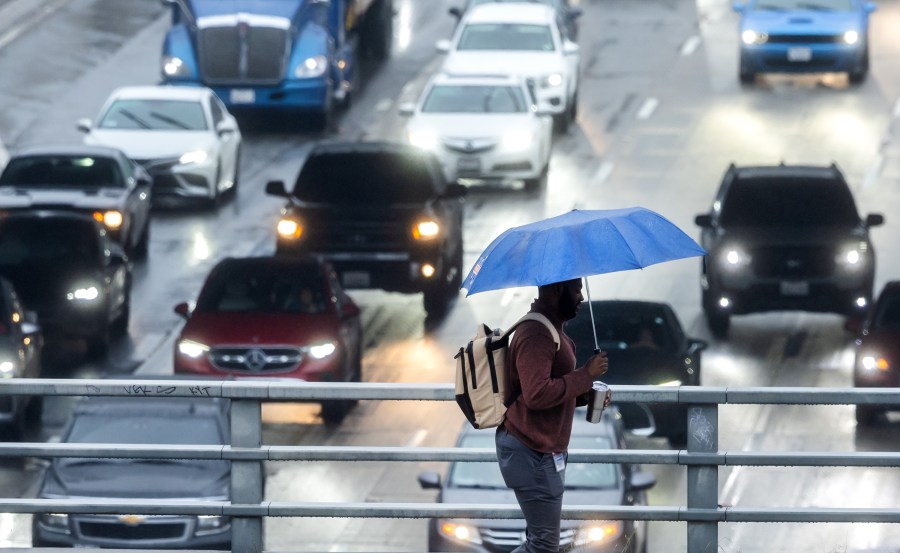

A winter storm that continues to bring showers to Southern California Friday is turning out to be a bigger rain producer than a system that dropped less than an inch of measurable rain on most of the region earlier this week.
Heavy downpours from this latest system caused debris flows in Malibu and Pacific Palisades overnight.
Forecasters are expecting the rain to taper off later in the afternoon as the storm moves off to the east but rain totals could still climb before that happens.
Here’s a look at the 24-hour rain totals around the Southland:
Los Angeles County (as of 4 a.m. Friday)
- Downtown Los Angeles 1.55″
- Beverly Hills 1.29″
- Santa Monica 1.26″
- Culver City 0.89″
- Hawthorne 0.67″
- Long Beach 0.66″
- La Cañada Flintridge 1.88″
- Porter Ranch 1.40″
- Burbank 0.68″
- Agoura Hills 0.66″
- Northridge 0.58″
- Calabasas 0.54″
- Canoga Park 0.40″
- Van Nuys 0.29″
- East Pasadena 1.67″
- Eagle Rock 1.58″
- Claremont 1.32″
- Alhambra 1.27″
- La Verne 1.22″
- Sierra Madre 0.94″
- Whittier 0.49″
- Newhall 0.87″
- San Gabriel Dam 2.56″
- Malibu Hills 2.22″
- Lancaster 0.09″
San Bernardino & Riverside counties (as of 6 a.m. Friday)
- San Antonio Heights 2.04″
- Cucamonga Basin 1.58″
- Ontario 0.94″
- Chino Hills 0.39″
- Glen Hellen Regional Park 2.56″
- Rialto 1.02″
- Cal State San Bernardino 1.96″
- Mt. Baldy 0.81″
- Big Bear 0.72″
- Running Springs 1.27″
- Riverside Airport 0.16″
- North Elsinore 0.48″
- Temecula 0.15″
- Beaumont 0.12″
- Live Oak Canyon 0.20″
- Poppet Flat 0.21″
Orange County (as of 6 a.m. Friday)
- Brea 0.67″
- Fullerton Dam 0.65″
- Garden Grove 0.28″
- Costa Mesa 0.20″
- Laguna Beach 0.24″
- Villa Park Dam 0.23″
- Anaheim Hills 0.24″
- Santiago Creek 0.24″
- Lower Silverado Canyon 0.43″
- San Juan Capistrano 0.16″
- Santiago Peak 2.26″
- Coldwater Canyon 0.63″
The National Weather Service is calling for drier, sunny skies to return on Saturday before another round of rain arrives next week.

