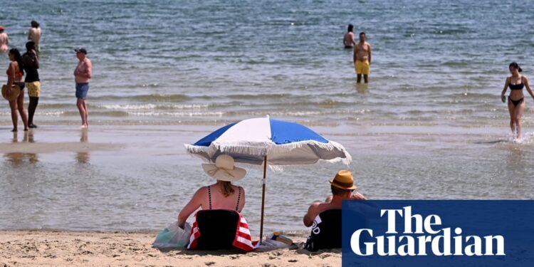
Extreme fire danger alerts are in place in parts of Victoria, as swathes of south-east Australia continue to swelter through a heatwave sweeping across the region.
However, the weather system driving the warm conditions is expected to bring a cool change by late on Saturday for much of Victoria, before it triggers intense rain and thunderstorms by the end of the weekend and into the middle of next week.
On Saturday, temperatures in parts of Victoria were significantly higher than usual, with mercury readings exceeding long-term averages by more than 15C.
Most of the state had reached temperatures in the mid to high 30s before noon on Saturday, with Melbourne expected to reach 37C.
Christie Johnson, a senior meteorologist at the Bureau of Meteorology, said the hot weather was being driven by a trough and a cold front which had already brought extreme heat over South Australia on Friday, before moving eastwards over Victoria and southern New South Wales.
The windy conditions, combined with above-average temperatures, posed an elevated fire danger, Johnson said.
Extreme fire danger warnings were issued for the Mallee and Wimmera districts, with total fire bans in place, while there were high fire danger warnings for most of the rest of Victoria, and parts of southern NSW and eastern SA.
Severe heatwave warnings centred around Mallacoota, in the far east of the state, with a brief window of warning also for Melbourne on Saturday. Low-intensity heatwave warnings were also in place across much of Victoria and southern NSW over the weekend.
Johnson said that despite the higher temperatures forecast for other parts of the country, the heatwave warnings were in place because Victoria and southern NSW were not accustomed to such heat.
“Obviously it’s going to be pretty hot across pretty much all of Victoria and southern NSW, but it’s important to note the heatwave warnings are based on average temperatures, because it’s usually a bit cooler in these areas,” she said.
The cool change accompanying the weather system was expected to push through Victoria late on Saturday.
“It will push through a cool change that will bring some relief but as of early Saturday the heat is particularly [present] over Victoria, but also Tasmania and southern and western parts of NSW,” Johnson said.
after newsletter promotion
“The trough, which is ahead of the cold front, will make its way to Melbourne probably by late afternoon around 5pm and by a similar time will reach the Mallee, and then gradually push its way eastwards.
“On the cold front itself there is a band of rain and thunderstorms, and that is over SA at the moment. We will expect to see that to push into western parts of Victoria.”
Johnson said a risk of severe thunderstorms current for SA, particularly over the Flinders Ranges, would move eastwards, before stalling over western NSW and Victoria over the weekend.
“So into Sunday there’s a risk of thunderstorms across most of Victoria and much of western NSW, as well as north eastern parts of SA and southern parts of the Northern Territory. We could see some severe thunderstorms, that trough is just very slow moving over the next few days,” she said.
The Bom has predicted above-average temperatures to linger over NSW and its east coast into mid next week, before thunderstorms are predicted.
Meanwhile, flood warnings are still in place for parts of southern Queensland, as water makes its way downstream after days of intense rainfall.


