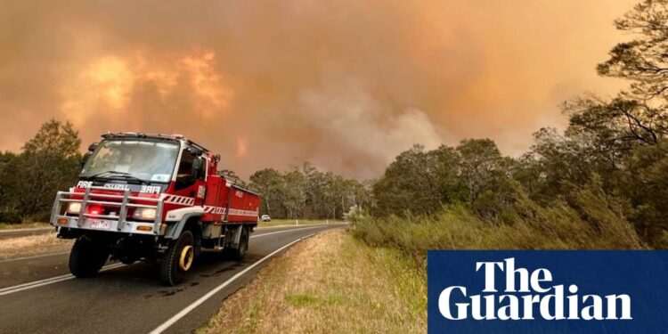
Two out-of-control bushfires in Victoria have forced townships to evacuate and destroyed at least one home as parts of Australia’s east remain on alert for fires, wild winds and storms.
Firefighters were on Sunday morning working to contain the fires in Victoria’s west, with flash flooding and heavy rainfall possible in the state’s north-east, south-east New South Wales and north-east Tasmania.
Residents in the Australian Capital Territory, and potentially parts of Sydney, are to be battered over the next 48 hours.
In Victoria “watch and act” fire warnings were in place for residents at Chetwynd and Kadnook near the Grampians and for 10 communities in the Otway ranges at the start of the Great Ocean Road, including Lavers Hill, where it remained unsafe to return.
Victoria’s emergency management commissioner, Rick Nugget, said it was an “incredibly challenging day” for the state, particularly in the west and south-west.
“We had elevated fire danger yesterday with strong winds and temperatures in the high 30s which resulted in over 80 grass and scrub and bushfires,” he said.
“We still have two fires that are not yet under control: Chapple Vale where over 700 hectares has been burnt, and Kadnook where 1,250 hectares at this stage has been burnt.
“To date we have confirmed one house destroyed in the Kadnook fire but we also believe possibly two more homes have been lost.”
More than 200 requests for assistance had been made over the past 24 hours across the state as storms with hail and lightning began to hit, according to officials.
Residents of the north-east Victorian town of Shepparton had made 70 requests, relating to building damage, fallen trees and downed power lines.
A senior meteorologist at the Bureau of Meteorology, Jonathan How, said a cool change had moved through Victoria on Sunday morning, bringing temperatures in the Grampians plunging from 34C on Saturday to 11C.
“That’s really helping to ease the conditions through there with small showers and a coolish day, and at the Otways a couple of showers have moved through this morning,” he said.
“There’s still a moderate to high fire danger because it’s still fairly windy behind cold front … but the real focus has become around the east with the rain.”
A total fire ban was active for the north-west and upper central west of NSW in anticipation of hot, windy conditions, and for southern Queensland, where temperatures into the low 40s are expected on Sunday.
Severe weather warnings have been issued for parts of Victoria’s north-east, south-east NSW, including the ACT, and north-east Tasmania, as a cold front brings heavy rainfall, damaging winds and possible flash flooding.
Six-hour totals of 60mm were likely across Albury, Tumbarumba, Gundagai, Tumut, Khancoban and Corowa, with isolated falls of 80mm possible near the Victorian border and damaging winds of up to 130km/h expected in high alpine areas.
The NSW State Emergency Service listed parts of southern NSW and the Snowy Mountains at “advice level”, urging residents to monitor conditions, secure loose items, stay away from fallen power lines and avoid parking under trees.
In Victoria, Hotham has been lashed with winds of up to 148km/h and a gust of 131km/h was recorded at Mount Buller.
“We could see destructive wind gusts of more than 130km/h for elevated Victoria, and localised heavy falls which could produce flash flooding,” How said.
Canberra had the highest risk of severe thunderstorms across the capitals. Showers and storms were possible in western Sydney and the Blue Mountains.
The heavy falls and damaging winds were expected to ease on Sunday evening as the cold front moved through Australia’s south-east.


