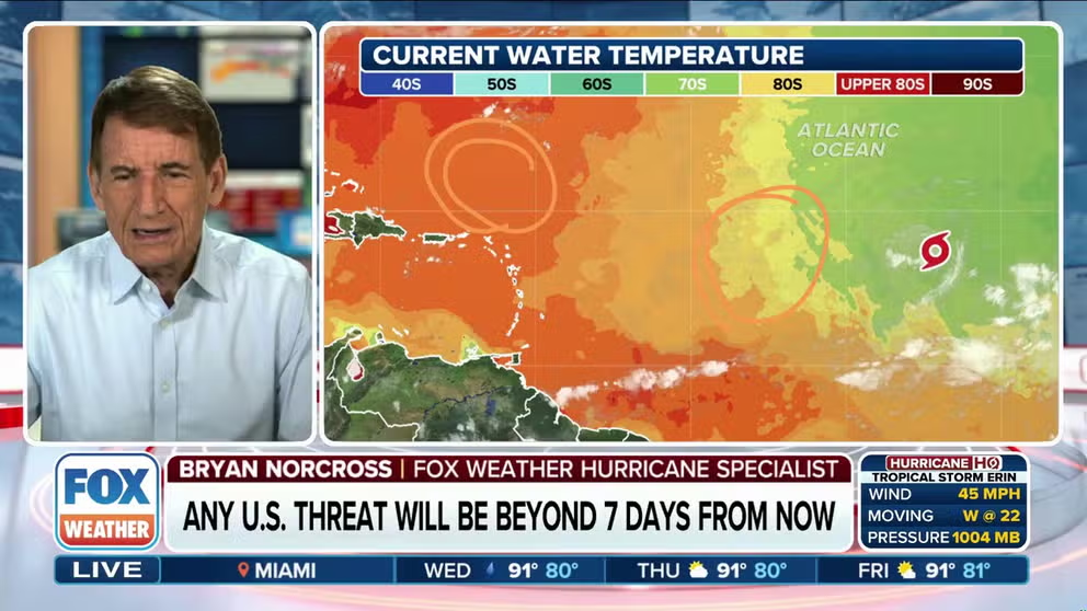
Updated at 10 a.m. EST on Aug. 12, 2025.
Tropical Storm Erin has not intensified since it formed yesterday. While the atmospheric pattern looks conducive to development and the ocean ahead is warmer, the air surrounding the system is still quite dusty and dry. It has, however, grown in size – an indication that it will likely have a large circulation when it strengthens.
The National Hurricane Center is forecasting Erin to steadily intensify as it tracks west. Erin is a small tropical storm, however. Dust or other outside forces can easily gum up the works. On the other hand, if a bubble of atmosphere supportive of development comes along, it could spin up quickly because there is less air to get moving.
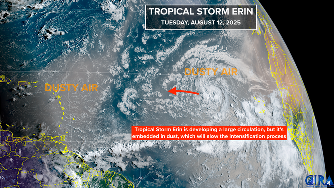
This is satellite imagery of Tropical Storm Erin in the Atlantic Basin.
(CIRA)
A gap in the dust allowed Erin to get going in the first place. Now the storm is surrounded, which is apparently arresting intensification, for now. In any case, over the weekend, there is a strong consensus among the various computer forecast models that Erin will be located over waters just to the north of Puerto Rico, although some model forecasts still bring it uncomfortably close to the islands.
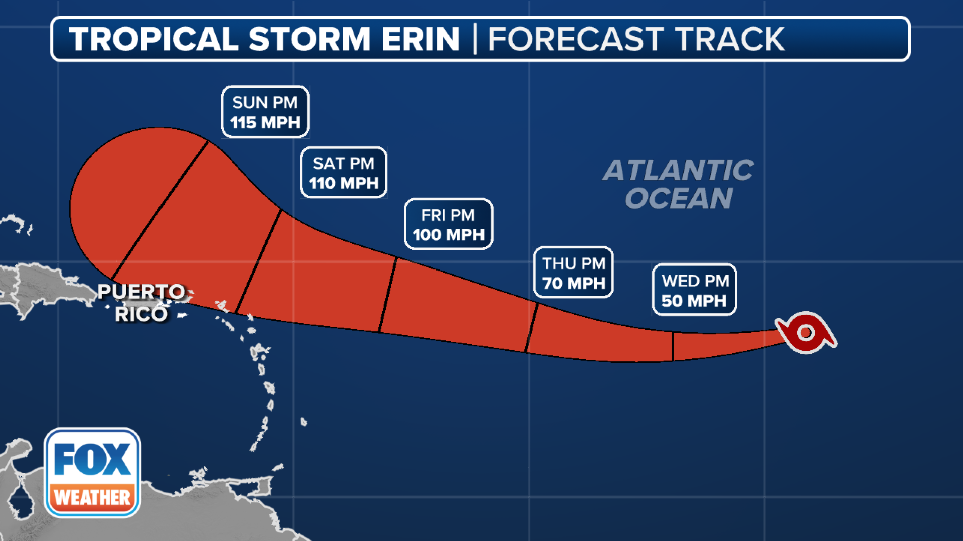
The NHC is predicting that Erin will be a Category 3 hurricane by Sunday, but there is significant uncertainty in that forecast due to the dusty road it will travel in the days ahead.
Over the weekend and into next week, the high-pressure system that is propelling Erin west will break down. A front and its accompanying dip in the jet stream will weaken the western end of the high and allow Erin to turn to the north.
(FOX Weather)
How sharp the turn will be is an open question. Looking at the most reliable computer forecast models that make long-range predictions, the majority of the plausible tracks keep Erin well offshore of the U.S. East Coast. However, some pose a threat to Bermuda.
A not-insignificant subset of plausible track forecasts still shows a threat to some part of the coastline from the Southeast to Atlantic Canada, however. If the dust and dry air impact Erin more than forecast, so that the system remains weak longer, it could swing farther west. The bottom line is that we can’t let down our guard just yet. And, importantly, dangerous beach and surf conditions are likely next week along much of the East Coast.
For now, just stay informed.
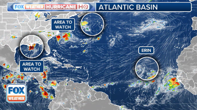
This graphic shows an overview of the tropics in the Atlantic and the Gulf.
(FOX Weather / FOX Weather)
Next in line
A train of disturbances is forecast to move off Africa behind Erin. None is forecast to develop much, but it’s the time of year that we have to pay close attention.
North in the Atlantic
The National Hurricane Center is still tracking a non-tropical disturbance over the Gulf Stream offshore of New England. It has a slight chance of briefly becoming tropical. In any case, it won’t threaten land.
In the Gulf
The National Hurricane Center is also noting the area of disturbed weather in the Gulf. It is not expected to develop, but heavy rain is likely to continue along the northern Gulf Coast. Stay aware of local alerts.


