FOX Weather is your Hurricane HQ
(FOX Weather)
Updated at 9:30 a.m. ET on Thursday, Aug. 28, 2025
A hostile pall is descending over the tropics, which should limit any significant development for the next week or two or so. Dust and dry air, an unsupportive upper-wind regime and higher-than-normal air pressure over the tropical belt should limit development between Africa and the Caribbean.
The National Hurricane Center is painting a low-probability potential development area for a disturbance forecast to move off the African coast late in the weekend. It’s going to have tough sledding once it’s over the ocean but could conceivably find a conducive enough patch of atmosphere to become a tropical depression. There is no indication of it threatening land at this point.
So systems can spin up in this type of environment, but it’s not likely to be on a threatening track from the tropical Atlantic until the pattern shifts.
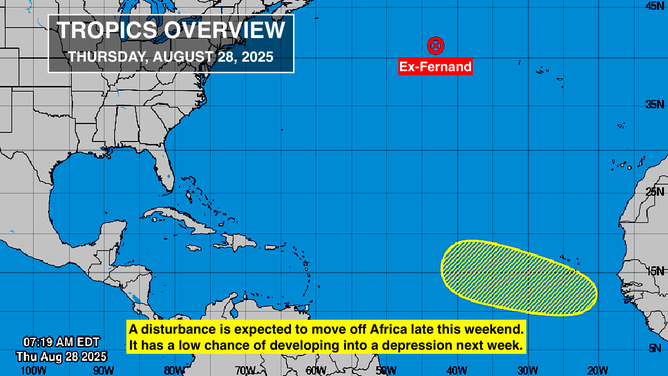
This graphic provides an overview of the tropical Atlantic Basin.
(National Hurricane Center / FOX Weather)
Besides the system that will move off Africa, the strong cold front pushing through the south and stalling over Florida could be a source of development off the Southeast coast next week. And, as always, non-tropical systems can always take on some tropical characteristics over the open ocean. But this time of year, the area of concern is the tropical Atlantic. That’s where the big storms normally come from.
Recall that last year, the tropics shut down completely for more than three weeks before storms came roaring back. This year, the weather pattern is different, and the ocean is not as warm, but a similar pause, or at least slowdown, in the normally busy part of the season looks likely.
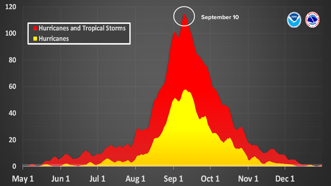
This graphic shows when the highest tropical activity in the Atlantic typically occurs.
(National Hurricane Center / FOX Weather)
The date in the hurricane season when, historically speaking, we are most likely to have a named storm active is Sept. 10. The National Hurricane Center calculates the odds by looking at all the tropical storms and hurricanes between 1944 and 2020. The year 1944 was chosen as a starting point because that’s when aircraft were routinely flown into storms, so we have more confidence that we know how strong they were.
So even though Sept. 10 is not the middle of the season on the calendar, it’s a reasonable point to focus on. And just like last year, based on what we know now, the second part of the hurricane season looks to be busier than we’ve seen so far.
For one thing, the cyclical pattern called the MJO that enhances and suppresses tropical activity is forecast to be in the enhancing phase beginning around the middle of September, although how strong it will be isn’t clear. In addition, NOAA’s Climate Prediction Center is now forecasting increased odds of La Niña developing for the last part of the season. Recall that La Niña tends to induce a pattern of upper-level winds that is more conducive to storm development.
There’s nothing to do with any of this now, of course, except to quit thinking that hurricane season is over. As last year proved, it’s not over until it’s over.
Tropical Storm Fernand is over. Its remnants are tracking over chilly water in the North Atlantic.
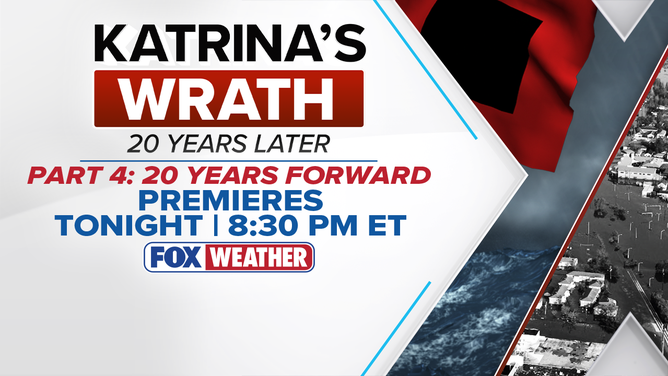
Tonight at 8:30 p.m. ET, we’ll air the final episode of our series Katrina’s Wrath: 20 Years Later. Part 4 is titled 20 Years Forward.
(FOX Weather)
Tonight at 8:30 p.m. ET, we’ll air the final episode of our series Katrina’s Wrath: 20 Years Later. Part 4 is titled 20 Years Forward. We’ll look at where things stand now. Tonight on FOX Weather. If you’re not sure how to watch, go to FOXWeather.TV, and find out how to watch for free on your TV, tablet, computer or phone.


