FOX Weather is your Hurricane HQ.
(FOX Weather)
Updated at 9:45 a.m. ET on Thursday, Oct. 16, 2025
The National Hurricane Center has a clean slate for the next seven days. After that time, the various computer forecasts continue to show a decent chance that the tropical disturbance over the far eastern Atlantic will track into the Caribbean next week and eventually develop.
The models show a weather pattern over the central and western Caribbean that would be conducive to the disturbance organizing, and some show strengthening, if the system gets that far.
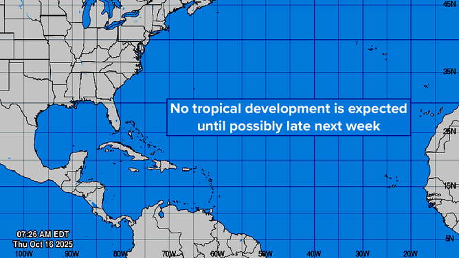
This graphic provides an overview of the tropical Atlantic Basin on Oct. 16, 2025.
(FOX Weather)
On the current schedule, the disturbance will arrive at the southeastern Caribbean islands – the Windward Islands – Sunday or Monday and begin organizing two or three days later in the central or southern Caribbean Sea.
There is no indication that the system would be very strong when it passes over the islands. Most likely it will be just a gusty moisture surge.
The track of the disturbance is unusually far south, especially for October. In fact, one of the open questions about the forecast is whether the system will track so close to the South American coast that it won’t be able to organize and intensify.
Adding up the forecasts of the various long-range computer models, the odds of the system developing in the next 10 days appear to be about 20-30%, with the odds of it becoming a strong storm in the very low range. The exclusive FOX Weather Tropical Threat analysis shows the consensus of the European, U.S. GFS and Google DeepMind forecasts.
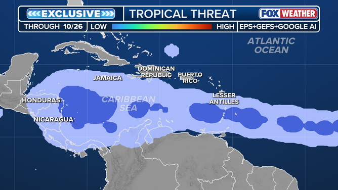
This graphic shows the exclusive FOX Weather Tropical Threat analysis.
(FOX Weather)
You see the potential track area expanding in the western Caribbean. That’s indicative of the system stalling. At that point, it might well be interacting with a large low-pressure area over Central America, but all that’s too far in the future to predict with any confidence.
The storm’s eventual track looks to be very dependent on when and where it intensifies and how strong it gets. Toward the end of the week, the jet stream is forecast to dip over Florida, with another dip coming the following week. If there’s a fairly strong storm far enough north in the Caribbean, the jet stream could scoop it up and direct it over the northern Caribbean islands. Currently, the odds of that happening look very low.
Forecasts for undeveloped systems this far out always show a wide range of possibilities, so don’t pay any attention to any specific forecast you see online. They are a cherry-picked, single low-odds possibility, while the best forecasts are made by evaluating the consensus among multiple models.
Nothing with this system is going to happen fast – the steering currents are already weak – so we’ll have lots of time to evaluate it in the days ahead.
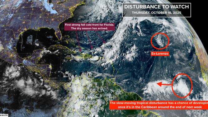
This satellite image provides an overview of the tropical Atlantic Basin on Oct. 16, 2025.
(FOX Weather)
Tropical Storm Lorenzo gave up the ghost. Its remnants are tootling around the open ocean.
The dry season has arrived in South Florida courtesy of the big nor’easter and the large system that absorbed it in the North Atlantic. The period with low humidity officially begins Oct. 15, and this year, it’s right on schedule.
Now, all we need is hurricane season to end. It’s trying, but not yet.


