FOX Weather is your Hurricane HQ.
(FOX Weather)
Updated at 9:30 a.m. ET on Sunday, July 27, 2025
The robust cluster of thunderstorms is obvious from the European satellite that covers western Africa. The disturbance is forecast to cross the African coast and move into the Atlantic late tomorrow or early Tuesday. The tropical ocean is still blanketed with Saharan dust and dry air, but some of the reliable computer forecast models indicate that this disturbance is carrying enough moisture that it has a chance of surviving its trek to the Caribbean.
The disturbance will have to run a gauntlet of occasionally hostile upper-level winds and significant dry air, so the odds are low that the system that arrives in the vicinity of the Caribbean islands at the end of the week will be very robust.
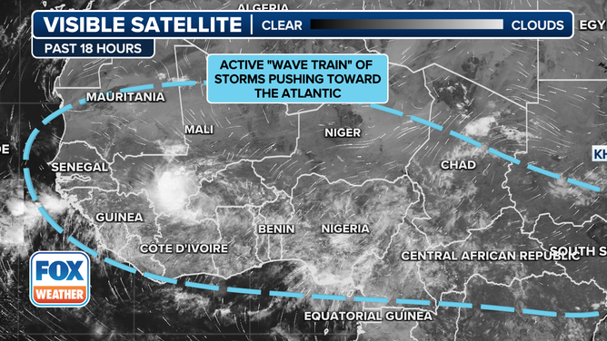
This satellite image shows some tropical waves getting ready to move off Africa this week.
(FOX Weather)
All the computer forecasts that predict that the dust, dry air, and upper winds will take a toll on the disturbance and keep it weak generally forecast nothing more than a moisture surge moving through the islands next weekend.
A number of the forecasts generated by both traditional and AI models, however, show a somewhat coherent system ending up near the northeast Caribbean around Saturday. There is no indication that it would be a strong storm at that time, but obviously it will be worth watching.
In the long range, nine or 10 days from now, things, as always, become quite uncertain, but some long-range forecasts indicate that the conditions north of the Caribbean and east of the Bahamas could be more conducive to development than over the tropical Atlantic.
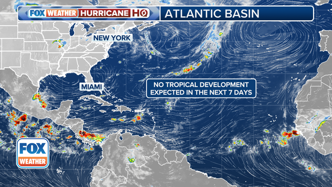
This graphic shows the tropical Atlantic basin.
(FOX Weather)
In addition, there is some indication that the overall atmospheric pattern, as reflected by the phenomenon called the MJO, will be moving into a phase more conducive for storm development around the second week of August.
There are a lot of ifs and maybes at this point, as there always are when we’re talking about forecasts more than a week in advance. And in this case, the system hasn’t even reached the ocean. So this is mostly only interesting because it’s the first Africa-born system that the computer forecasts have given a chance of fighting off the dust and dry air. As we move into August, obviously, there will be more.
The National Hurricane Center isn’t picking up on the system yet – an indication that the consensus of the computer forecasts is that the disturbance will remain disorganized this week.
In the Pacific
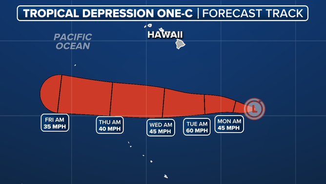
This graphic shows the forecast track for Tropical Depression One-C in the Central Pacific Ocean southeast of Hawaii.
(FOX Weather)
A tropical depression has developed southeast of the Hawaiian Islands. It’s forecast to continue west well south of the islands and never develop into more than a tropical storm.
The system is one of three potential storms in the Eastern Pacific. That’s mostly interesting because it can be an indication that the MJO pulse supportive of tropical development is migrating across the Pacific. The pulse moves from west to east, so if it hangs together, it would be expected to move over the Atlantic in another week or so. We’ll see.
For now, it’s important to remember that nothing unusual is happening. The calendar is heading for August, so we start to pay attention to African disturbances. That’s just the way the cookie crumbles.


