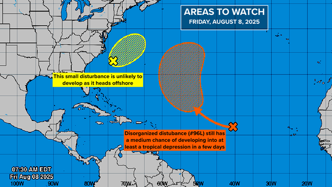
Neither of the disturbances that the National Hurricane Center has been watching are likely to impact land, and the odds of them developing are decreasing.
The small, disorganized system offshore of the Carolinas is unlikely to develop before it merges with a front just to its north. Eventually it will be swept into the North Atlantic.
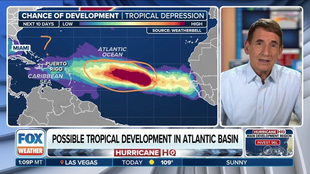
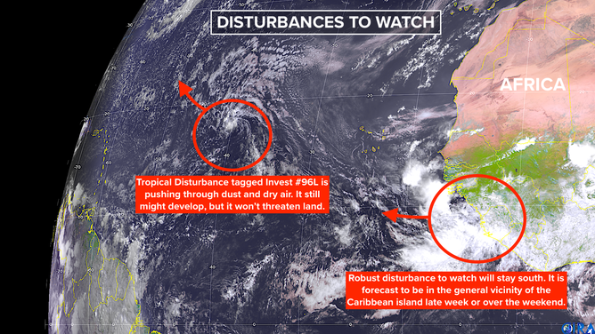
The disturbance in the tropical Atlantic tagged Invest #96L with the big orange potential development area is struggling against Saharan Dust and dry air. It is heading into the North Atlantic. The potential development area is so large because generally hostile conditions in the middle of the Atlantic will likely slow the development process. If it happens, it will likely take a few days. The NHC still has that system’s odds of development in the medium range.
Systems to Watch Next Week
The systems to watch are the ones next in line. A fairly robust disturbance is moving off Africa a little farther south than the last one. That will allow it to avoid the dust and dry air just north of the tropical belt. Computer forecasts uniformly drive the disturbance west in the general direction of the Caribbean through next week.
Atlantic tropical activity on August 8, 2025
On the current schedule, this new disturbance would reach the vicinity of the Caribbean islands late next week or over that weekend. Whether it will have shifted to the north by that time is unknowable. The sledding is on the rough side across the Tropical Atlantic. Dust and dry air look likely to impact the system on its trip west.
As the system is approaching the vicinity of the islands, the atmospheric pattern is forecast to become more conducive to the system strengthening. Since a system’s intensity and track are often related – a stronger system is normally more likely to turn north – we’ll have to see how quickly this one organizes as it moves west. The more organized it gets, the better the forecasts are likely to be.
Long-Range Projections
Beyond 7 or 8 days from now, we can only make broad statements about the forecast. The consensus of the various long-range computer forecast models is that the weather pattern over Florida, the Gulf, and the Southeast will be generally supportive of the system developing into a hurricane. That only applies, of course, if it doesn’t arc to the north early, which is not out of the question.
Tropical disturbances in the Atlantic on August 8, 2025
Despite what you might see posted on social media, there is nothing more to know. All long-range forecasts for a system that has not even begun to develop are subject to large errors and are likely to change many times. Posts showing landfall in the United States are not worth your attention and are only there to cause angst.
Two or three other disturbances are forecast to move off Africa behind this one. They will all bear watching, of course. There is nothing more to say at this point.
History tells us that activity picks up in the middle of August, so it would be unusual if that didn’t happen. The great Dr. Bill Gray used to ring a bell on August 20, signaling the start of the busy part of the season. This year, activity might kick in a bit sooner. The overall atmospheric pattern looks like it will be generally conducive to storm development for the next couple of weeks.
Updated NOAA Seasonal Forecast
NOAA released their final update to their hurricane season forecast. The bottom-line message is the same—a normal to slightly above-normal season.
But remember, a normal season (which is derived from the average of activity between 1991 and 2020) includes 7 hurricanes. It only takes one making landfall in your community, of course, to make it a terrible year.


