An early winter preview is forecast for the Upper Midwest, the Ohio Valley and the Northeast next week. Strong northwesterly winds will move over the relatively warmer waters of the Great Lakes, potentially generating lake-effect snow Monday into Tuesday. Snow is most likely along the eastern shores of Lake Michigan, Lake Erie and Lake Ontario. November marks the start of lake-effect snow across the Great Lakes.
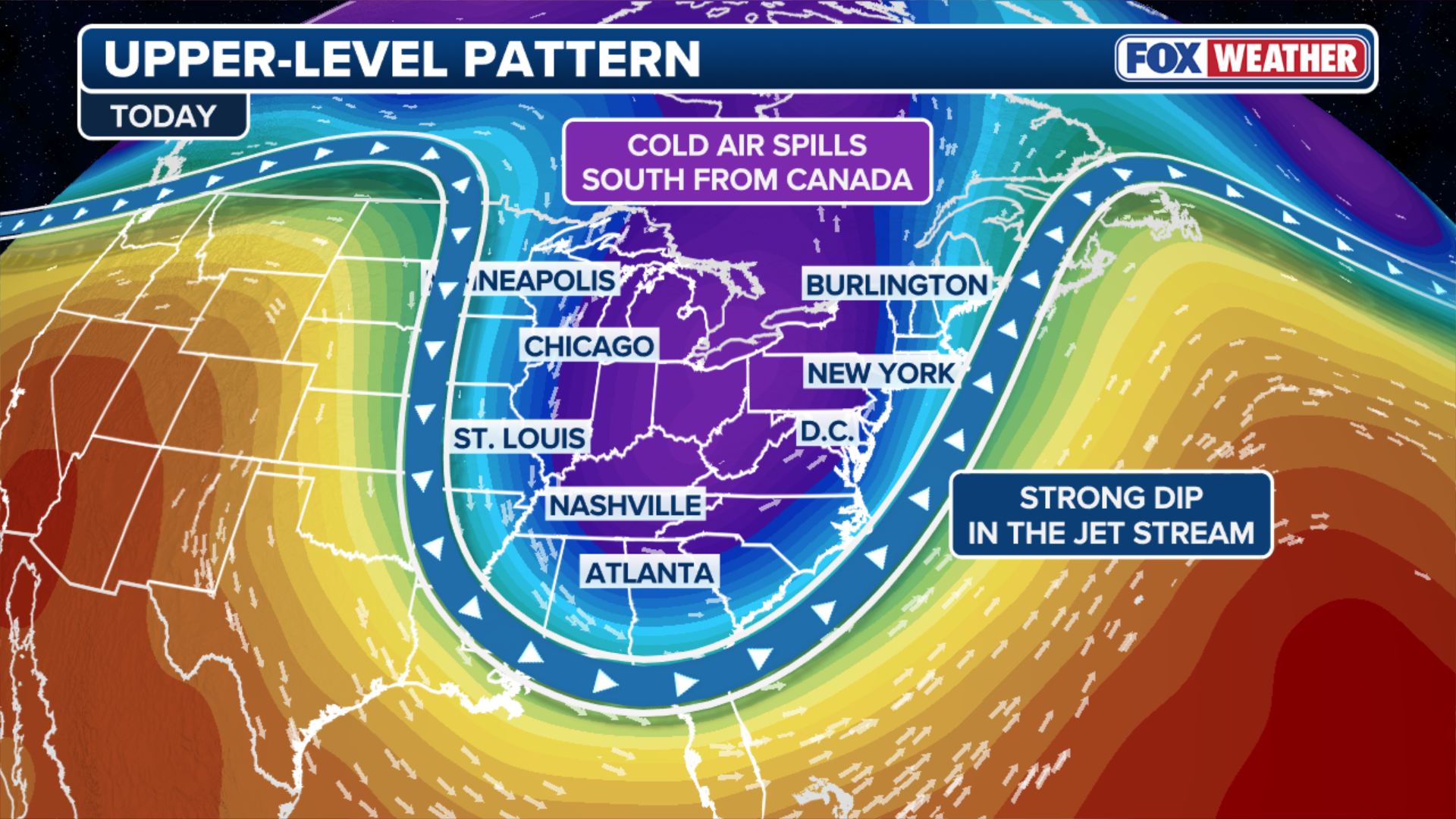
An early winter preview is forecast for the Upper Midwest, the Ohio Valley and the Northeast next week, as a strong dip in the polar jet stream is expected to plunge temperatures anywhere from 10-20 degrees below average for more than 200 million Americans.
The colder conditions will also create the potential for light to moderate snow across that region beginning Sunday, the first of the season for many.
(FOX Weather)
A strong area of low pressure will usher in the coldest air of the season from Canada into parts of the Lower 48 beginning Sunday.
Major cities around the Great Lakes could see temperatures plunge more than 20 degrees between Friday and Monday.
Cleveland has a forecast high temperature of around 60 degrees on Friday and will struggle to reach 40 degrees come Monday.

Winter temperatures will work their way into the Deep South by Monday as arctic air from Canada fully engulfs the eastern U.S. Highs on Monday may not reach freezing, 32 degrees, for millions, as the chill will be felt from Nashville, Tennessee to Tampa, Florida.
Freezing conditions to reach the Deep South
The colder temperatures will reach parts of the Southeast with projected low temperatures in the 30s on Monday for places like Atlanta and as far south as Jackson, Mississippi.
Even parts of Florida will see low temperatures in the 30s and 40s on Monday morning.
The FOX Forecast Center said numerous record lows are possible across the Southeast, including portions of Southeast Florida, by Tuesday morning.
“This is going to be a hard freeze, it will probably be damaging to sensitive vegetation. ” said FOX Weather Meteorologist Stephen Morgan. “If you have pets that are outside, make sure they’re warm, bring them inside.”

(FOX Weather)
Weather pattern has potential to bring first snow of season
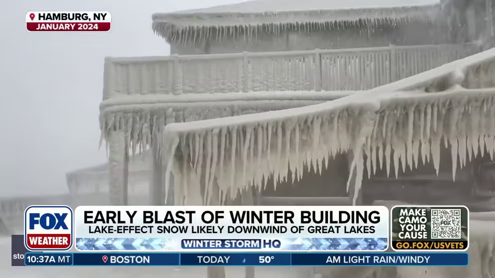
While air temperatures will plummet, water temperatures across the Great Lakes will remain warm, creating the potential for lake-effect snow for places like Grand Rapids, Michigan, Cleveland and Buffalo, New York.
Snow could also fall across interior parts of Maine, as well as, New Hampshire and Vermont.
The FOX Forecast Center said specific rain and snowfall totals from computer forecast models will come into better focus over the next few days.

(FOX Weather)
According to FOX Weather Center, the cold is expected to spread farther east into Tuesday before temperatures rebound closer to fall averages by the end of the week.
HOW MUCH WILL IT SNOW ACROSS AMERICA? EARLY FLAKE OUTLOOK FOR BREWING LA NIÑA WINTER
Locales at lower elevations in the interior Northeast, including Boston, typically see their first snow in the final weeks of November, while the first flakes across the rest of the country usually fall in December.


