After a few days of spring-like temperatures, winter weather is expected to make a comeback as back-to-back storm systems are set to move across the Northern Tier of the U.S. later this week.
RECAPPING THIS YEAR’S WINTER AS WE HEAD INTO METEOROLOGICAL SPRING
First storm: Thursday to Friday
The first storm will begin during the day on Thursday, as an extension of the atmospheric river that is currently impacting the Pacific Northwest.
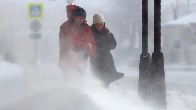
People walk in a street during a snowstorm.
(Nail FattakhovTASS via Getty Images / FOX Weather)
According to FOX Forecast Center, an area of low pressure is forecast to rapidly form in Montana and the Dakotas, then move east.
This low pressure will quickly deepen and create a massive surge of wind over the Plains and Rockies.
(FOX Weather)
High wind alerts are in place across the region since wind gusts up to 70 mph are possible. These winds could create power outages as well as impact travel.
(FOX Weather)
Snow will begin in the Dakotas early Thursday, which will lift the warm front and strengthen the system.
Moisture will collide with the colder air north, allowing for heavy snow to break out over northern Minnesota and Michigan.
HOW HIGH PRESSURE AND LOW PRESSURE DRIVE THE WEATHER
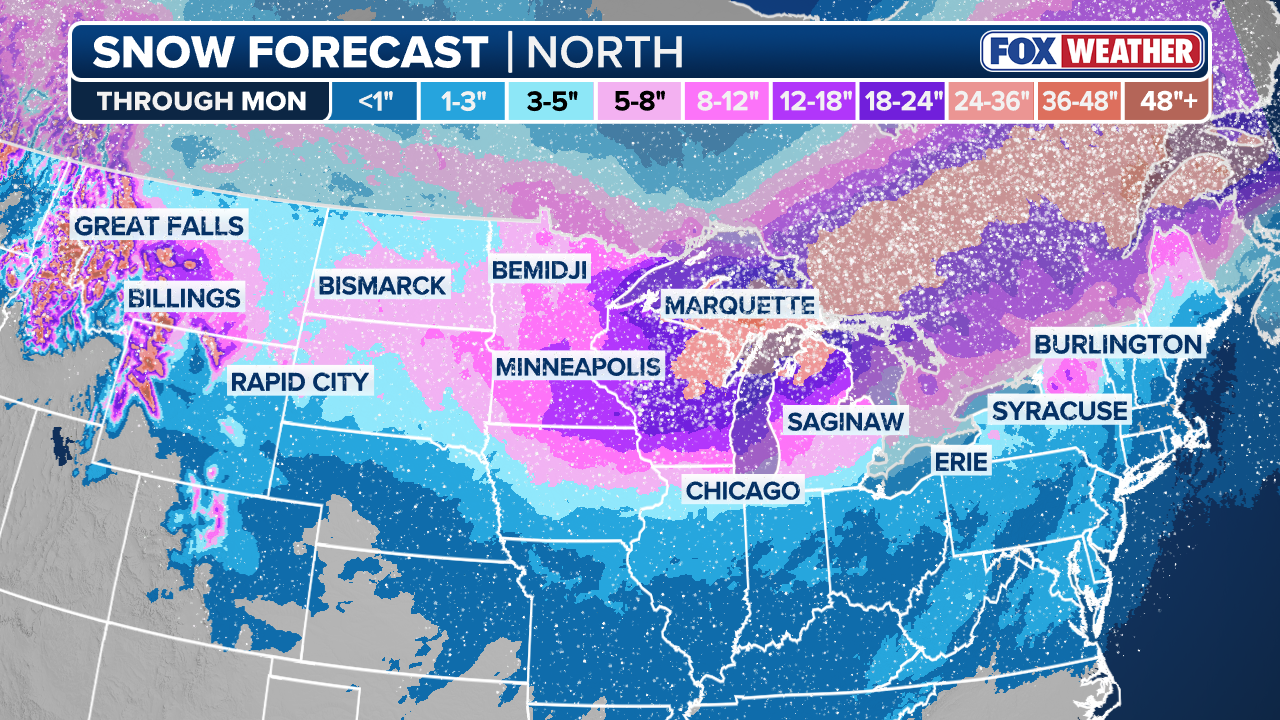
The FOX Forecast Center predicts that 5 to 8 inches of snow will accumulate north of Interstate 94. The wind of the clipper will carry over into the Great Lakes, potentially creating blizzard conditions.
Blizzard warnings have been issued for the lakeshore regions of Lake Superior in Minnesota.
People commute in downtown Milwaukee as Wisconsin braces for a winter storm that in the coming days could bring blizzard conditions, causing possible power outages, and make holiday travel conditions dangerous.
(Alex Wroblewski for The Washington Post via Getty Images / Getty Images)
The heavy snow and wind will make traveling difficult on Thursday night into Friday morning.
HURRICANE SEASON 2026: THESE ARE THE STORM NAMES YOU’LL SEE THIS SEASON
The clipper will eventually move into New England, bringing a round of snow to ski country. The totals will not be impressive, but after days of warm weather, it could lead to snow melts and ice jams.
Video shows the power of an ice jam on the Kankakee River, which has flooded homes in the town of Wilmington, Illinois.
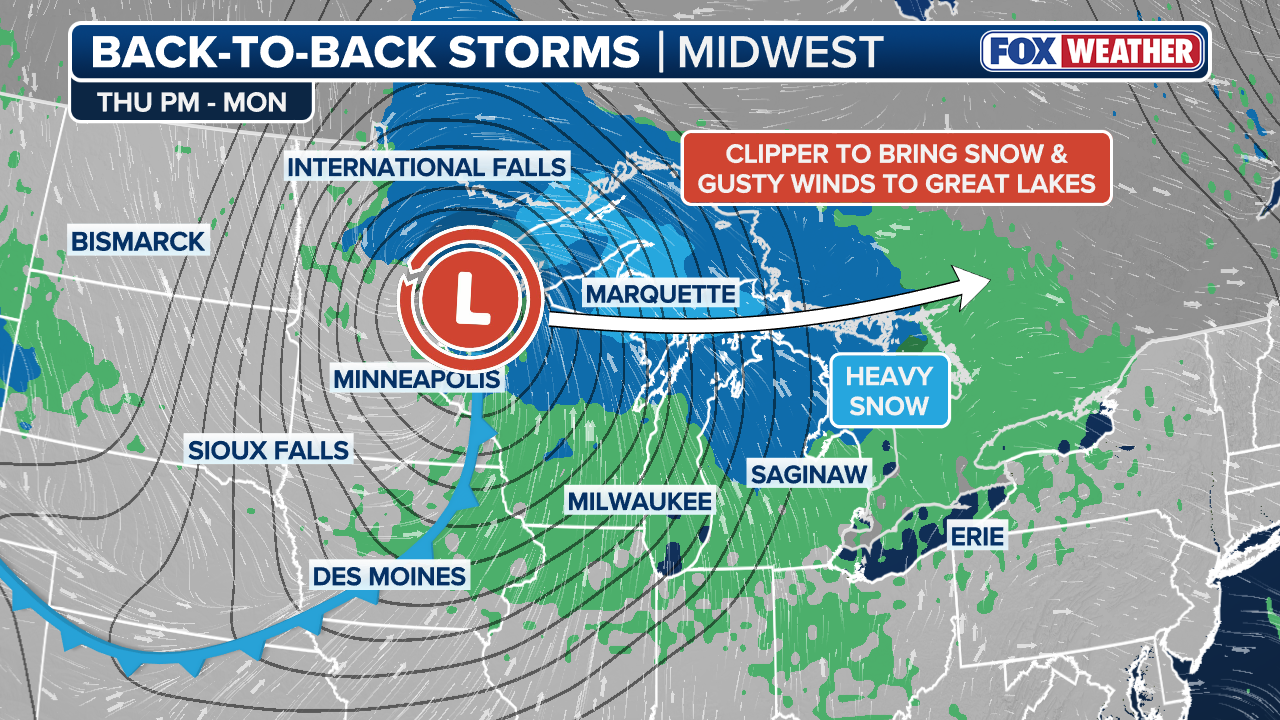
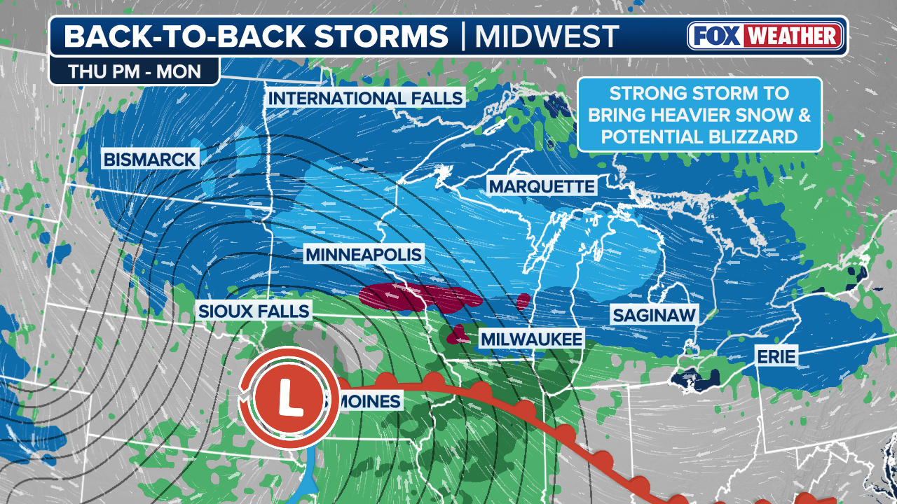
Second storm: Saturday to Monday
As the first storm ends, a second storm is expected to form, impacting millions from Saturday into early Monday.
On Friday afternoon, heavy rain and mountain snow will move out of the Pacific Northwest as a dip in the jet stream pushes east across the Northern Rockies.
(FOX Weather)
This dip in the jet stream will move into the Plains by Saturday, causing a low pressure system to develop across the Midwest.
With a high pressure system situated across Canada, cooler air will be ushered in behind this area of low pressure, allowing a strong temperature gradient to set up. As the low moves east into the Great Lakes, heavy snow is likely to break out across the Upper Midwest and northern Great Lakes.

Lake Effect Snow Falls In Mayville, NY.
(FOX Weather)
The low pressure will strengthen into Sunday, causing strong winds.
Limited visibility is likely due to blowing moderate to heavy snow, which could lead to blizzard conditions across Minnesota, Wisconsin and northern Michigan. This includes cities such as Minneapolis, Marquette, MI and Green Bay, WI.
Northern portions of New York and New England could see some snow as well, starting late Sunday into early morning.

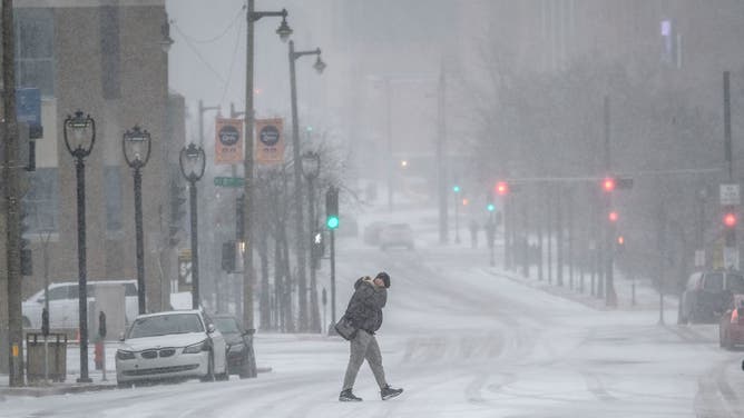
The beginning of spring has brought with it a snowy theme in Madison, Wisconsin. The snowy weather caused a difficult morning commute and travel complications for students.
(Robert Ray / FOX Weather)
A blast of arctic air will move in after the second storm, impacting the Upper Midwest all the way down into the Tennessee Valley.
This will be a sharp change compared to the record-breaking warmth that is impacting much of the East Coast this week.


