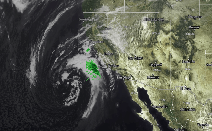
Southern California is about to get drenched by back-to-back storms.
The first system, arriving overnight Monday into Tuesday morning, is expected to bring less than half an inch of rain to most areas of metro Los Angeles.
“I expect we’ll see showers continuing into the afternoon and then tapering off in the evening,” said KTLA weather anchor Kacey Montoya. “Then we get a nice break until Wednesday.”
The second and more powerful storm arrives Wednesday afternoon, with the heaviest rain expected after midnight. Thunderstorms are also possible.
“It’s going to be very heavy rain for several hours overnight into early Thursday morning,” Montoya said.
Rain totals of 1 to 2 inches are likely in coastal areas and valleys. The National Weather Service office in Los Angeles has issued a flood watch that takes effect Wednesday at 10 p.m. and continues until 6 p.m. on Thursday.
“Excessive runoff may result in flooding of rivers, creeks, streams, and other low-lying and flood-prone locations,” the warning states. “Debris flows are possible near recent burn scars. Areas of flooding are possible in the mountains below the snow level.”
Snow levels are forecast to drop to 3,000 feet. Montoya says areas above 5,000 feet could see several inches of snow, and mountains above 6,000 feet will get buried by 1 to 2 feet.
“That’s good news for the ski resorts,” she said.
The skies finally clear on Friday ahead of another potential storm system in the extended forecast.


