
A recent challenge sponsored by the National Institute of Standards and Technology tasked drone designers with creating a system to help first responders map indoor environments. Whether it’s a burning building or an active shooter scene, the potential of such technology could save a lot of lives. To find out more about the challenge, Terese Manley, who is the Unmanned Aircraft System portfolio lead at NIST and was also the prize manager for this particular challenge, joined the Federal Drive with Tom Temin to discuss.
Interview transcript:
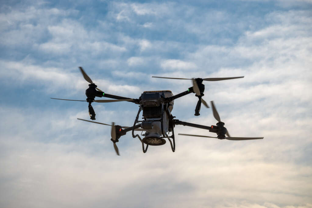
Eric White: Absolutely. So tell me about this. What is the technology that you all were looking to explore here? It seems kind of futuristic. I’m not going to lie. I’ve watched Minority Report, but basically sending in drones to map indoor environments so that first responders just have a look at the layout before they actually head into an active scene or something like that.
Terese Manley: Yeah. And let me just kind of back up a little bit, Eric, because it is important to understand a little bit about flying indoors with drones. And you’ll often here me calling it UAS, which is the Uncrewed Aircraft System. At NIST, we manage standards and measurements and do research for various things in the area that we look at for public safety. And using UAS is using it as an operational tool. So we evaluate some of the very unique UAS applications. Some of them are outdoors and we’ve done use cases in the past that evaluate what drones might be able to provide a first responder in an outdoor scenario, such as search and rescue. But there’s also a search and rescue indoors or a SWAR team scenario or a firefighter scenario. So our whole life revolves around providing UAS needs for in advancing the technology for public safety. And so when I talk about some of those unique needs, when you fly a drone indoors, there’s no GPS, for example. You also have noise considerations with propellers. You also have considerations with the confined space and that it’s a smaller space where you have to fly through windows or doors. There are various things with the thermal cameras and the lighting when you’re indoors. You don’t always have the luxury that you do during daylight. And you also have concerns with losing signal and the connection between the drone and the pilot or the ground control station. So there’s all sorts of things, not only just the obstructions of potentially a downed building in an emergency earthquake situation. So those are kind of some of the examples. You’ve just described what our use case was for the prize challenge, which is nothing more than a competition. That’s the way that we manage our research. And the scenario there is really having a potential firefighter incident commander or even a law enforcement commander outside of the building and needing to make sure that the indoor space is safe for either that firefighter or a law enforcement person. So they might be in a search and rescue operation or they may be looking for the bad guys. But being able to fly a drone in a space with a near real-time 3D map, very high quality. That incident commander being able to see that map outside of the building and then knowing where to send their firefighters or their law enforcement to keep them safe and to rescue potentially a victim or do a search and rescue. So those are some of the areas where they have asked us to look at in our research. And I can get a little bit into the way we do research, but that hopefully answers that question for you.
Eric White: Absolutely. And this is Terese Manley. She is the UAS portfolio lead at the National Institute of Standards and Technology. So, yeah, I imagine that it comes with its own unique set of challenges flying indoors. I’ve tried my hand at flying a drone every so often and I got to say I probably wouldn’t have won this prize challenge. But what are some of the other considerations for a drone operator that you have spoken to? Is it kind of going from flying outdoors to indoor? Is the shift that hard for them or is it more difficult and it actually takes some specialty training there?
Terese Manley: Well, drones have come a long way, certainly with the autonomous flight and some of the automated features for navigation and control. So things have improved, not only for the local hobbyist, but also for a first responder using this in an operation. But there are, as I mentioned, not having GPS, not having the ability to see where your drone may be flying in an indoor space makes it much more difficult. You also have steel or other concrete structure elements within a building that limit that signal. So a drone operator just can’t necessarily see where they’re going. And so there has to be more perfections in the design and the enhancements of the drone itself. So we look at some of those areas, as I just mentioned, about.
Eric White: Yeah. And what role did deployment play in your award? Because I imagine you pull up to a scene, every second counts. You can’t have somebody saying, ‘OK, give me 20 minutes and I’ll set up this drone system.’ Where you all looking for something that is easily operable and that somebody could hop out of a car, launch the drone, and it’s right into the scene?
Terese Manley: Yeah, you’re spot on, Eric. We are looking at for first responders. They need to be able to have something that’s easily deployable, throw it in the backseat of their SUV or their truck and be able to deploy it within a few minutes. That’s kind of the beauty of some of our competitions is that we not only are looking at the advancing the UAS technology, but also being able to fly it quickly and easily. And we have looked at different energy sources. For example, we have looked at endurance and the flight time, which is also a very tough thing for drones to fly for a long period of time if they’re under 55 pounds, certainly a military-sized drone, a drone that costs $1 million, could do all of this and fly for a very long time. But we need to make sure that the drones that a first responder uses can also fly as long as possible for the mission. We started off some of our research early on with flying drones, carrying the cellular network and being able to provide that communication on the ground for first responders. And operation isn’t just 30 minutes, which is a typical battery lane on another 55-pound drone. We want to make sure that they can extend that operation. So, yeah, a lot of considerations, definitely.
Eric White: All right. So tell me about some of the entrants that you had in the competition and how the systems that you witness there are advancing the research that you all are doing in this area at NIST.
Terese Manley: Yeah, that’s another great question. NIST is part of the Department of Commerce. So these prize competitions have a way of increasing or enhancing the economic development of small businesses or university or research organizations across the country. And that’s one of our platforms is really to have small businesses participate, give them an opportunity to highlight where they’re going, but also improve or shorten the time of research and development for some of those elements that they may have been working on and that we can support through a prize competition with cash awards. So we do have a lot of small businesses who participate and research organizations and we do promote the use of various drones. So not getting into anything in particular, the drones themselves, generally are custom. We require that if it is an off-the-shelf drone that they want to compete with, that it must be altered in some way to support the needs of a first responder. And so we make those elements very well known because we are interested in pushing forward U.S. development in drones so that we have more options for our first responders to purchase and also having some of those features and capabilities of UAS.
Eric White: Where things currently stand with the 3D mapping technology? Obviously, you say the technology is there. What is the holdup? Is it all just about costs and feasibility or what is it that needs to happen next for it to become a real tool that first responders can rely upon almost on a daily basis?
Terese Manley: When our drone operators compete or even in a small business, they’re looking at the design trade-offs. Since we’re looking at the cost, bringing the cost of a UAS and all the payloads, a payload being some of that 3D mapping technology, bringing that down to a cost level that supports a public safety agency or a small business. Those technologies really aren’t available today with the under 55-pound drone that’s flying and fly for a long period of time. So although the technologies are available for larger drones or for aerial or other ground robots, we believe that this technology has its place. Some of the reasons why we run prize competitions is to innovate. It allows us to accelerate innovation. And so bringing the cost down is one of those innovative ways that participants can figure out how to alter, whether it be onboard computing or offboard computing at the edge. There are various elements. And so those design trade-offs are really needed in order for us to push that forward. So it’s a hard question to answer exactly. I don’t know if 3D mapping will be available on a drone to give the visibility and the high-quality maps that we need for a first responder today or an incident commander. I don’t know if that would happen next year, but we did see a lot of advancement and teams were able to do it. But as far as moving that forward in manufacturing, those things take a little bit more time.
Copyright
© 2025 Federal News Network. All rights reserved. This website is not intended for users located within the European Economic Area.


