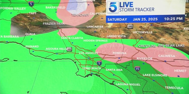
LOS ANGELES (KTLA) – Much of Southern California will see its first raindrops of the winter this weekend.
It’s a welcome change, as an unusually dry winter has brought an active and destructive fire season throughout the region.
Meteorologists say that no more than an inch of rain is expected in most areas, but exact totals may not be particularly predictable due to an unstable air mass hovering over Southern California.
“As there is a lot of uncertainty with this system, small changes in the storm track can change the precipitation amounts and potential for convective storms,” the National Weather Service said.

The first drops should be expected on the coast on Saturday afternoon.
KTLA meteorologist Kaj Goldberg said inland areas, like the San Gabriel Mountains and parts of Orange and Riverside counties, could expected the rain to start on Saturday night. He added that rain chances will be off and on throughout the weekend.
The NWS gave rainfall predictions to the following cities between Saturday and Monday: 0.8 inches in Los Angeles, .52 in Santa Clarita, .22 in Lancaster, .89 in Covina, .88 in Long Beach, .73 in Redondo and .4 in Oxnard.
In the areas above 6,000 feet in elevation, between 2 and 4 inches of snow is expected.
During that timeframe, isolated thunderstorms are also a possibility in some areas. Those storms could bring more aggressive rainfall to those areas, resulting in potential risk to areas devastated by fires, like those in the Santa Monica and San Gabriel mountains.
“Residents living near the recent burn scars should make preparations to protect their homes, businesses, and properties due to the potential for flooding. Be prepared to evacuate if local authorities tell you to go,” the NWS said.
“The loss of life and property with flooding after fires could be equally devastating to the actual fire itself,” the NWS added.


