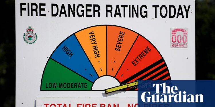
A short-lived heatwave is bringing hot, dry and windy conditions to much of southern Australia, with total fire bans in place and some areas experiencing catastrophic fire danger.
Forecaster Jonathan How from the Bureau of Meteorology said the combination of high temperatures and gusty winds was driving up fire dangers on Saturday, particularly across South Australia and Victoria.
Across these states – and New South Wales and Tasmania – temperatures were six to 12C above average for this time of year.
“Thankfully, it’s not going to be a long-lived heatwave [and] it’s just going to be that one day for most people today,” How said, ahead of warm and humid conditions in the tropics pushing wet weather over Australia from Saturday night.
In South Australia, temperatures were climbing to the high 30s and low 40s on Saturday, with a top of 40C forecast at Whyalla and Murray Bridge, 39C at Port Augusta and 38C at Renmark. Adelaide was forecast to reach 36c.
The state’s Country Fire Service warned of catastrophic fire danger for the eastern Eyre peninsula and Yorke peninsula, with most of the southern and coastal districts experiencing extreme fire danger. Total fire bans were in place for Saturday across much of the state.
“Extreme fire danger means that if a fire were to start, it would become very dangerous very quickly,” How explained. “Catastrophic is the highest fire danger rating [and means] that if a fire does start, it will be extremely dangerous and difficult to control.”
Melbourne and central parts of Victoria had a high fire danger, while Mallee and Wimmera to the north-west had an extreme fire danger and total fire bans in place.
The bureau was forecasting a maximum of 37C at Mildura, 36C at Shepparton and 35C at Bendigo, while Melbourne was set to reach a top of 34C.
after newsletter promotion
According to Weatherzone, there have been severe rain deficits this year in most of southern and eastern South Australia, and in large swathes of Victoria. This includes Whyalla, under a catastrophic fire danger rating on Saturday, which has received just 118mm of rain this year – less than half of what is expected by this point.
Hobart was expected to reach 25C on Saturday, above average for the Tasmanian capital, with Sydney at a similar top of 24C.
How said there was a risk of dry lightning on Saturday through NSW and northern Victoria, bringing the risk of starting fires.


