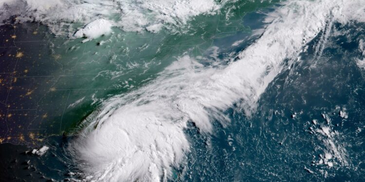
Severe weather is returning to New York City as Debby, now considered a post-tropical depression, continues to make its way north.
The tristate area is likely to receive several inches of rain in just a few days while being battered by high winds that could progress into tornadoes.
The rainfall is forecast to continue well into Friday night with the potential to develop into severe thunderstorms, according to the National Weather Service.
The New York metro area could be pummeled with as much as 2 inches of rain per hour, similar to storms the city saw earlier this week.
NOAA’s Weather Prediction Center has the city in a Level 2 flood threat, while Upstate New York should expect even heavier rainfall. The rain could then lead to river and stream flooding, with the Hudson Valley and Catskills especially at risk.
“I don’t want to be a Debbie Downer, but the forecast shows us that Tropical Storm Debby is about to lead to massive downfalls of rain all over the state of New York,” Gov. Hochul said at a press conference.
The area stretching between Philadelphia and into New England is likely to receive damaging winds that could lead to dangerous conditions, fallen trees and power outages. Wind gusts could reach up to 60 mph.
However, Debby is weakening from a tropical storm and its current path is arching up and over NYC, so it may not pass directly through the metro area.
The probability of those high winds morphing into tornadoes on Friday is under 5% for most of the city, as well as New Jersey, Long Island, Westchester County and Connecticut, the NWS said.
Ahead of the storms, New York City Emergency Management (NYCEM) issued a travel advisory for Friday morning, put all city agencies and response units on alert, and activated the city’s flash flood emergency plan.
Northern Manhattan, northern Queens and the Bronx are considered most vulnerable to flooding, the city said Thursday.
“Although not expected to be as severe as the flooding NYC experienced previously this week, storms may cause widespread minor flooding across the city, along with localized instances of flash flooding, that may result in disruptions to travel and transportation, particularly during the evening commute,” the NYCEM said in its announcement.
Crews from multiple departments and agencies are proactively inspecting and clearing catch basins in flood-prone regions. However, people in those areas should still prepare for potential flooding by making sure they have access to essential supplies such as food, water, first aid and necessary medications.
They should also be prepared to head to higher ground if conditions deteriorate.
As part of its advisory, the agency warned of delays and sudden disruptions to all travel. It urged the use of public transportation as much as possible in order to alleviate traffic conditions and allow emergency services and utility vehicles to get to their destinations more quickly.
However, New Yorkers should avoid flooded subway stations and not walk, bike or drive into flooded areas.
While lingering showers and residual flooding could continue into early Saturday, weather in the city should begin to improve by mid-morning. Expect temperatures in the 80s, lower humidity and plenty of sunshine.
Originally Published:


