More than 44 million people across the United States were under some form of heat warning or advisory Monday, with daily temperature records set to be smashed while the Midwest reels from dangerous storms and flash flooding, with more rain to come.
The number of those affected has reduced since the weekend but this prolonged and intense blast of heat, which has come earlier than usual in the season, still poses a real health risk to those who spend prolonged periods outdoors or who have no access to cool spaces, authorities warned.
The National Weather Service issued heat warnings for the Southeast, Mid-South, and central/southern Plains, from South Dakota down to Texas, as well as and the South and parts of southern California.
It could reach well into the upper-90s in these areas, the weather service said, while cities including Wichita, Kansas, Little Rock, Arkansas, and Dallas, Texas should all see temperatures at or above 100.
In New Orleans, Louisiana, it could feel as hot as 110 when humidity is taken into account. Overnight temperatures will drop to the mid-to-lower 70s, making sleep uncomfortable for some.
Excessive heat is expected to linger in the South through Friday, NBC News meteorologist Michelle Grossman said Monday morning.

“The arrival of this more intense heat early in the Summer season leads to a higher level of heat-related stress, especially for those outdoors and without reliable air conditioning available,” the NWS said.
The Associated Press news agency calculated that the U.S. experienced more heat waves in 2023 than any year since 1936. Excessive heat contributed to more than 2,300 deaths, the highest in 45 years, its study found.
“It’s more important for people who are going to be outside to stay hydrated, because heat, humidity and low winds, even if you’re in good shape and not really acclimated to it, it could be a danger,” said Bruce Thoren, a National Weather Service meteorologist in Oklahoma. “It happens quickly.”
Midwest floods
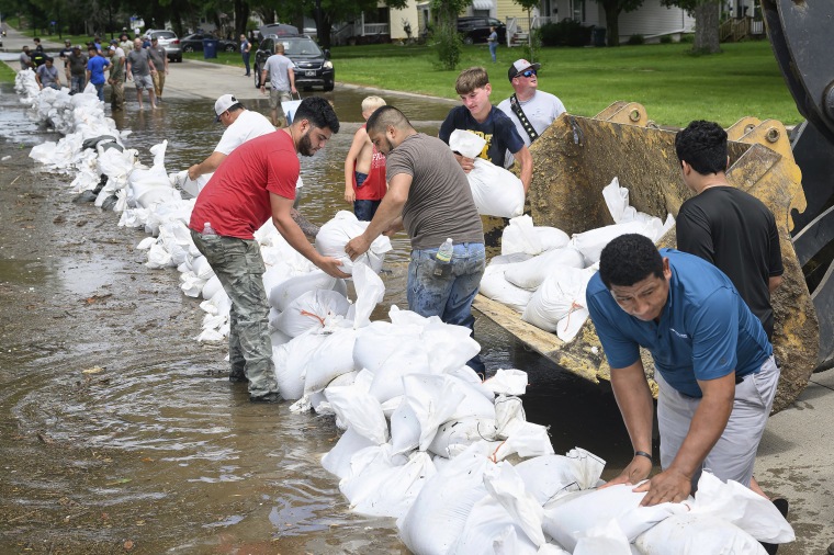
The heat wave comes after rising floodwaters in the Midwest caused chaos, killing at least one person in South Dakota, amid forced evacuations and rescues. A state of disaster was declared in 21 counties across Iowa and entire towns and cities were cut-off from surrounding areas.
Some 15 inches of rain caused at least 13 river to flood the area around the borders of Iowa, South Dakota and Minnesota, Eric Tigges of Clay County emergency management said. Some areas received eight times their normal daily rainfall.

“When the flood gauge is underwater, it’s really high,” Tigges said at a news conference.
And there is more rain to come: the NWS forecast that a new weather front will move northwards the Upper Midwest on Monday, bringing “plentiful moisture” and a slight risk of storms, which could bring very large hail and tornadoes.
This weather system will then move east on Tuesday towards to the Midwest and Great Lakes regions, with storms and a change of flash flooding.


