Tropical Storm Norbert remains active in the Pacific as the basin’s 16th named storm of the season. The season has already produced three major hurricanes, with El Niño helping fuel tropical activity and potentially reaching historic strength later this year.
Last updated at 10 a.m. on Sunday, Sept. 13, 2026.
100 YEARS AGO TODAY
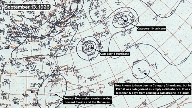
On September 13, 1926, the Atlantic was alive with tropical activity. The newspapers were focused on the Category 4 hurricane southwest of Bermuda. Based on the direction it was moving, the thinking was that it might impact the East Coast of the United States – maybe Charleston, South Carolina.
It was strolling along, and then as now, slow-moving storms are harder to forecast. In the end, it curled north.
GET THE LATEST FROM HURRICANE SPECIALIST BRYAN NORCROSS
The tropical depression in the Caribbean was also mentioned in the news coverage. It was clearly heading in the general direction of Florida and the Bahamas, although Cuba was in between. The depression was described as a disturbance attended by light winds, but every Florida newspaper mentioned it because it was relatively close.
On this day in history 100 years ago.
(Bryan Norcross)
The hurricane, well out to sea, heading toward the North Atlantic got no notice. And amazingly, in the end, the most important storm on the map, the one near the northeast Caribbean, when it was mentioned, was described as a disturbance that ships should be aware of.
The modern analysis is that that disturbance was a strengthening hurricane on this date in 1926, reaching Category 2 strength by evening.
OLYMPUS DIGITAL CAMERA
(SKashkin / Getty Images)
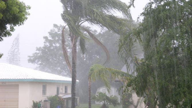
But on this Monday morning 100 years ago, people in Miami and South Florida went about their business preparing for the winter tourist season to come. They had no idea that the storm that would change their lives at the end of the week even existed.
THE ATLANTIC IN 2026
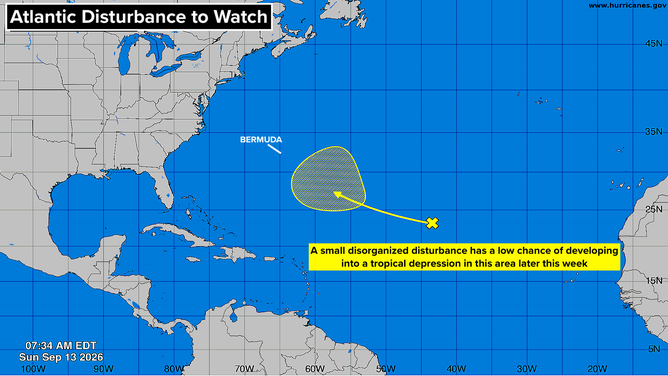
The National Hurricane Center is making note of a disorganized disturbance in the middle of the Atlantic. It’s currently under strong upper-level winds, so no development is likely in the short term.
REMAINS BELIEVED TO BE LINKED TO HURRICANE HELENE VICTIM DISCOVERED YEARS AFTER DEADLY STORM
Next week, it could find a pocket of atmosphere conducive to organization. The NHC puts low odds on that possibility at this point. The AI computer forecast models have been somewhat enthusiastic about this happening for several days, though they generally don’t perform especially well if a system hasn’t yet developed.
Tropical disturbance with small chance of developing in the next 7 days.
(Bryan Norcross / FOX Weather)
For now, it’s just something to keep an eye on, especially in Bermuda. There’s no indication that it could threaten the U.S. Whatever form it takes, it’s likely to turn north into the open Atlantic.
Otherwise, the tropical Atlantic and the Caribbean are shut off by El Niño-driven upper-level winds. A large non-tropical upper-level low pressure system is forecast to drift across Florida and into the Gulf late in the week. It could bring extra stormy weather across the peninsula, but will also keep anything tropical from developing in the immediate future.
HOW HIGH PRESSURE AND LOW PRESSURE DRIVE THE WEATHER
IN THE PACIFIC
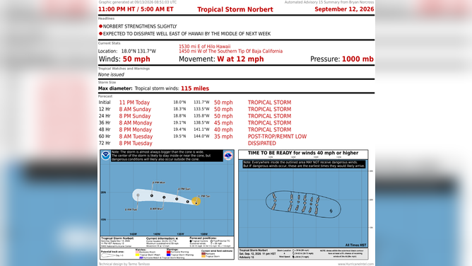
Norbert is a mid-range tropical storm tracking in the direction of Hawaii. Fortunately, the islands are protected by the same type of upper-level wind pattern that has shut off tropical activity in the Atlantic. As a result, Norbert is forecast to weaken and die out before it gets to the islands.
Latest on Tropical Storm Norbert.
(Bryan Norcross)
On the current schedule, Norbert’s remnants and tropical moisture will reach the Big Island and Maui about Thursday, bringing the possibility of heavy rain. Plan to stay aware in case weather alerts are necessary there later this week.
The developing system behind it, which is likely to eventually be named Odalys, will follow on Norbert’s heels and succumb to the same hostile upper winds. Nothing looks likely to come of that one.
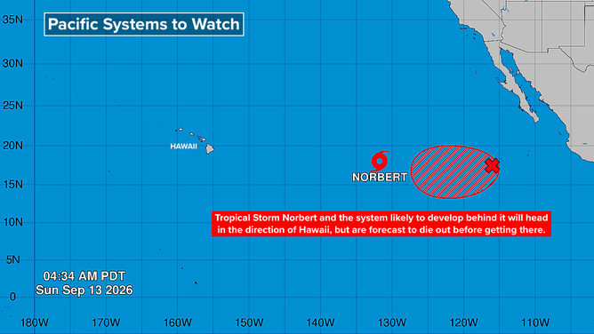
More tropical activity expected behind Norbert.
(Bryan Norcross)
The consensus of the long-range computer forecasts is that yet another system will likely follow Odalys. If this one develops, it will be named Polo. There’s no indication it would threaten land.
At least for a while, the Eastern Pacific seems to be calming down.