A roaring Pacific. A snoozing Atlantic. The culprit? A brewing super El Niño. FOX Weather meteorologists Britta Merwin and Craig Herrera break down the tale of two seasons:
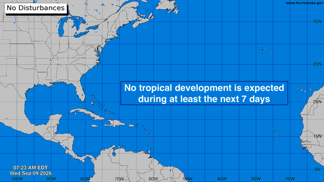
The atmospheric environment over the Caribbean and the tropical Atlantic continues to be hostile to any systems that are in a position to develop. Disturbances are moving off Africa on schedule, but the dust and dry air plus the El Niño-driven upper-level winds are prohibiting the systems from getting any traction.
There’s no sign of any change in that weather regime for the foreseeable future.
Atlantic Basin on Sept. 9, 2026.
(Bryan Norcross)
You might have seen some talk about a slight chance of a disturbance in the northwestern Gulf. There is no sign that that will develop into anything. The atmosphere is dry, the disturbance is extremely weak, and it’s not forecast to stall over the Gulf waters. It could enhance some showers along the Texas coast, but that looks to be about it.
Enjoy the Zen.
On the other hand in the Eastern Pacific
Now-Tropical Storm Lowell has moved away from Hawaii. It will die out in the next few days.
KAUA’I STILL WITHOUT POWER AMID DEVASTATION FOLLOWING HURRICANE LOWELL’S RARE DIRECT HIT ON HAWAII
Off the coast of Mexico, there’s a hotspot where two systems have a good chance of developing. The first one is well on its way. It will likely be named Norbert.
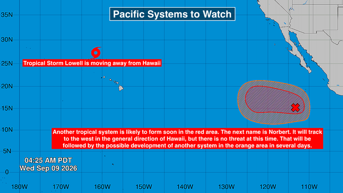
Pacific Basin on Sept. 9, 2026.
(Bryan Norcross)
The computer forecast models show eventually-Norbert tracking to the west in the general direction of Hawaii. The steering currents are not strong and there’s no indication it will even make it that far, however. For now at least, there’s no threat to the islands.
Following eventually-Norbert, another system is forecast to develop in essentially the same area. Its long-range plans are less certain, but at this point there’s no indication it would threaten land. If it develops, it will get the name Odalys.