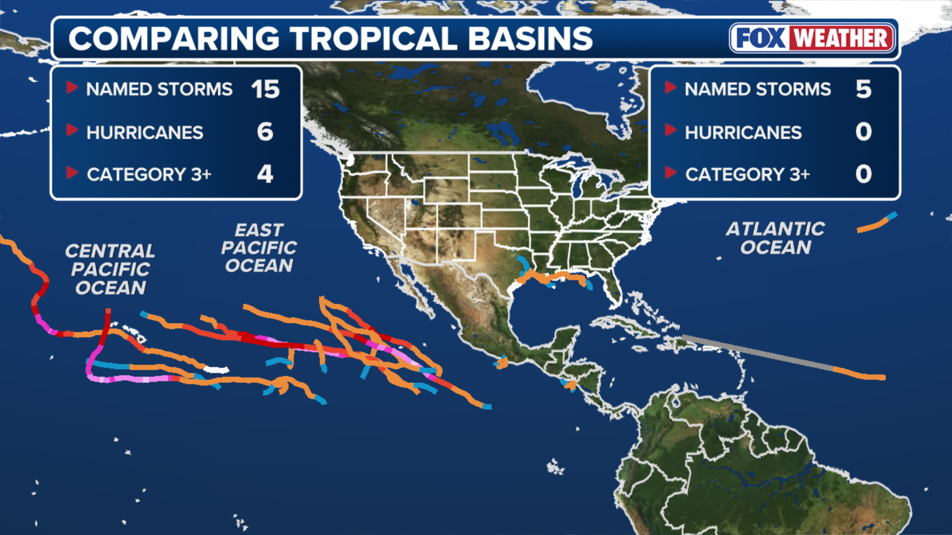
A roaring Pacific. A snoozing Atlantic. The culprit? A brewing super El Niño. FOX Weather meteorologists Britta Merwin and Craig Herrera break down the tale of two seasons:
THE TAKEAWAY:
- A looming Super El Niño has caused activity in the Pacific Basin to surge, while quieting Atlantic activity.
- The Pacific Basin has nearly double the average Accumulated Cyclone Energy value.
- The Atlantic has yet to produce a hurricane this season, putting it within reach of historic territory for the latest first hurricane.
Since the 2026 hurricane season began, we’ve seen two extremes: The Pacific Basin roaring with tropical activity while the Atlantic continues to stay quiet.
This is largely due to both basins being influenced by an El Niño weather pattern. Typically, El Niño suppresses Atlantic activity by increasing wind shear while having the opposite effect in the Pacific, where warmer ocean temperatures help fuel increased activity.
BREWING SUPER EL NIÑO EXPECTED TO BE STRONGEST ANYONE ALIVE ON THE PLANET HAS EVER EXPERIENCED
Adding to that, forecasts indicate this could be a “super El Niño,” potentially making it one of the strongest events on record.
(FOX Weather)
For perspective, so far, there have been 15 named storms, including six hurricanes and four major hurricanes—Category 3 or more — across the Pacific Basin.
For comparison, an entire Eastern Pacific season typically produces 14 named storms, eight hurricanes and four major hurricanes.

Authorities conduct a water rescue in Texas amid Edouard.
(Governor Greg Abbott’s Office / FOX Weather)
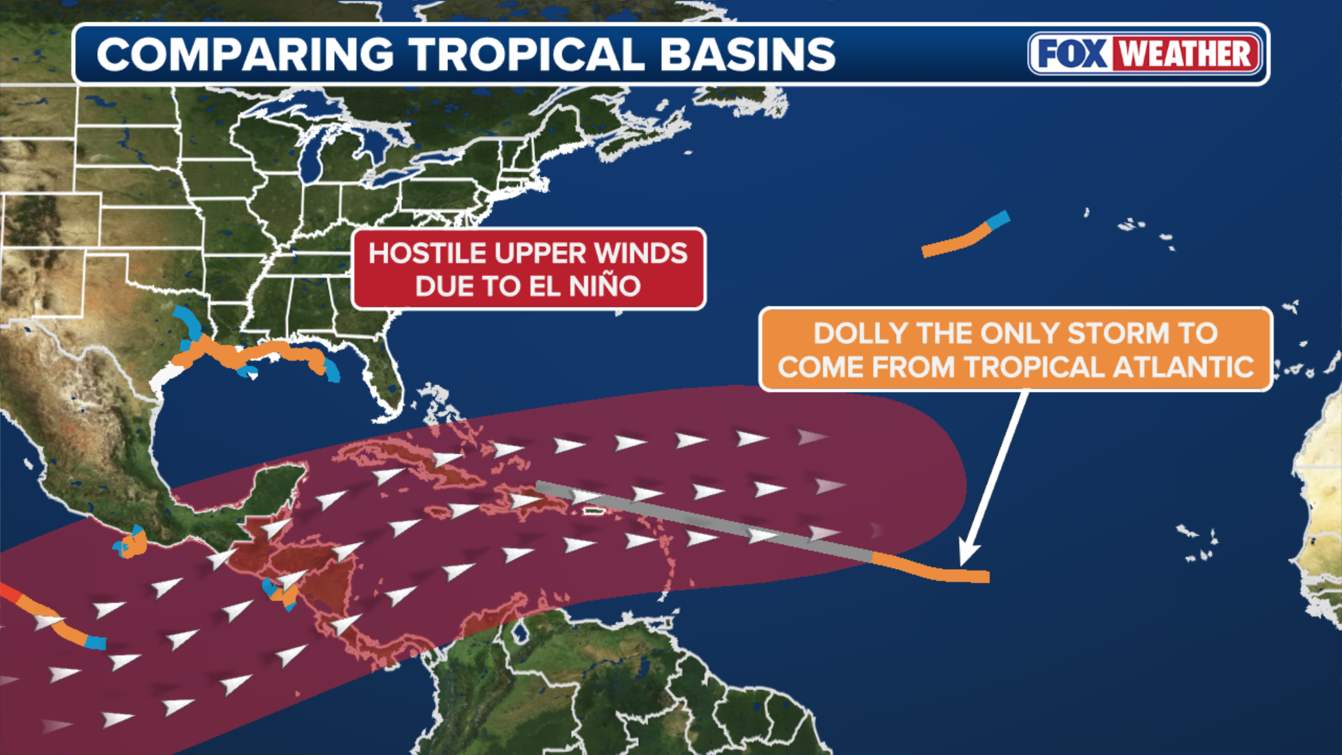
Meanwhile, the Atlantic is a very different story, only producing five named storms so far, all of which have peaked at tropical storm strength.
An average Atlantic season produces 14 named storms, seven hurricanes and three major hurricanes.
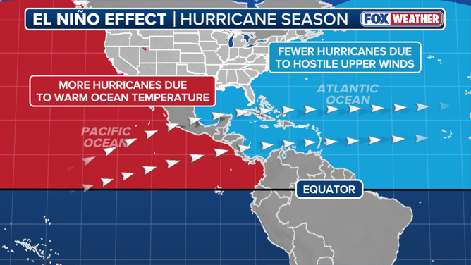
El Niño impact on hurricane season.
(FOX Weather / FOX Weather)
In fact, the Atlantic Basin is nearing historic territory for the latest first hurricane of the season, with the first hurricane yet to form.
Since the beginning of the satellite era in 1966, the latest first hurricanes in the Atlantic occurred between Sept. 2 and Sept. 11.
Accumulated Cyclone Energy (ACE) is one metric used to measure the intensity of a season across different basins.
(FOX Weather)
Developed by Colorado State University, ACE measures the combined intensity and duration of tropical cyclones.
WHAT’S THE DIFFERENCE BETWEEN A TROPICAL DEPRESSION, TROPICAL STORM AND HURRICANE?
However, the Atlantic’s unusual lack of activity and the Pacific’s surge in activity aren’t just reflected on the calendar.
So far this season, the Pacific Basin has an ACE value of 170, compared to an average year-to-date value of 89, nearly double the average.
DAYLIGHT REVEALS UTTER DEVASTATION AS POWERFUL LOWELL MAKES RARE DIRECT HIT ON HAWAII
Notably, the Pacific’s unusual activity has also been felt in Hawaii, where both Hurricane Lala and Hurricane Lowell brought significant impacts to the islands this season.
-
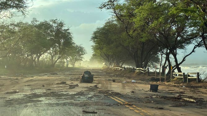
Damage reported on Maui as Hurricane Lowell impacts the Hawaiian Islands.
(Hawaii Department of Transportation) -

Storm surge damage from Hurricane Lowell in Koloa on Kaua’i on Tuesday, Sep. 8, 2026.
(FOX Weather) -

Hurricane Lowell brings extensive damage to Kauai hotel
( ) -

Hurricane Lowell brings extensive damage to Kauai hotel
( ) -
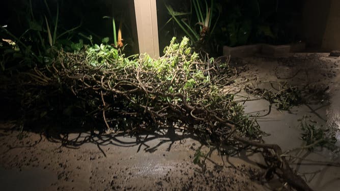
Hurricane Lowell brings extensive damage to Kauai hotel
( ) -
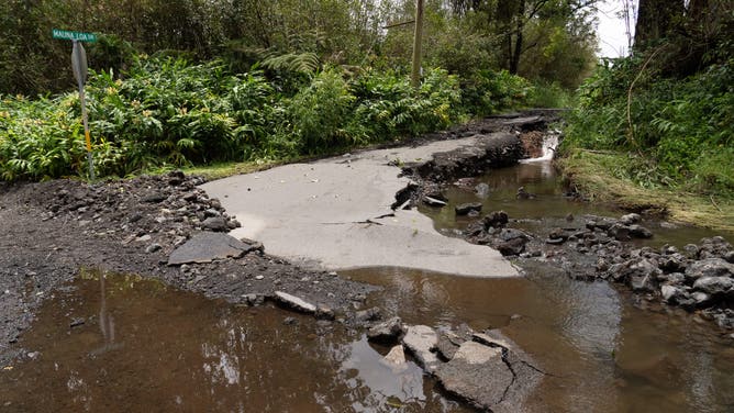
A road damaged by Hurricane Lala is seen in Mountain View, Hawaii, on August 16, 2026. Hurricane Lala was pulling away from Hawaii’s Big Island early Sunday, as heavy rain and strong winds struck the US Pacific state and officials warned of potentially dangerous flooding. The heavy rain and flood risk will then spread westward across the island chain on Sunday, according to the NHC.
(Jill K. Briggs / AFP) -
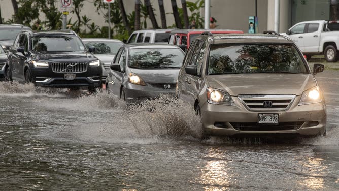
Vehicles make their way through a flooded intersection in front of the Hawaii Convention Center in Honolulu, Hawaii, on August 16, 2026. Hurricane Lala was pulling away from Hawaii’s Big Island early Sunday, as heavy rain and strong winds struck the US Pacific state and officials warned of potentially dangerous flooding. The heavy rain and flood risk will then spread westward across the island chain on Sunday, according to the NHC.
(Eugene Tanner / AFP) -
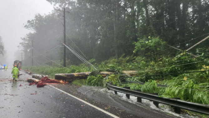
Downed trees and power lines in Waiohinu, HI, from Hurricane Lala on Saturday, Aug. 15.
(Hawaii Department of Transportation ) -
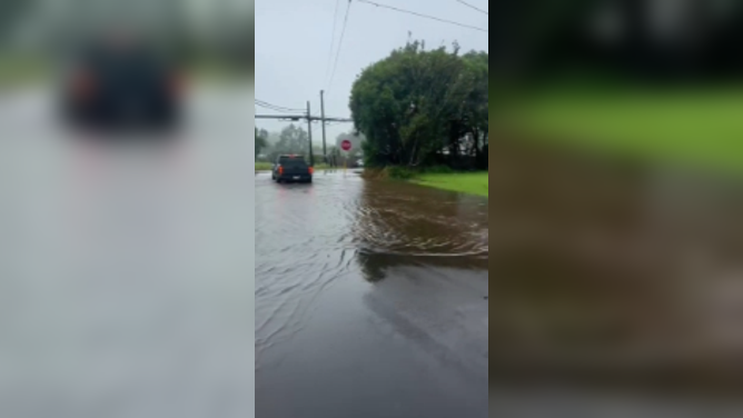
Flooding in Waimea Big Island, Hawaii from Hurricane Lala on Saturday, Aug. 15.
(Christina Butler)
Experiencing impacts from two hurricanes in a single season is highly unusual for Hawaii.
In contrast, ACE sits at just 4.4 in the Atlantic, compared to an average year-to-date value of 51.
The current state of El Niño is the main factor behind the stark difference between the two basins.
LATEST FROM FOX WEATHER HURRICANE SPECIALIST BRYAN NORCROSS
El Niño’s daily relative ocean temperature is currently nearly 2.4 degrees Celsius above average, very close to levels observed during the 1997 El Niño.
(FOX Weather)
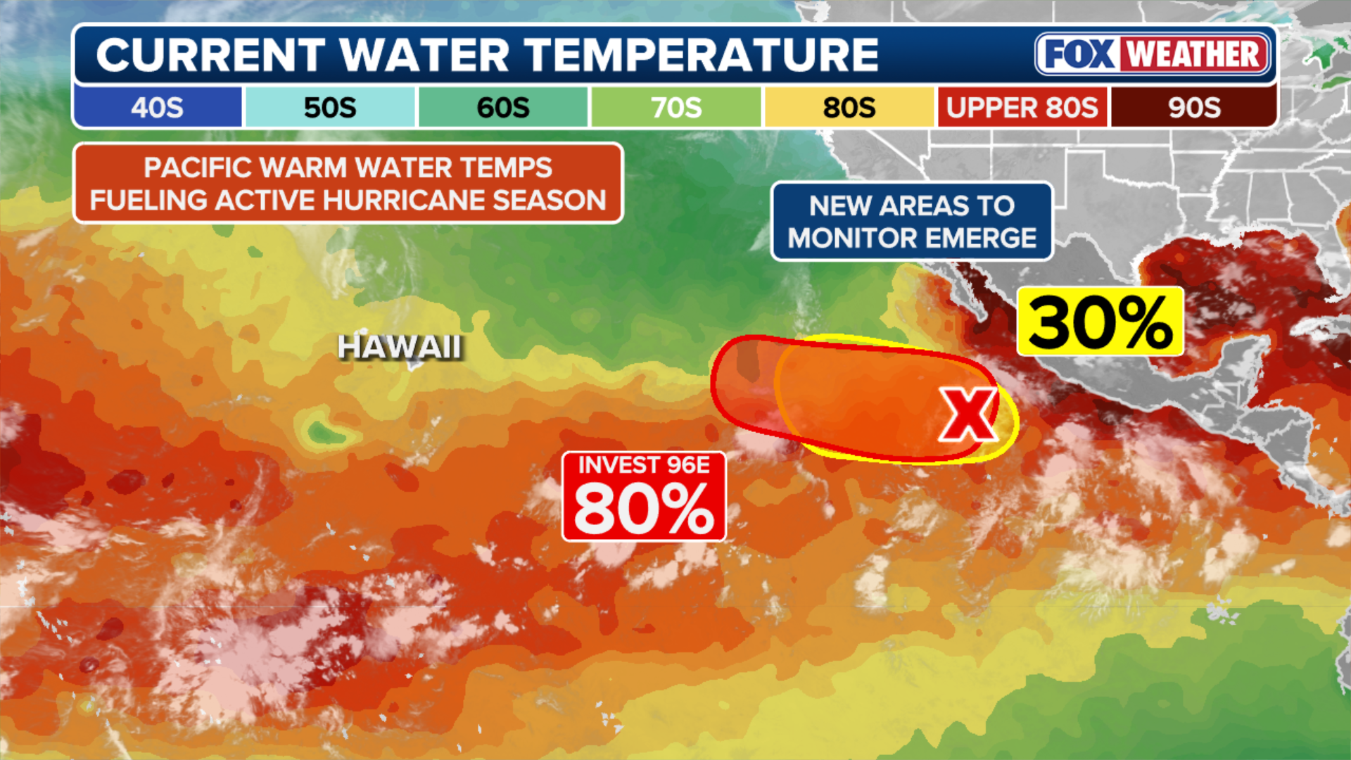
With waters remaining well above average across much of the Eastern Pacific, several areas off the west coast of Mexico will need to be watched.
This includes newly designated Invest 96E, which has a high potential for development over the next few days. The next name on the list is Norbert.
Meanwhile, on the Atlantic side, no development is expected over the next seven days.