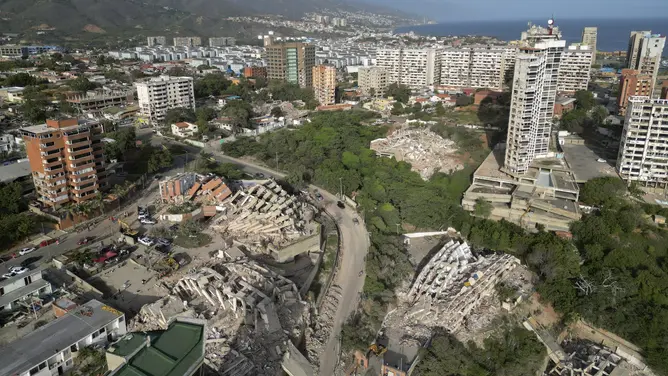
Rescue operations continue in Venezuela after two deadly earthquakes struck back-to-back on Wednesday night. Aerial video shows collapsed buildings and debris scattered across La Guaira the day after the earthquakes.
THE TAKEAWAY
- A team of scientists discovered a new way to identify where some of Earth’s biggest earthquakes are most likely to occur.
- Researchers from the University of California, Riverside, identified areas where stress has been building.
- Using GPS measurements that track subtle ground movements, the researchers developed an algorithm to identify the sections.
- The researchers stress that their method is helpful, but cannot predict when an earthquake will happen.
A team of scientists discovered a new way to identify where some of Earth’s biggest earthquakes are most likely to occur, potentially giving communities another tool to prepare for major disasters.
UNDERSTANDING THE PACIFIC RING OF FIRE: WHERE EARTHQUAKES AND VOLCANOES MEET
In a recent study published in Geophysical Research Letters, researchers from the University of California, Riverside, identified areas along major faults where stress has been building.
This aerial view shows collapsed buildings in Catia La Mar, La Guaira state, Venezuela, on June 27, 2026, following earthquakes that struck the region.
(Federico PARRA / AFP / Getty Images)
The findings could help scientists better understand where a future rupture is most likely to occur.
The team tested its approach in the Kamchatka subduction zone in eastern Russia, where a massive earthquake recently struck.
MAGNITUDE 5.6 EARTHQUAKE JOLTS ALASKA IN LATEST SEISMIC ACTIVITY ALONG PACIFIC RING OF FIRE
Researchers focused on subduction zones, where one tectonic plate slides beneath another. These areas are responsible for some of the largest earthquakes on Earth and can produce devastating tsunamis.
Images from around La Guaira, Venezuela show the extent of damage following back-to-back major earthquakes on Wednesday night. The death toll is expected to rise as search and rescue efforts continue.
“Earthquakes capture headlines when they happen, but for years beforehand, the fault is quietly accumulating strain,” lead scientist and UCR geophysicist Gareth Funning said. “This strain can be measured.”
Using GPS measurements that track subtle ground movements, the researchers developed an algorithm to identify sections of faults that are locked and storing energy.
These locked areas, known as asperities, act like patches of friction along a fault. They can resist movement as stress builds until they eventually rupture during a major earthquake.
A magnitude-7.8 earthquake shook the Philippines on Monday, June 8, causing widespread damage to the island nation. Footage captured by Arnel Tagusi Mandula shows rubble and debris on Santol Street, in General Santos City.
The researchers identified one of these locked regions beneath Russia’s Kamchatka Peninsula before a major earthquake struck there.
While the method cannot determine when an earthquake will occur, the rupture happened in the same area where the model showed strain had accumulated.
SCIENTISTS UNCOVER POTENTIALLY SIGNIFICANT MOVEMENT AT ONE OF AMERICA’S MOST DANGEROUS FAULT LINES
The findings also showed that earthquakes in the same region can behave very differently.
Kamchatka experienced massive earthquakes in both 1952 and 2025, but the more recent earthquake produced a much smaller tsunami.
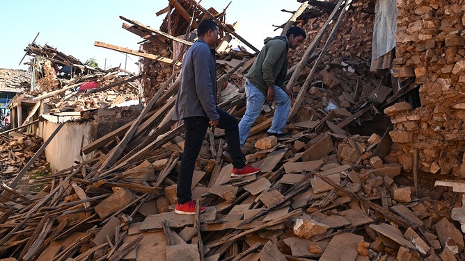
People walk over the ruins of houses in the aftermath of an earthquake at Jajarkot district on November 4, 2023.
(PRAKASH MATHEMA/AFP / Getty Images)
Researchers are now applying the same approach to other major subduction zones in Japan, Mexico, New Zealand and the Pacific Northwest.
ALASKA LANDSLIDE UNLEASHED ONE OF THE LARGEST TSUNAMIS EVER RECORDED, NEW STUDY SHOWS
Each region presents its own challenges, including areas where tectonic energy is released gradually instead of through sudden, major earthquakes.
The team is also investigating whether similar techniques could help scientists better understand earthquake risks along California’s faults.
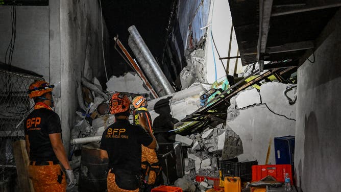
The earthquake in the southern Philippines killed at least 32 people, according to provincial authorities, after toppling buildings and sparking tsunami warnings across the region.
(Jam STA ROSA / AFP via Getty Images) / Getty Images)
“In the Bay Area, the Hayward Fault has both creeping and locked sections, much like subduction zones,” Funning said. “We’re investigating whether we can identify the parts most likely to generate future earthquakes.”
The researchers stress that their method is helpful, but cannot predict when an earthquake will happen or how large a resulting tsunami will be.
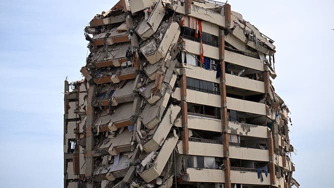
A view shows a heavily damaged apartment building following an earthquake in Catia La Mar, La Guaira state, about 30 km northwest of Caracas, on June 25, 2026.
((Photo by Juan BARRETO / AFP via Getty Images) / Getty Images)
However, this could give scientists and communities a better understanding of where the greatest earthquake hazards may exist, potentially improving long-term planning and preparedness.
WHAT ARE THE LARGEST EARTHQUAKES TO STRIKE THE US?
“Your peace of mind shouldn’t come from believing we can forecast the exact earthquake,” Funning said. “Especially where we live in Southern California, it’s not a matter of if, but when. There is no substitute for preparation.”