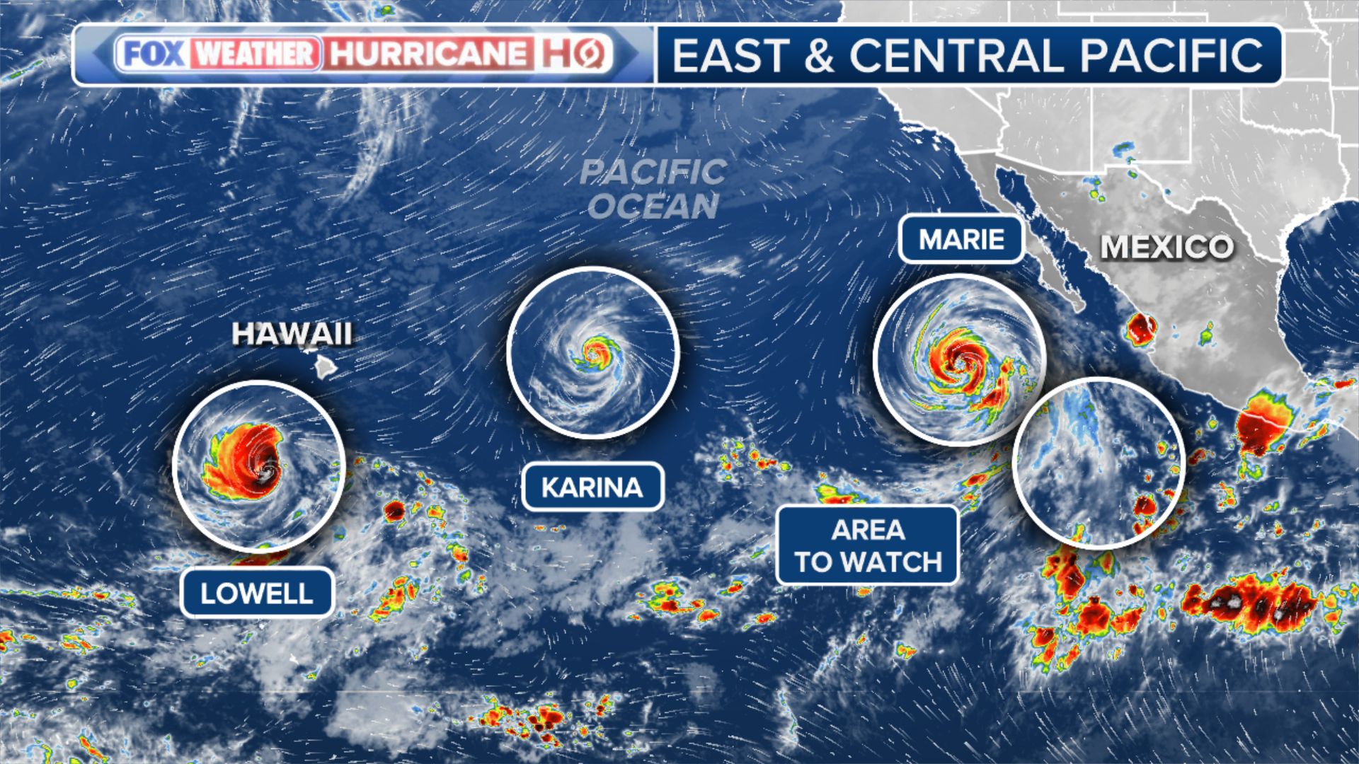
Although Hurricane Marie is forecast to remain well offshore, its impacts will still reach the Southwest and California through Labor Day weekend, bringing flash flood concerns inland and rough surf along the coast. FOX Weather meteorologists Bob Van Dillen and Michael Estime break down the latest forecast.
THE TAKEAWAY
- Hurricane Marie to bring rough surf to California.
- Marie’s tropical moisture will fuel the Southwest monsoon.
- Rare annular Hurricane Karina to stay north of Hawaii.
A strengthening El Niño and favorable atmospheric conditions continue to fuel an active Pacific hurricane season, with Hurricanes Karina and Marie churning in the West.
Although Hurricane Marie remains well offshore, its impacts will still be felt across the Southwest and California, where flood threats and big surf are on the table through Labor Day Weekend.
In the Central Pacific, Karina has taken on the rare structure of an annular hurricane, a trait found in only about 4% of hurricanes. Although Karina isn’t expected to threaten Hawaii, Hurricane Lowell is taking aim at the island chain.
Let’s take a closer look at the forecast for each hurricane.
Hurricane Marie’s impact on the U.S.
Hurricane Marie is a Category 2 storm with maximum sustained winds of 100 mph as it churns well off Mexico‘s southwestern coast. out
While the hurricane is forecast to remain well offshore as it tracks west-northwest over the next several days, it will still send impacts into the Southwestern U.S. through the holiday weekend.
 Hurricane Marie Statistics.
On the West Coast, Marie’s biggest impact will be large waves and life-threatening rip currents that will roughen up Labor Day Weekend.
For California surfers, the last time Hurricane Marie impacted the West Coast was in 2014, when it produced picture-perfect, pumping surf. With Marie’s impacts set to return, don’t expect conditions to rival what many still consider the benchmark for a hurricane-generated swell in California.
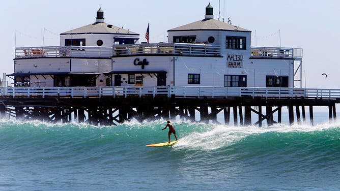
Laird Hamilton rides a standup paddle board as he prepares to shoot the Malibu Pier in Malibu on Wednesday August 27, 2014 in Malibu, California, with a high surf advisory is in effect for Southern California as Hurricane Marie spun off in the distant Pacific.
(Al Seib / Los Angeles Times via Getty Images / Getty Images)
High Surf Advisories are in effect from Los Angeles south to San Diego, where some of the largest waves could exceed 10 feet. In addition, Coastal Flood Advisories have been issued as elevated surf increases the risk of minor coastal flooding and beach erosion.
HOW THE BIGGEST WAVES IN THE WORLD BREAK OFF THE COAST OF PORTUGAL
A pronounced dip in the jet stream over the Northwestern U.S. will help pull some of Marie’s tropical moisture into the Four Corners and Southern California, fueling an enhanced Southwest monsoon pattern.
A Level 2 out of 4 flash flood risk is in place across southern Arizona on Friday.
 Hurricane Marie Forecast Cone.
By Sunday, a broader Level 1 out of 4 flash flood risk expands westward into Southern California, where cities including Los Angeles could see periods of rain.
For now, rainfall totals across Southern California are expected to remain modest, with most locations receiving a quarter-inch of rain or less. Farther east, deeper tropical moisture could increase the threat of flash flooding across southern Nevada, Utah and northern Arizona.
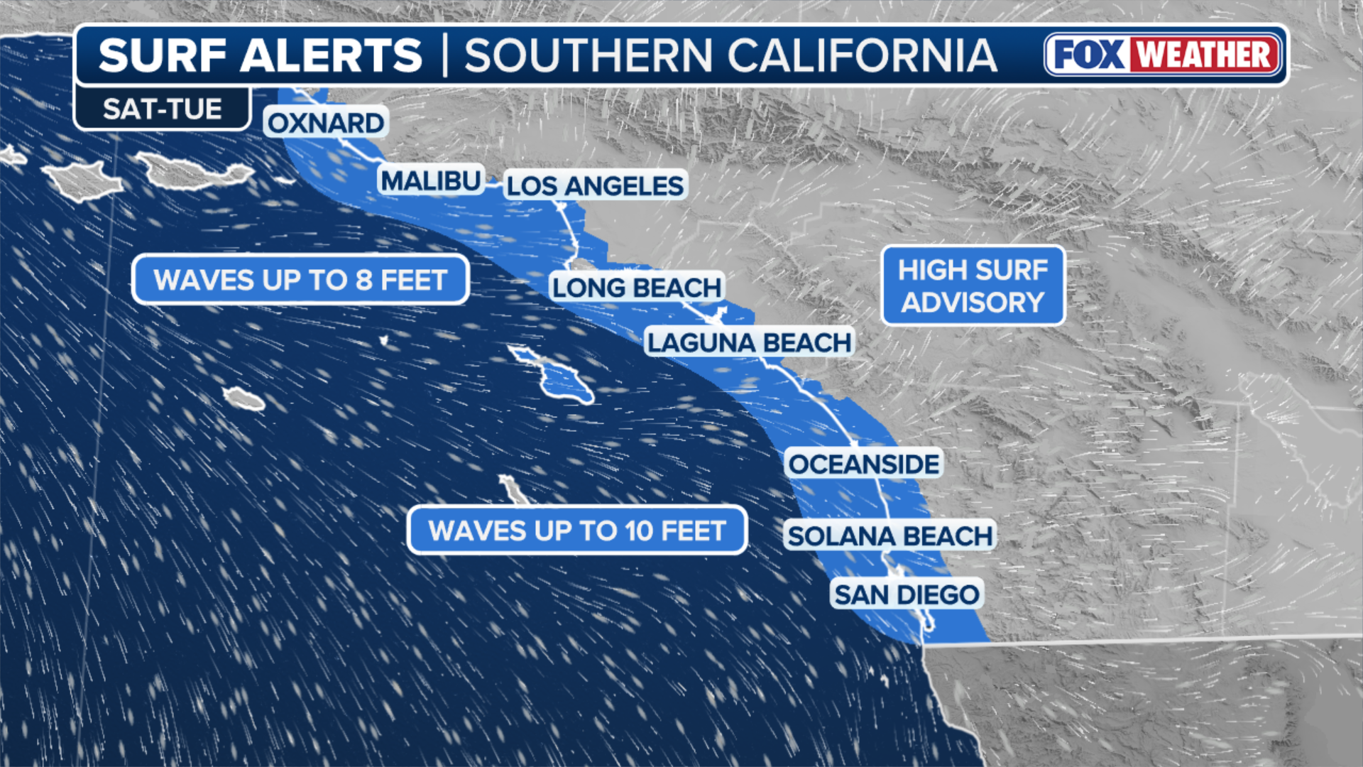 California Surf Advisories.
Moisture from Hurricane Marie, combined with an upper-level trough, will help fuel thunderstorms across the Southwest, raising concerns for flash flooding on Sunday in slot canyons such as Zion Canyon and the Grand Canyon.
ONE STILL MISSING FOLLOWING DEADLY FLOODING AT GRAND CANYON NATIONAL PARK AS MONSOON STORMS LINGER
The renewed threat comes just one week after deadly flash flooding in the Grand Canyon killed two people and prompted dozens of rescues.
 Southwest Flash Flood Threat.
Hurricane Karina
Hurricane Karina presents far less of a threat, and likely, the storm’s impacts will only be felt over the open Pacific Ocean.
As Karina moves into the Central Pacific, although it has significantly weakened from its peak intensity of a Category 4 storm after rapidly intensifying, it still remains a hurricane.
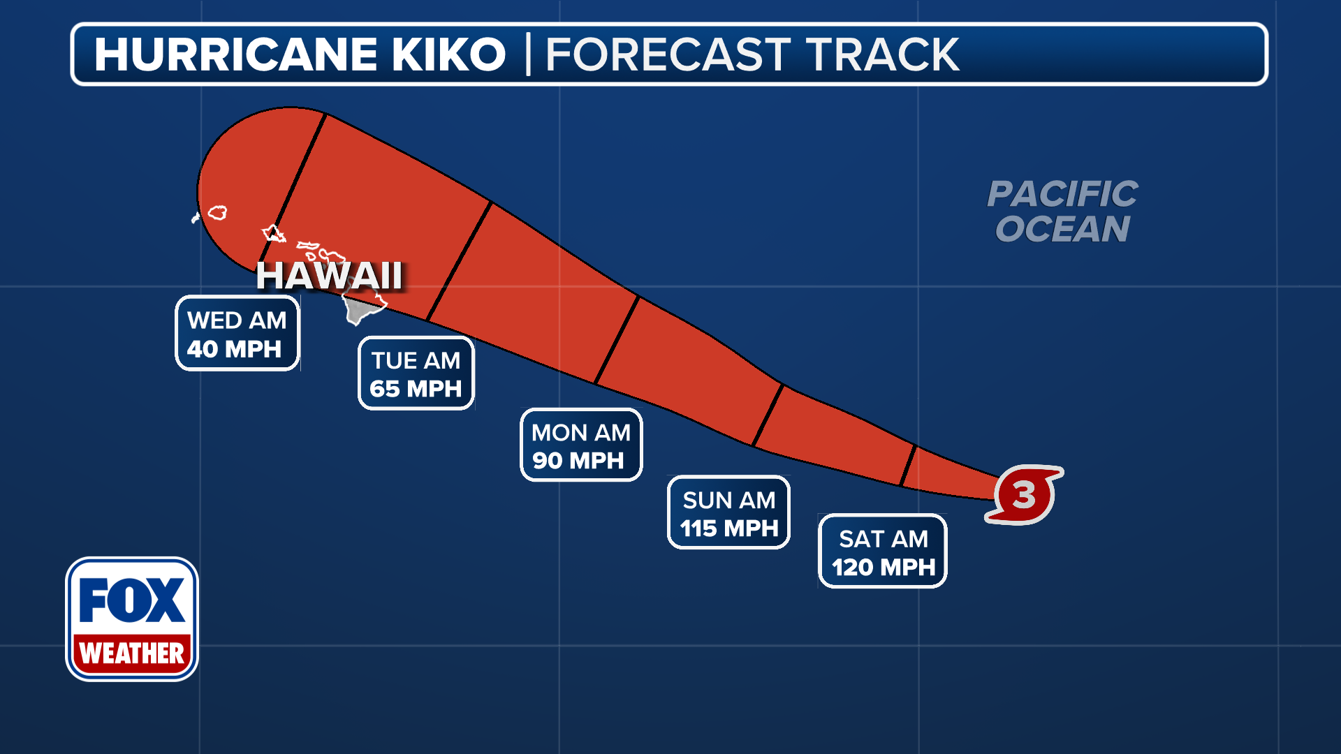 Hurricane Karina Forecast Cone.
According to the FOX Forecast Center, Karina is expected to remain no threat to Hawaii. Hurricane Lowell, however, is forecast to take aim at the western Hawaiian Islands, threatening damaging winds, heavy rain, coastal flooding and dangerous surf.
WHAT IS AN ANNULAR STYLE OF HURRICANE?
Karina is a rare annular-type hurricane, that looks the part of a tire truck, or a donut, and features a massive, perfectly circular eye surrounded by a single, thick, uniform ring of intense thunderstorms.
 Hurricane Karina Statistics.
According to the FOX Forecast Center, only about 4% of hurricanes become annular hurricanes, a rare structure that helps insulate them from hostile atmospheric conditions, allowing them to retain their intensity longer than most tropical cyclones.
Annular or not, Karina’s ultimate fate remains the same: The hurricane is forecast to weaken and dissipate well north of Hawaii by Monday.