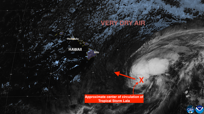
🌀EXCLUSIVE ANALYSIS: Tropical Storm Lala is expected to strengthen into a hurricane as it approaches Hawaii. FOX Weather Hurricane Specialist Bryan Norcross says the Big Island will bear the brunt of the most intense weather, regardless of whether the center of the storm makes landfall. See the exclusive analysis:
Last updated at 9 a.m. on Aug. 14, 2026.
Tropical Storm Lala is forecast to become Hurricane Lala as it tracks toward Hawaii. It’s a sprawling system and impacts will arrive well before the center approaches the islands and continue well after it has moved past.
LATEST FROM FOX WEATHER HURRICANE SPECIALIST BRYAN NORCROSS
Whether the center of Lala officially makes landfall on the Big Island or passes by just to the south, Hawaii Island will take a hard hit. Extreme rainfall – over 2 feet in some locations – will fall on the east flank of the huge mountains. All that water has to run downhill, and that means mudslides and flash flooding.
Satellite imagery of Pacific Basin on Aug. 14, 2026.
(CIRA / FOX Weather)
Lala’s winds are forecast to be at hurricane strength when the storm passes just south of the Hawaiian Islands. But those winds are at the surface of the ocean. At higher elevations, the winds are stronger, and they are enhanced by the mountain peaks and passes. Winds could top 100 miles an hour in those areas.
HAWAII BRACES FOR TROPICAL STORM LALA AS STORM CONTINUES TO STRENGTHEN TOWARD HURRICANE STATUS
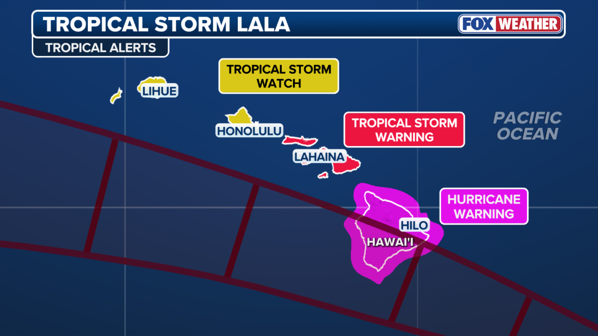
The strongest winds and heaviest rain will occur on the right side – the north side – of the storm’s track, which unfortunately is where the islands are.

(FOX Weather)
Huge waves will crash against the east and south coast of the Big Island, pushing water into low-lying areas.
On this very unusual track paralleling the Hawaiian chain, every island will be affected. Heavy and dangerous rain will fall on the windward and mauka (inland toward the mountain) areas.
The peak impacts will occur Sunday on Oahu, causing disruptions across the island, including in Honolulu.
(FOX Weather)
Even after the center of the storm passes late Sunday, a feeder band will be over or near the islands, which could cause the rain to continue.
It’s critical that everyone in the State of Hawaii from Hawaii Island to Lihue follow the instructions of the local officials and the Hawaii Emergency Management Agency.
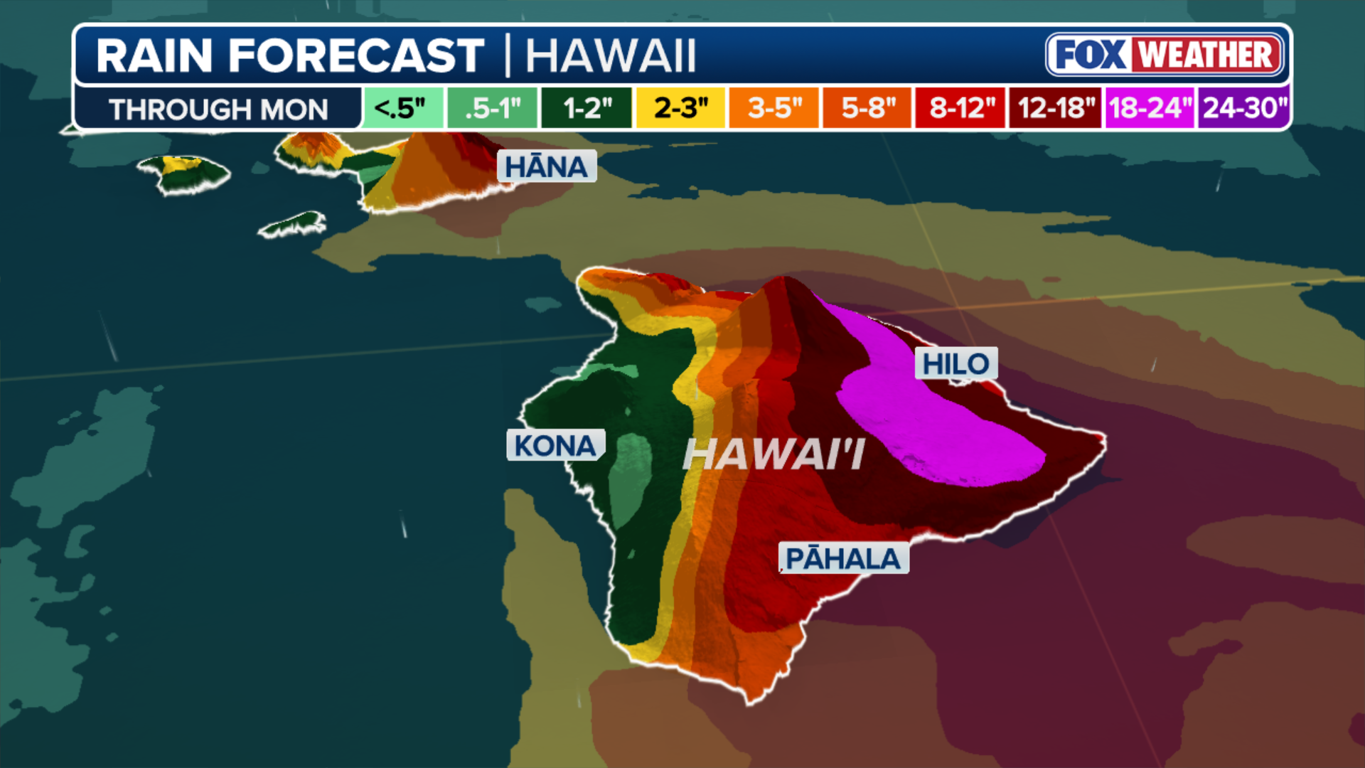
(FOX Weather)
Elsewhere in the Pacific
Tropical Storm Hernan is just east of Lala, but it will die before it becomes a problem.
The National Hurricane Center is painting two other yellow potential development areas meaning there’s a chance that tropical systems could form over those very warm waters, but the odds currently are in the low range.
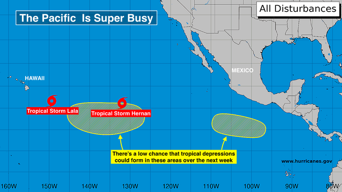
Pacific Basin on Aug. 14, 2026.
(Bryan Norcross)
In the tropical Atlantic
The two systems we’ve been following, Invest 92L and Invest 94L, are both struggling to find their footing because Saharan dust is gumming up their works.
92L’s chances of developing into at least a depression are quickly decreasing. It’s most likely to move into the Caribbean over the weekend as a moisture surge with gusty winds. Any rain on those islands will be beneficial.
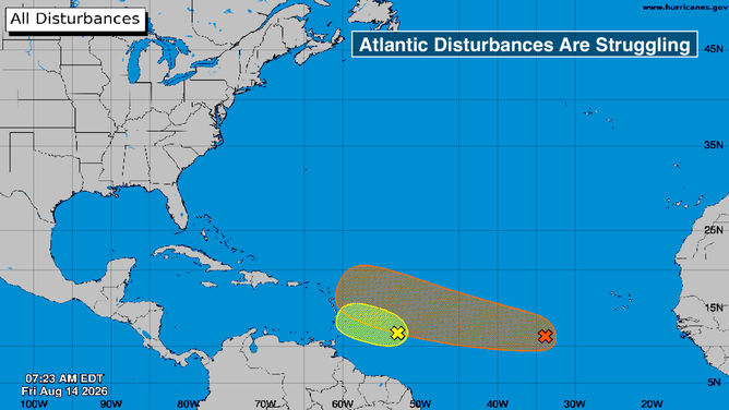
Atlantic Basin on August 14, 2026.
(Bryan Norcross)
94L is on a slightly different track. Most of the computer forecasts predict it will lift north and pass near or over the northeast corner of the Caribbean. It could develop into a tropical depression or a low-end tropical storm, but the dust and hostile upper-level winds will limit its potential. It might bring some moisture to the northeastern Caribbean islands about Tuesday.
Another robust disturbance is moving off Africa. But it will move into the same unsupportive atmospheric environment. At the current time, there’s no sign that it will develop.