Genevieve strengthened into the first Category 5 hurricane in the Eastern Pacific basin since Hurricane Kristy in 2024 as it rapidly intensified early Monday. Hurricane Genevieve is also the Northern Hemisphere’s first major hurricane of the 2026 season, across both the Atlantic and Eastern Pacific basins.
Last updated at 9:15 a.m. on July 27, 2026
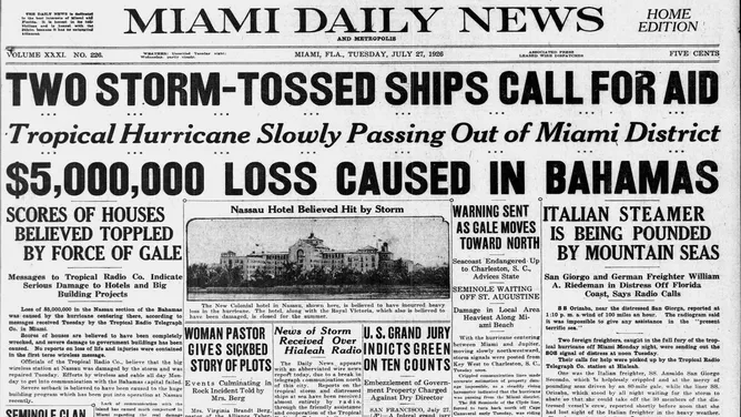
By the morning of July 27, 1926, the destructive Nassau Hurricane was heading northbound offshore of Fort Lauderdale. Winds were still lashing the beach areas and increasing in Palm Beach County and other points north on the Florida East Coast.
Nassau Hurricane headlines
(Bryan Norcross / FOX Weather)
By late morning, hurricane warnings in South Florida were dropped as alerts were issued from Jupiter, just north of the Palm Beaches, north to Charleston, SC. The storm was on a slow arc toward Central Florida or farther north.
The wind in Miami blew from the previous evening through the overnight hours. Most of the damage was near the ocean in Miami Beach, but the waterfront in downtown Miami on the mainland also took a hit. Awnings were ripped off, some buildings were undermined, and ocean water poured through some beachfront hotels. Wires were down across the region. Parts of Ocean Drive and Collins Avenue were washed out. Boats broke loose from their moorings and sank.
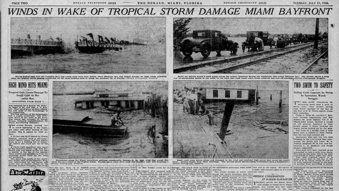
Nassau Hurricane headlines
(Bryan Norcross / FOX Weather)
Top winds over Miami Beach were estimated at only 50 to 60 mph, but they were relentless as the storm slowly tracked by offshore. The 110 mph winds with the core of the hurricane pushed ocean water up and over the beaches and into the inland waterways.
Fort Lauderdale Beach suffered damage as well. Parts of the Beach Road were washed out. High water flooded homes and roads in the eastern part of the city.
GENEVIEVE RAPIDLY INTENSIFIES INTO FIRST CATEGORY 5 HURRICANE IN THE EASTERN PACIFIC SINCE 2024
The hurricane is estimated to have been a Category 4 when it mauled Nassau the morning of Monday, July 26. But by that Tuesday, it had weakened to a Category 2. Newspapers in Daytona Beach and Jacksonville didn’t express any concern to their readers that morning. But that’s where the storm was heading.
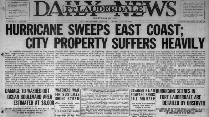
Nassau Hurricane headlines
(Bryan Norcross / FOX Weather)
The July 1926 hurricane in South Florida is largely forgotten because of the destructive impact of the great hurricane to come less than two months later. And it had a role in the September events because of the low bar of expectations it set for what a hurricane could inflict on Miami.
Now in the Atlantic
There are no signs of any tropical development into next month.
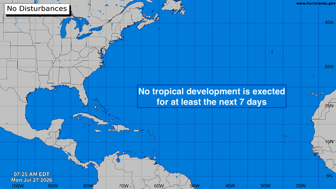
Atlantic Basin
(Bryan Norcross)
Looking at the storm naming statistics, we are right on track. On average, the C storm is named on August 3, and the first hurricane doesn’t develop until August 11.
Fausto to track north of Hawaii
Fausto is weakening nicely. The system is down to Category 1 strength as cooler water and hostile upper winds take their toll. Confidence is high now that Fausto’s center will track well north of the islands with the strongest winds on the north side of the storm, away from land.
Impacts will be confined to strong swells and high surf on the east- and north-facing beaches.
HURRICANE FAUSTO TO PASS NORTH OF HAWAII, BUT COULD STILL GENERATE DANGEROUS 15-FOOT WAVES
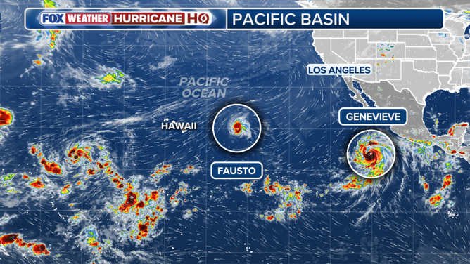
Pacific Basin
(FOX Weather / FOX Weather)
Hurricane Genevieve is now at Category 5 strength — a relatively rare event in the Eastern Pacific. Its track will take it out to sea over cold water where it will fade away.
The storm’s main impacts will be large swells along the Mexico and Southern California coasts. Eventually, swells generated by Genevieve will reach Hawaii as well.