The National Hurricane Center has tagged two different areas to watch in the Atlantic. Both have low chances of developing over the next week. FOX Weather Meteorologist Britta Merwin breaks down the forecast.
Updated at 9:35 a.m. on Thursday, July 16, 2026.
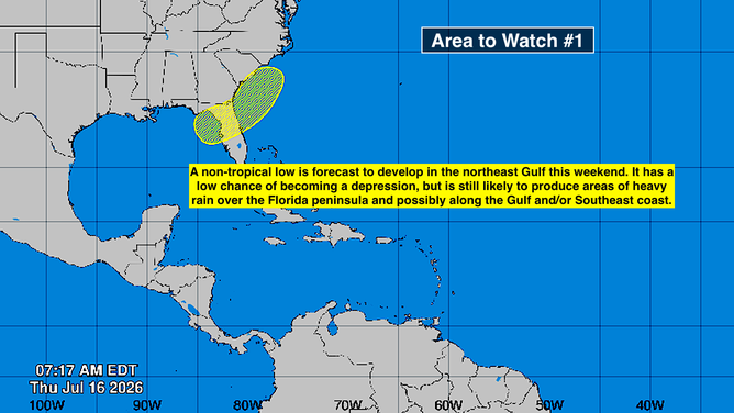
The National Hurricane Center is painting two Areas to Watch for possible (but unlikely) tropical development. Even without tropical development, however, the yellow zone that spans Florida from the Gulf to the ocean waters off the Southeast coast has the potential to disrupt weekend plans.
A combination of factors, including a front that’s pushing slowly through the Southeast and a well-organized upper-level disturbance, are likely to come together to generate a low-pressure system in or near the extreme northeastern Gulf over the weekend. A weak tropical disturbance now over Cuba will add some extra moisture and spin. This type of slow-moving system has the potential to produce heavy rain wherever a plume of moisture sets up.
TROPICAL STORM ELIDA FORMS AS STRENGTHENING EL NIÑO FUELS ACTIVE EASTERN PACIFIC HURRICANE SEASON
The first area to watch in the Atlantic.
(Bryan Norcross / FOX Weather)
The National Hurricane Center is giving the system a low chance of becoming at least a tropical depression over the weekend or early next week. If anything, the computer forecast models show the odds of something developing are lower than yesterday.
Slow-moving non-tropical systems that start out energized by the contrast of cold and warm air can transition to a tropical system powered by the warmth of the ocean. That’s especially true when the seawater temperature is unusually high, which it is in the northeast Gulf and offshore of Georgia and the Carolinas.
Whether it technically ends up a tropical system or not, the consensus of the forecasts is that there will be a swath of heavy rain from the Gulf Coast across part of Florida to the coastal sections of the Southeast. In Florida, the focus looks likely to be the I-75 corridor from Southwest Florida up to at least the Georgia line. How far south the rain zone develops is an open question, because we don’t know exactly where the initial system will form.
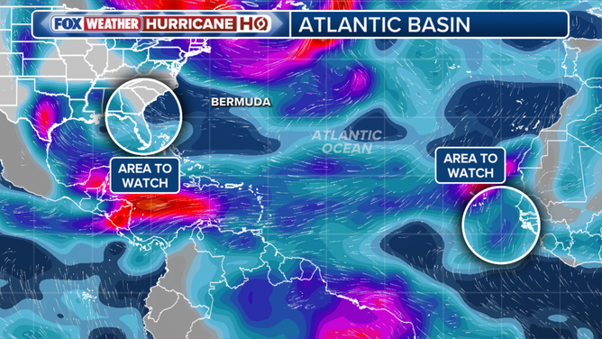
Atlantic tropic overview
Next week, there’s also a big question about the track of the low. If it ends up over or inland of the coastline, it almost certainly won’t be a tropical system, but the rain over the coastal sections of Georgia and the Carolinas will be heavier.
On the other hand, today the computer forecasts show a weaker system that is more likely to track west under the heat dome to the north. We won’t know until the system develops over the weekend, but the odds highly favor simply a rainy weather pattern, not a concerning tropical system.
The bottom line is that there’s a high probability that an extra-rainy weather pattern will develop over or near the northern half of Florida over the weekend and affect the coastal sections from the Gulf to the Carolinas early next week, although the heaviest rain could well stay offshore. There’s a low probability that the system will take on any tropical characteristics and transition to a tropical depression or tropical storm.
On the other side of the Atlantic
The NHC is also painting a potential development area near the Cabo Verde Islands off the coast of Africa. There is a pocket of moist air south of the Saharan dust plume that could spawn a tropical depression or tropical storm as it moves near the islands and then tries to head west across the Atlantic. It doesn’t appear that the system would last very long because the road ahead is full of dust, dry air, and hostile upper winds.
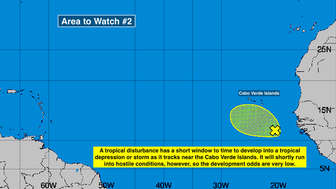
Second area to watch in the Atlantic off the coast of Africa.
(Bryan Norcross / FOX Weather)
This disturbance is starting out tropical, but it will have to thread a needle to develop a circulation and get a mention in the 2026 hurricane season record book. The National Hurricane Center puts the odds of that happening at very low.
Except for these small pockets that are slightly conducive to development, hostile conditions prevail across the Atlantic, the Caribbean, and the Gulf, and long-range forecasts say that that will continue for the foreseeable future.
In the Pacific
Tropical Storm Elida is forecast to reach hurricane strength as it tracks into the open ocean well offshore of Mexico. Another system, likely Fausto, is forecast right behind it. Neither appears to be a threat to land.
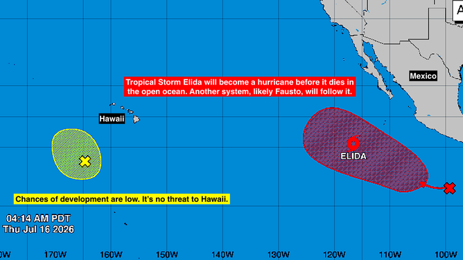
A look at tropical activity in the Eastern Pacific Ocean.
(Bryan Norcross / FOX Weather)
An Area to Watch well south of Hawaii is less likely to develop, but in any case, is moving away from the islands.