Despite an El Niño that’s predicted to become the strongest on record this fall, forecast models are predicting a near-average hurricane season in the Atlantic from late September into November, toward the end of the season. Things are expected to remain quiet for now, as strong upper-level winds keep anything from forming.
The latest European tropical forecast model shows an increase in activity in the Atlantic as we move into late hurricane season despite a strengthening El Niño predicted to reach super status.
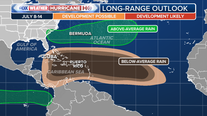
The Atlantic hurricane season is off to a quiet start, with only one named storm in mid-June, and no significant tropical activity expected heading into mid-July.
STRENGTHENING EL NIÑO SUPPRESSES TROPICAL ACTIVITY IN ATLANTIC FORECASTING A QUIET JULY
July 8-14 tropical long-range outlook for Atlantic
(FOX Weather)
Forecast models show the Atlantic Basin is expected to remain quiet as peak season approaches and El Niño continues to intensify heading into the fall months.
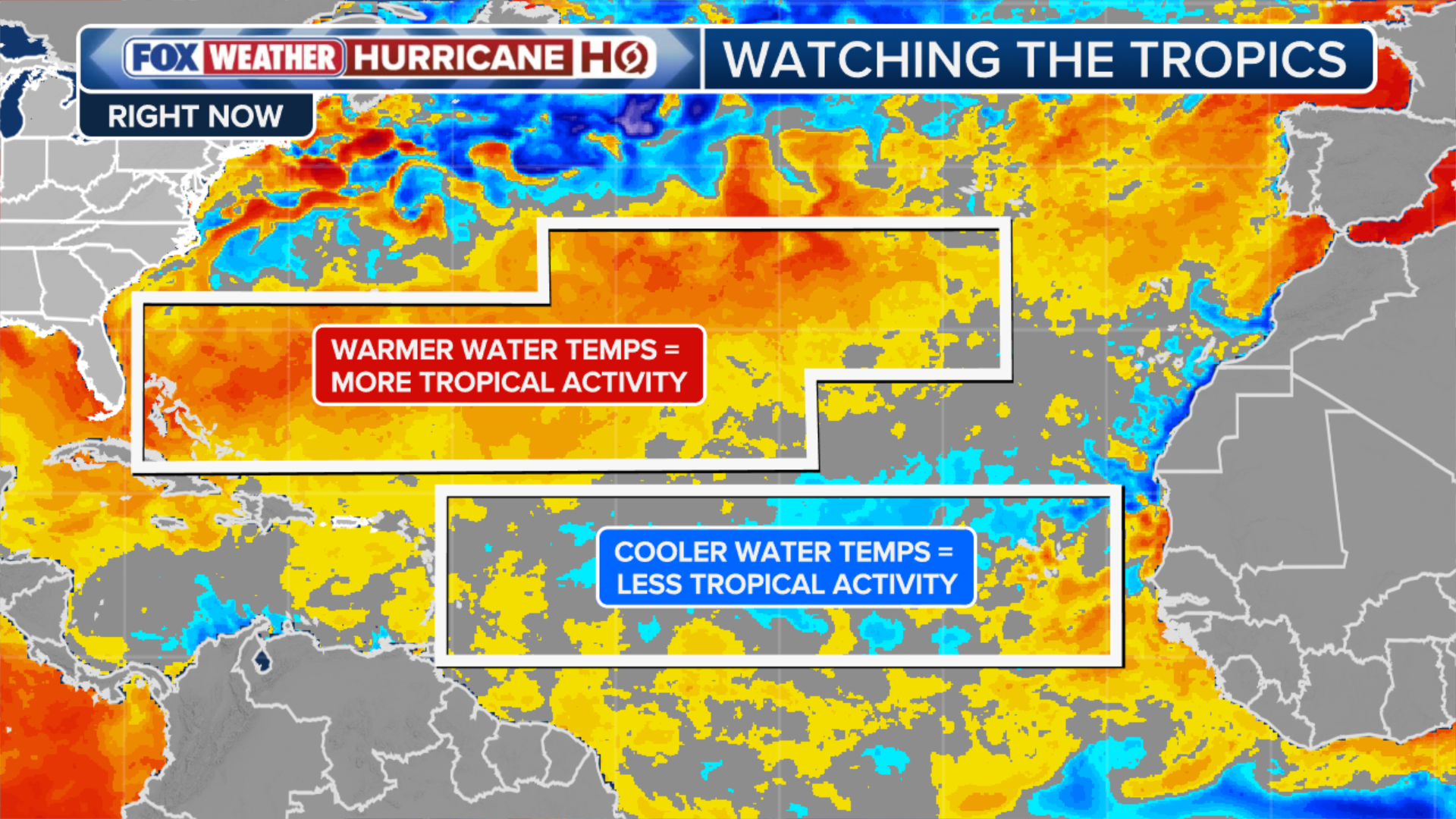
However, starting late September into early October, things could shift, as above-average sea surface temperatures return across much of the Atlantic.
NOT JUST HURRICANES: TROPICAL STORMS IN HISTORY THAT PACKED A PUNCH WITH HISTORIC, DEADLY FLOODING
The warming sea surface temperatures have the potential to offset some of the suppressing effects of El Niño, the FOX Forecast Center said.
(FOX Weather)
We already know El Niño conditions are present in the Pacific, which typically suppresses tropical activity in the Atlantic due to harsh upper-level wind shear in the Atlantic.
This intense wind shear typically rips developing tropical disturbances apart before they can organize into dangerous hurricanes, the FOX Forecast Center said.
JULY OUTLOOK: PATTERN FLIP TO SIMMER AND SOAK MILLIONS AS EXTREME HEAT SHIFTS WEST
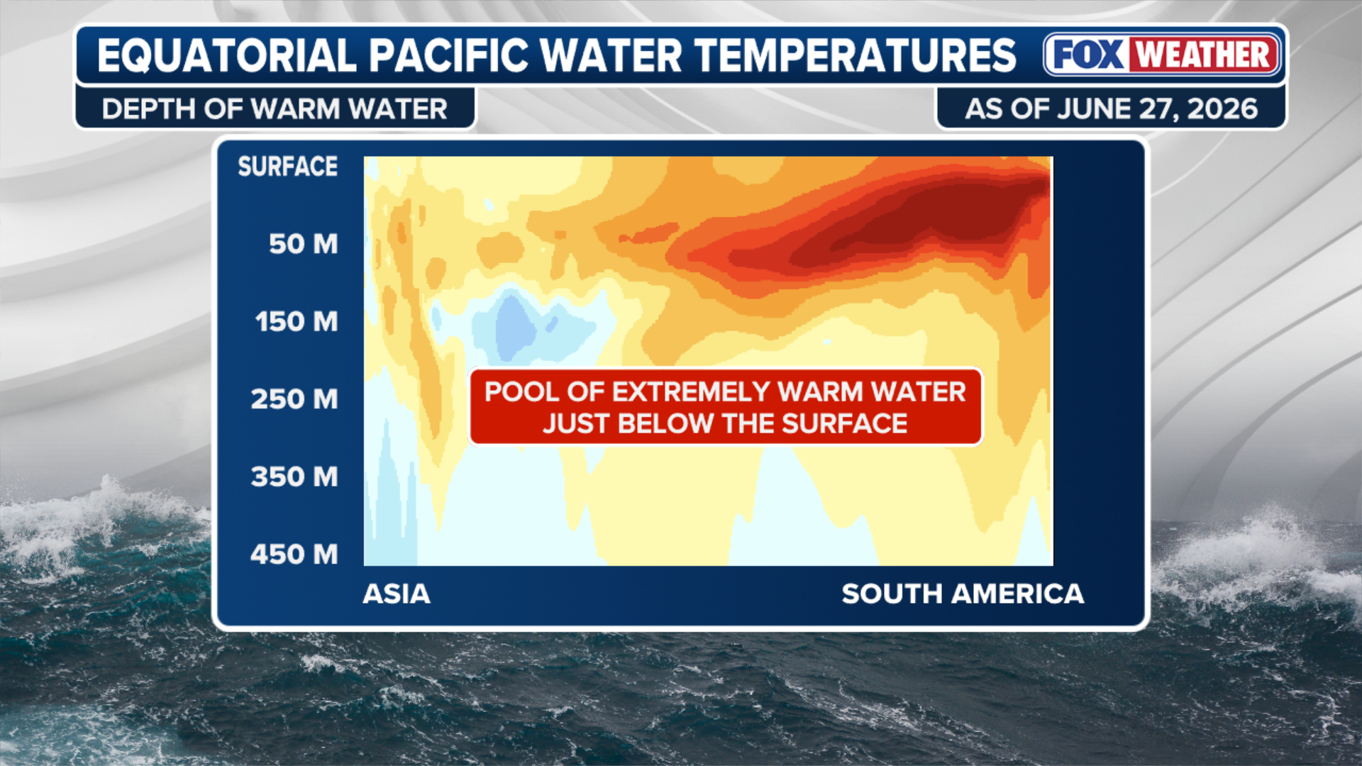
El Niño usually has the exact opposite effect in the central and eastern equatorial Pacific, where deep warm water and low wind shear create the perfect environment for dangerous major hurricanes and super typhoons.
(FOX Weather)
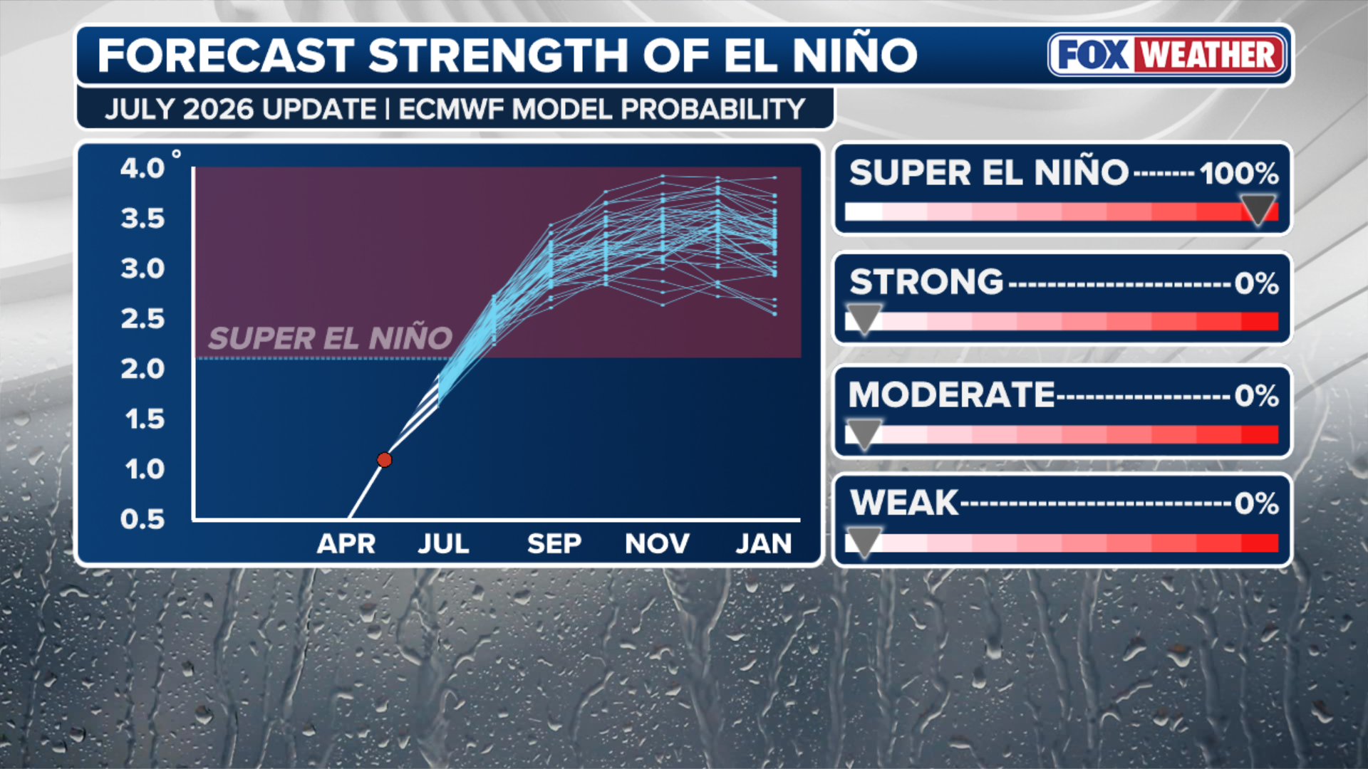
As the latest El Niño-Southern Oscillation (ENSO) update is released by the Climate Prediction Center on Thursday, we’ll find out just how strong El Niño is, and if it still has a 100% chance of becoming a super El Niño this fall.
With conditions expected to remain more favorable closer to the Lower 48, a greater share of tropical development could occur in the Gulf and off the Southeast coast.
EL NIÑO SURGES TOWARD ‘MONSTER’ TERRITORY, SIGNALING AN ACTIVE WINTER FOR EAST AND WEST COASTS
The European forecast model (ECMWF) reflects this, with wetter-than-average conditions across the Southeast and drier-than-average conditions across the Caribbean and the Atlantic’s Main Development Region.
(FOX Weather)
The most recent hurricane prediction forecasts from NOAA and Colorado State University (CSU) call for below-average activity, eight to 14 named storms and 11 named storms, respectively, this season.
On average, the Atlantic Basin produces 12 named storms and 6 hurricanes between August and November.
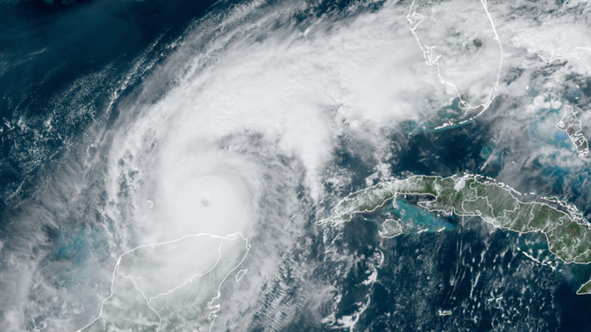
Hurricane Milton in 2024.
(CIRA CSU / NOAA)
The updated July ECMWF forecast calls for exactly 12 named storms and 6 hurricanes, resulting in a near-average hurricane season.
For now, El Niño is keeping activity in the Atlantic at bay, as hostile upper-level winds increase over the Atlantic through at least July.
Stay with FOX Weather as we continue to monitor the latest forecasts.