
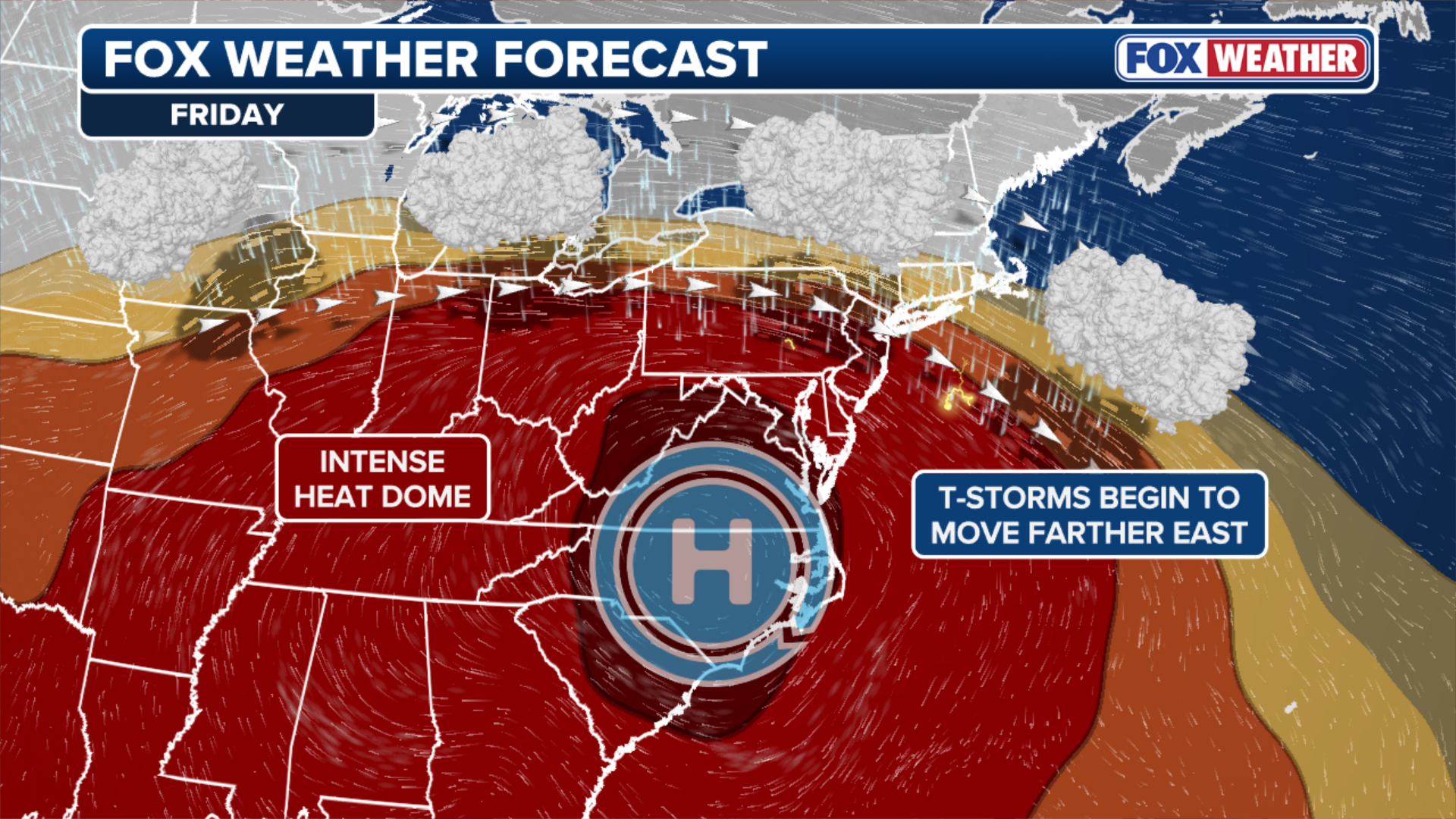
Pop-up thunderstorms could rumble across the Northeast and Mid-Atlantic Friday afternoon, with more possible on the afternoon and evening of July 4. While they won’t be enough to break the heat, they could disrupt nighttime fireworks celebrations.
PHILADELPHIA — Severe thunderstorms are expected to erupt across parts of the Northeast and Mid-Atlantic beginning Friday afternoon and continuing through the July 4 holiday weekend. While they won’t be enough to break the historic heat wave baking the region, they could disrupt nighttime fireworks celebrations with damaging wind gusts and heavy rain.
Storms could also delay travelers at major East Coast airports and create brief periods of difficult driving for holiday road-trippers.
-
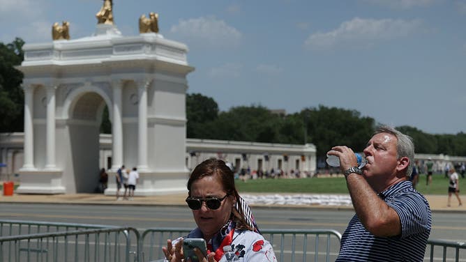
WASHINGTON, DC – JULY 02: A man drinks from water bottle during the Great American State Fair on the National Mall on July 2, 2026 in Washington, DC.
((Photo by Alex Wong/Getty Images)) -
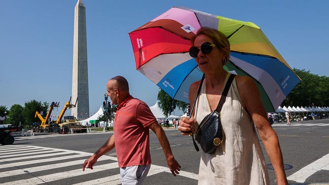
WASHINGTON, DC – JULY 2: People walk near the Washington Monument which was closed due to a heat wave on July 2, 2026 in Washington, DC. Temperatures are expected to be around 100 degrees Fahrenheit over the next few days as celebrations for America’s 250th birthday continue. (Photo by Kevin Carter/Getty Images)
( ) -

People cool off under trees during a heat wave in New York, the United States, on July 2, 2026.
((Photo by Zhang Fengguo/Xinhua via Getty Images))
Sweltering temperatures across the region approaching and exceeding 100 degrees, combined with high humidity will fuel thunderstorm development Friday.
NOAA‘s Storm Prediction Center (SPC) has issued a Level 2 out of 5 risk of severe thunderstorms across a corridor from southern Michigan to western Massachusetts and the New Jersey shore.
This includes the Detroit, Cleveland, Pittsburgh, Washington, D.C., Philadelphia and New York City metro areas. Damaging wind gusts are expected to be the main hazard.

(FOXX Weather)
Storms threaten America 250 fireworks celebrations
On July 4 itself, the thunderstorm threat will redevelop along the Northeast coast.
HOLIDAY FORECAST: DANGEROUS HEAT, POP-UP STORMS TARGET AMERICA 250 CELEBRATIONS FROM COAST TO COAST
A Level 2 threat from New York City through Philadelphia, Baltimore, Washington, D.C., and Richmond, Virginia.

(FOX Weather)
According to the FOX Forecast Center, storms could produce damaging downbursts — concentrated bursts of straight-line winds in excess of 60 mph — Saturday evening, potentially jeopardizing America 250 fireworks shows.
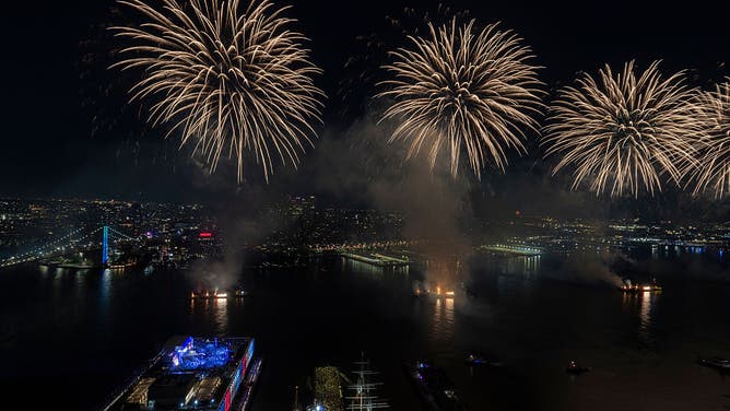
FILE – NEW YORK, NY – JULY 4: Fireworks light up the sky over the East River and Brooklyn during the Macy’s Fourth of July fireworks show on July 4, 2025, in New York City.
((Photo by Gary Hershorn/Getty Images) / Getty Images)
Meanwhile, the ridge of high pressure responsible for the oppressive heat dome will begin shifting south Saturday, bringing the most intense heat to the Mid-Atlantic and the Carolinas.
As the ridge shifts south Saturday, it will open the door to a more active thunderstorm pattern.
By late Sunday into Monday, forecast models are increasingly indicating a storm system could develop off the New Jersey coast that would enhance rainfall across the Northeast and fully break down the heat dome.
(FOX Weather)
“At this time, the slower-moving system appears likely to bring a swath of heavy rain across Pennsylvania, New Jersey, and New York’s Southern Tier,” the FOX Forecast Center said.
“Forecast adjustments remain likely, so this system will be monitored closely.”
(FOX Weather)
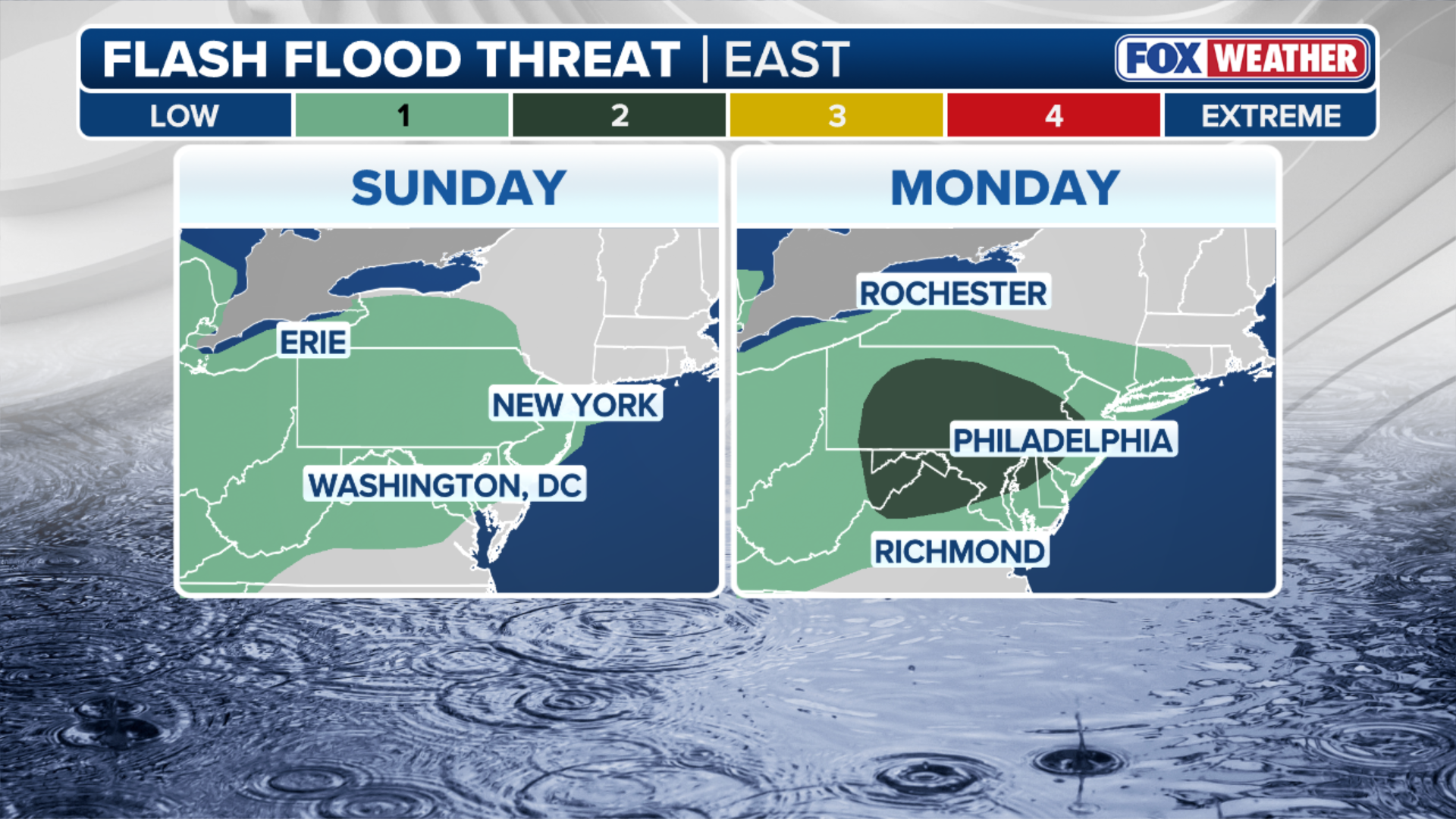
A Level 2 out of 4 flash flood risk is in place across portions of southern Pennsylvania, the Delmarva, as well as the Philadelphia area.
A widespread 1-2 inches of rain is expected across the region through Wednesday, with pockets of 2-3 inches of rain expected across eastern Pennsylvania and north Jersey.


